Estimated Value: $541,000 - $570,000
Studio
--
Bath
--
Sq Ft
6,752
Sq Ft Lot
About This Home
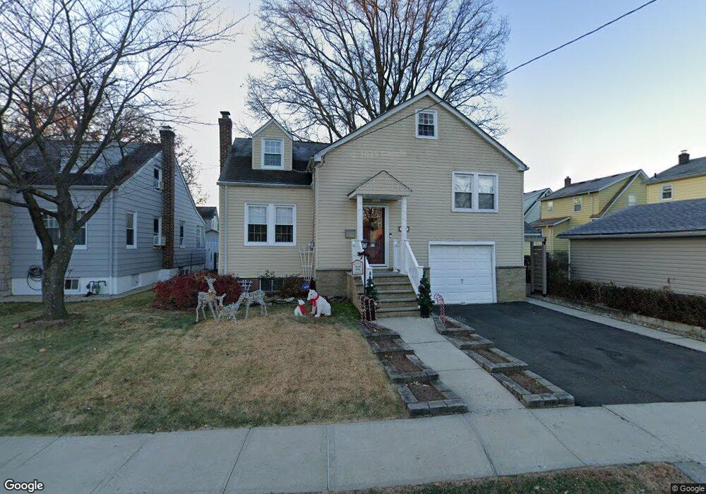
This home is located at 2032 Morrison Ave, Union, NJ 07083 and is currently estimated at $557,161. 2032 Morrison Ave is a home located in Union County with nearby schools including Franklin Elementary School, Burnet Middle School, and Union High School.
Ownership History
Date
Name
Owned For
Owner Type
Purchase Details
Closed on
Oct 24, 2006
Sold by
Mioduszewski Romuald
Bought by
Marques Isabel and Coughlin Timothy
Current Estimated Value
Home Financials for this Owner
Home Financials are based on the most recent Mortgage that was taken out on this home.
Original Mortgage
$291,200
Outstanding Balance
$173,188
Interest Rate
6.4%
Estimated Equity
$383,973
Purchase Details
Closed on
Feb 10, 2006
Sold by
Glassner Gloria
Bought by
Falcon Realty Group Llc
Create a Home Valuation Report for This Property
The Home Valuation Report is an in-depth analysis detailing your home's value as well as a comparison with similar homes in the area
Home Values in the Area
Average Home Value in this Area
Purchase History
| Date | Buyer | Sale Price | Title Company |
|---|---|---|---|
| Marques Isabel | $364,000 | -- | |
| Falcon Realty Group Llc | $225,000 | -- |
Source: Public Records
Mortgage History
| Date | Status | Borrower | Loan Amount |
|---|---|---|---|
| Open | Marques Isabel | $291,200 |
Source: Public Records
Tax History
| Year | Tax Paid | Tax Assessment Tax Assessment Total Assessment is a certain percentage of the fair market value that is determined by local assessors to be the total taxable value of land and additions on the property. | Land | Improvement |
|---|---|---|---|---|
| 2025 | $9,946 | $44,500 | $20,300 | $24,200 |
| 2024 | $9,643 | $44,500 | $20,300 | $24,200 |
| 2023 | $9,643 | $44,500 | $20,300 | $24,200 |
| 2022 | $9,308 | $44,500 | $20,300 | $24,200 |
| 2021 | $9,082 | $44,500 | $20,300 | $24,200 |
| 2020 | $8,901 | $44,500 | $20,300 | $24,200 |
| 2019 | $8,781 | $44,500 | $20,300 | $24,200 |
| 2018 | $8,632 | $44,500 | $20,300 | $24,200 |
| 2017 | $8,504 | $44,500 | $20,300 | $24,200 |
| 2016 | $8,297 | $44,500 | $20,300 | $24,200 |
| 2015 | $8,159 | $44,500 | $20,300 | $24,200 |
| 2014 | $7,976 | $44,500 | $20,300 | $24,200 |
Source: Public Records
Map
Nearby Homes
- 1395 Isabella Ave
- 2011 Kay Ave
- 1584 Walker Ave
- 2144 Tyler St
- 2210 Stecher Ave
- 1535 Gregory Ave
- 1779 Oak Hill Dr
- 1263 Coolidge Ave
- 1244 Grandview Ave
- 1481 Walker Ave
- 1239 Victor Ave
- 1265 Shetland Dr
- 1841 Cider Mill Rd
- 2273 Balmoral Ave
- 1218 Schmidt Ave
- 1618 Andrew St
- 1968 William St
- 1011 Adams Ave
- 2037 Tampa Terrace
- 1115 Falls Terrace
- 1393 Isabella Ave
- 1389 Isabella Ave
- 1387 Isabella Ave
- 2024 Morrison Ave
- 1400 Cherry St
- 2022 Morrison Ave
- 2023 Stecher Ave
- 2021 Stecher Ave
- 2029 Stecher Ave
- 2019 Stecher Ave
- 2031 Stecher Ave
- 1404 Cherry St
- 1403 Isabella Ave
- 2015 Stecher Ave
- 2018 Morrison Ave
- 1408 Cherry St
- 1401 Cherry St
- 1405 Isabella Ave
- 1386 Isabella Ave
- 1392 Isabella Ave
Your Personal Tour Guide
Ask me questions while you tour the home.