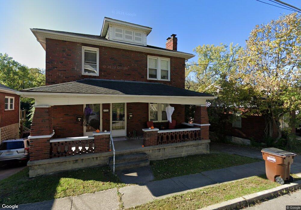
2032 New Linden Rd Newport, KY 41071
Estimated Value: $235,000 - $259,000
2
Beds
2
Baths
2,023
Sq Ft
$122/Sq Ft
Est. Value
About This Home
This home is located at 2032 New Linden Rd, Newport, KY 41071 and is currently estimated at $246,688, approximately $121 per square foot. 2032 New Linden Rd is a home located in Campbell County with nearby schools including Newport Primary School, Newport Intermediate School, and Newport High School.
Ownership History
Date
Name
Owned For
Owner Type
Purchase Details
Closed on
Jun 11, 2010
Sold by
M S Mcbride Properties Llc
Bought by
Naasz Arik L
Current Estimated Value
Home Financials for this Owner
Home Financials are based on the most recent Mortgage that was taken out on this home.
Original Mortgage
$98,671
Outstanding Balance
$67,825
Interest Rate
5.5%
Mortgage Type
FHA
Estimated Equity
$178,863
Purchase Details
Closed on
Sep 15, 2006
Sold by
Jp Sousa Iv Llc
Bought by
Ms Mcbridge Properties Llc
Home Financials for this Owner
Home Financials are based on the most recent Mortgage that was taken out on this home.
Original Mortgage
$86,400
Interest Rate
6.99%
Mortgage Type
Adjustable Rate Mortgage/ARM
Purchase Details
Closed on
Jul 9, 1996
Sold by
Roberts James E
Bought by
Sousa J Philip
Create a Home Valuation Report for This Property
The Home Valuation Report is an in-depth analysis detailing your home's value as well as a comparison with similar homes in the area
Home Values in the Area
Average Home Value in this Area
Purchase History
| Date | Buyer | Sale Price | Title Company |
|---|---|---|---|
| Naasz Arik L | $100,000 | None Available | |
| Ms Mcbridge Properties Llc | $108,000 | None Available | |
| Sousa J Philip | $60,000 | -- |
Source: Public Records
Mortgage History
| Date | Status | Borrower | Loan Amount |
|---|---|---|---|
| Open | Naasz Arik L | $98,671 | |
| Previous Owner | Ms Mcbridge Properties Llc | $86,400 |
Source: Public Records
Tax History Compared to Growth
Tax History
| Year | Tax Paid | Tax Assessment Tax Assessment Total Assessment is a certain percentage of the fair market value that is determined by local assessors to be the total taxable value of land and additions on the property. | Land | Improvement |
|---|---|---|---|---|
| 2024 | $662 | $172,000 | $25,000 | $147,000 |
| 2023 | $479 | $121,200 | $20,000 | $101,200 |
| 2022 | $621 | $121,200 | $20,000 | $101,200 |
| 2021 | $635 | $121,200 | $20,000 | $101,200 |
| 2020 | $645 | $121,200 | $20,000 | $101,200 |
| 2019 | $590 | $107,000 | $12,000 | $95,000 |
| 2018 | $583 | $107,000 | $12,000 | $95,000 |
| 2017 | $585 | $107,000 | $12,000 | $95,000 |
| 2016 | $530 | $107,000 | $0 | $0 |
| 2015 | $509 | $100,000 | $0 | $0 |
| 2014 | $500 | $100,000 | $0 | $0 |
Source: Public Records
Map
Nearby Homes
- 2115 Monmouth St
- 2115 Joyce Ave
- 39 19th St
- 2220 New Linden Rd
- 100 Mayo Cir
- 8 Laycock Ln
- 43.5-45.5, Kentucky Dr
- 85 & 87 Kentucky Dr
- 94 Home St
- 12 Amelia St
- 58 16th St
- 260 Bluegrass Ave
- 252 Linden Ave
- 120 Main St Unit 205
- 120 Main St Unit 306
- 120 Main St Unit 313
- 120 Main St Unit 323
- 125 15th St
- 41 W 14th St
- 35 W 14th St Unit Lot 43
- 2030 New Linden Rd
- 2034 New Linden Rd
- 2036 New Linden Rd
- 2028 New Linden Rd
- 2038 New Linden Rd
- 2101 Monmouth St
- 2040 New Linden Rd
- 2105 Alexandria Pike
- 2105 Monmouth St
- 2026 New Linden Rd
- 2103 Alexandria Pike
- 2033 New Linden Rd
- 2031 New Linden Rd
- 2035 New Linden Rd
- 2007 Monmouth St
- 2107 Alexandria Pike
- 2029 New Linden Rd
- 2042 New Linden Rd
- 2107 Monmouth St
- 2037 New Linden Rd