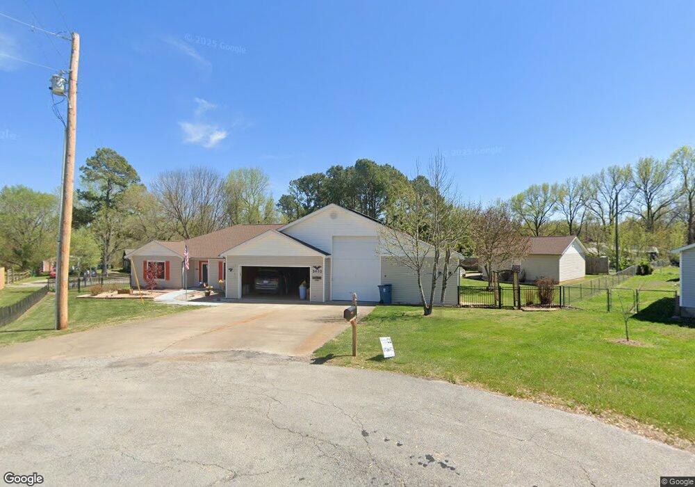
2032 Park Cir Pea Ridge, AR 72751
Estimated Value: $314,000 - $371,000
--
Bed
2
Baths
1,859
Sq Ft
$185/Sq Ft
Est. Value
About This Home
This home is located at 2032 Park Cir, Pea Ridge, AR 72751 and is currently estimated at $344,454, approximately $185 per square foot. 2032 Park Cir is a home located in Benton County with nearby schools including Pea Ridge Intermediate School, Pea Ridge Primary School, and Pea Ridge Junior High School.
Ownership History
Date
Name
Owned For
Owner Type
Purchase Details
Closed on
Nov 3, 2013
Bought by
Dod 1 and Dod 2013
Current Estimated Value
Purchase Details
Closed on
Jun 19, 1997
Bought by
Clark Tr
Purchase Details
Closed on
Sep 9, 1996
Bought by
Schuettpelz
Purchase Details
Closed on
Aug 19, 1996
Bought by
Erwin
Purchase Details
Closed on
May 8, 1995
Bought by
Messer Vern D
Purchase Details
Closed on
Apr 27, 1995
Bought by
Dod 04-27-1995
Purchase Details
Closed on
Mar 2, 1993
Bought by
Clark Rev Trust
Purchase Details
Closed on
Feb 12, 1993
Bought by
Nesselhauf 1/2 Int Of 1/8 Int
Purchase Details
Closed on
Jan 6, 1992
Bought by
Messer
Purchase Details
Closed on
Apr 22, 1986
Bought by
Clark Rev Trust
Create a Home Valuation Report for This Property
The Home Valuation Report is an in-depth analysis detailing your home's value as well as a comparison with similar homes in the area
Home Values in the Area
Average Home Value in this Area
Purchase History
| Date | Buyer | Sale Price | Title Company |
|---|---|---|---|
| Dod 1 | -- | -- | |
| Clark Tr | -- | -- | |
| Schuettpelz | $10,000 | -- | |
| Erwin | $9,000 | -- | |
| Messer Vern D | -- | -- | |
| Dod 04-27-1995 | -- | -- | |
| Clark Rev Trust | -- | -- | |
| Nesselhauf 1/2 Int Of 1/8 Int | -- | -- | |
| Clark Rev Trust | -- | -- | |
| Messer | $5,000 | -- | |
| Clark Rev Trust | -- | -- |
Source: Public Records
Tax History Compared to Growth
Tax History
| Year | Tax Paid | Tax Assessment Tax Assessment Total Assessment is a certain percentage of the fair market value that is determined by local assessors to be the total taxable value of land and additions on the property. | Land | Improvement |
|---|---|---|---|---|
| 2025 | $2,745 | $63,280 | $6,400 | $56,880 |
| 2024 | $2,582 | $63,280 | $6,400 | $56,880 |
| 2023 | $2,347 | $44,680 | $5,600 | $39,080 |
| 2022 | $2,167 | $44,680 | $5,600 | $39,080 |
| 2021 | $2,123 | $44,680 | $5,600 | $39,080 |
| 2020 | $1,930 | $31,740 | $2,800 | $28,940 |
| 2019 | $1,930 | $31,740 | $2,800 | $28,940 |
| 2018 | $1,806 | $31,740 | $2,800 | $28,940 |
| 2017 | $0 | $31,740 | $2,800 | $28,940 |
| 2016 | $0 | $31,740 | $2,800 | $28,940 |
| 2015 | $1,766 | $31,030 | $3,000 | $28,030 |
| 2014 | $1,759 | $31,030 | $3,000 | $28,030 |
Source: Public Records
Map
Nearby Homes
- 446 W Pickens Rd
- 1821 Woodhause Cir
- 1703 Cuppett Cir
- 1701 Cuppett Cir
- 1717 Cuppett Cir
- 1715 Cuppett Cir
- 2288 Hayden Rd
- 1307 Joyce St
- 1305 Joyce St
- 2320 Barnes Cir
- 901 Carlock Dr
- 1600 Christman St
- 2112 Decker Rd
- 725 Todd Cir
- 1285 Weston St
- 435 Mcculloch St
- 296 Van Dorn St
- 264 Mcintosh St
- 2105 Crandall Rd
- 2109 Crandall Rd
- 2036 Park Cir
- 2040 Park Cir
- 350 W Pickens Rd
- 2027 Park Cir
- 396 W Pickens Rd
- 2024 Park Cir
- 1752 Reed St
- 2044 Park Cir
- 400 W Pickens Rd
- 2023 Park Cir
- 2055 Park Cir
- 2020 Park Cir
- 422 W Pickens Rd
- 2059 Park Cir
- 2019 Park Cir
- 2050 Park Cir
- 2.21 Ac N Hwy 94 & N Harvey Wakefield Ave
- 8.8Ac Boundary Line Rd
- 15899 Mariano Rd