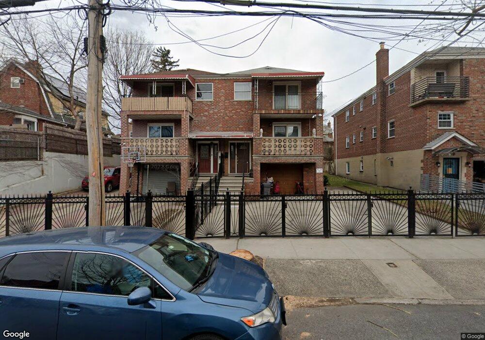
2032 Paulding Ave Bronx, NY 10462
Morris Park NeighborhoodEstimated Value: $903,000 - $1,124,000
--
Bed
--
Bath
2,530
Sq Ft
$391/Sq Ft
Est. Value
About This Home
This home is located at 2032 Paulding Ave, Bronx, NY 10462 and is currently estimated at $989,285, approximately $391 per square foot. 2032 Paulding Ave is a home located in Bronx County with nearby schools including P.S. 083 The Donald Hertz School, Emblaze Academy Charter School, and St. Clare of Assisi School.
Ownership History
Date
Name
Owned For
Owner Type
Purchase Details
Closed on
Feb 1, 2017
Sold by
Haxhari Altin and Haxhari Viktor
Bought by
Haxhari Aleksander and Haxhari Altin
Current Estimated Value
Purchase Details
Closed on
May 1, 2013
Sold by
Haxhari Altin and Haxhari Edmond
Bought by
Haxhari Altin and Haxhari Viktor
Home Financials for this Owner
Home Financials are based on the most recent Mortgage that was taken out on this home.
Original Mortgage
$425,000
Interest Rate
3.45%
Mortgage Type
New Conventional
Purchase Details
Closed on
Jul 22, 2005
Sold by
Ivri Eli and Ivri Rivka
Bought by
Haxhari Altin and Haxhari Edmond
Create a Home Valuation Report for This Property
The Home Valuation Report is an in-depth analysis detailing your home's value as well as a comparison with similar homes in the area
Home Values in the Area
Average Home Value in this Area
Purchase History
| Date | Buyer | Sale Price | Title Company |
|---|---|---|---|
| Haxhari Aleksander | -- | -- | |
| Haxhari Altin | -- | -- | |
| Haxhari Altin | $543,000 | -- |
Source: Public Records
Mortgage History
| Date | Status | Borrower | Loan Amount |
|---|---|---|---|
| Previous Owner | Haxhari Altin | $425,000 |
Source: Public Records
Tax History Compared to Growth
Tax History
| Year | Tax Paid | Tax Assessment Tax Assessment Total Assessment is a certain percentage of the fair market value that is determined by local assessors to be the total taxable value of land and additions on the property. | Land | Improvement |
|---|---|---|---|---|
| 2025 | $8,388 | $42,509 | $8,029 | $34,480 |
| 2024 | $8,388 | $41,760 | $7,718 | $34,042 |
| 2023 | $8,481 | $41,760 | $8,326 | $33,434 |
| 2022 | $7,946 | $57,540 | $11,400 | $46,140 |
| 2021 | $7,902 | $48,960 | $11,400 | $37,560 |
| 2020 | $7,498 | $43,200 | $11,400 | $31,800 |
| 2019 | $7,280 | $34,800 | $11,400 | $23,400 |
| 2018 | $7,167 | $35,158 | $9,823 | $25,335 |
| 2017 | $6,761 | $33,168 | $11,037 | $22,131 |
| 2016 | $6,255 | $31,291 | $11,051 | $20,240 |
| 2015 | $3,942 | $29,520 | $12,660 | $16,860 |
| 2014 | $3,942 | $29,520 | $12,660 | $16,860 |
Source: Public Records
Map
Nearby Homes
- 1963 Hone Ave
- 1059 Neill Ave
- 1958 Colden Ave
- 1054 Lydig Ave
- 2037 Radcliff Ave
- 2116 Paulding Ave
- 1088 Lydig Ave
- 1917 Lurting Ave
- - Lydig Ave
- 1004 Rhinelander Ave
- 1859 Hone Ave
- 1925 Bogart Ave
- 2166 Paulding Ave
- 2080 Matthews Ave
- 1903 Tomlinson Ave
- 2129 Muliner Ave
- 1116 Rhinelander Ave
- 2090 Barnes Ave Unit 6A
- 2090 Barnes Ave Unit 4D
- 2090 Barnes Ave Unit 2H
- 2030 Paulding Ave
- 2034 Paulding Ave
- 1030 Lydig Ave
- 2026 Paulding Ave
- 2039 Hone Ave
- 2043 Hone Ave
- 2024 Paulding Ave
- 2035 Hone Ave
- 2029 Hone Ave
- 2022 Paulding Ave
- 2045 Hone Ave
- 2027 Hone Ave
- 2031 Paulding Ave
- 2029 Paulding Ave
- 2033 Paulding Ave
- 2027 Paulding Ave
- 2020 Paulding Ave
- 2035 Paulding Ave
- 2023-2025 Paulding Ave
- 2025 Hone Ave