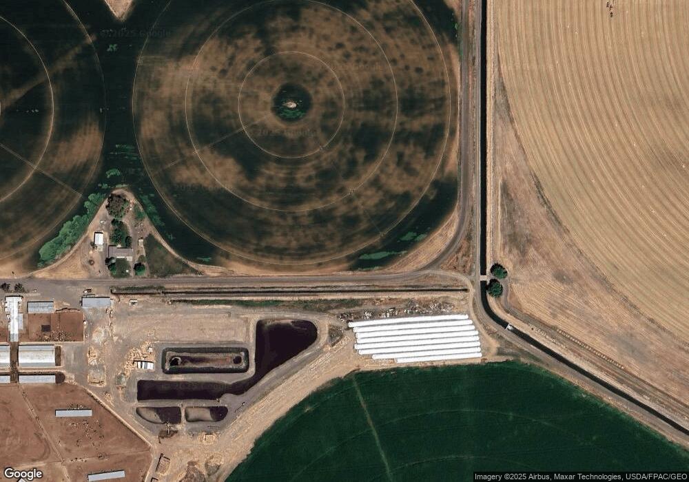
2032 Road 10 8 NW Ephrata, WA 98823
Estimated Value: $127,000 - $145,251
--
Bed
--
Bath
--
Sq Ft
4.79
Acres
About This Home
This home is located at 2032 Road 10 8 NW, Ephrata, WA 98823 and is currently estimated at $136,084. 2032 Road 10 8 NW is a home located in Grant County with nearby schools including Ephrata High School.
Ownership History
Date
Name
Owned For
Owner Type
Purchase Details
Closed on
Mar 4, 2025
Sold by
Ohl Dennis L and Ohl Loc
Bought by
Tempel Jessika and Tempel Matthew
Current Estimated Value
Home Financials for this Owner
Home Financials are based on the most recent Mortgage that was taken out on this home.
Original Mortgage
$112,800
Outstanding Balance
$111,952
Interest Rate
7%
Mortgage Type
New Conventional
Estimated Equity
$24,132
Purchase Details
Closed on
Jun 24, 2020
Sold by
Brown Clinton L and Brown Clington L
Bought by
Ohl Dennis L and Ohl Loc
Purchase Details
Closed on
Aug 12, 2015
Sold by
Matheson Joshua A and Matheson Benita
Bought by
Livi Brown Clinton L and Livi Clinton L Brown Revocable
Purchase Details
Closed on
Jan 9, 2008
Sold by
Livi Brown Clinton L
Bought by
Matheson Joshua A and Matheson Benita
Home Financials for this Owner
Home Financials are based on the most recent Mortgage that was taken out on this home.
Original Mortgage
$80,000
Interest Rate
7%
Mortgage Type
Seller Take Back
Create a Home Valuation Report for This Property
The Home Valuation Report is an in-depth analysis detailing your home's value as well as a comparison with similar homes in the area
Home Values in the Area
Average Home Value in this Area
Purchase History
| Date | Buyer | Sale Price | Title Company |
|---|---|---|---|
| Tempel Jessika | $141,000 | Frontier Title | |
| Ohl Dennis L | $44,000 | Stewart Title Moses Lake | |
| Livi Brown Clinton L | -- | None Available | |
| Matheson Joshua A | $83,000 | Security Title Guaranty |
Source: Public Records
Mortgage History
| Date | Status | Borrower | Loan Amount |
|---|---|---|---|
| Open | Tempel Jessika | $112,800 | |
| Previous Owner | Matheson Joshua A | $80,000 |
Source: Public Records
Tax History Compared to Growth
Tax History
| Year | Tax Paid | Tax Assessment Tax Assessment Total Assessment is a certain percentage of the fair market value that is determined by local assessors to be the total taxable value of land and additions on the property. | Land | Improvement |
|---|---|---|---|---|
| 2024 | $728 | $60,250 | $60,250 | $0 |
| 2023 | $694 | $35,080 | $35,080 | $0 |
| 2022 | $454 | $35,080 | $35,080 | $0 |
| 2021 | $472 | $35,080 | $35,080 | $0 |
| 2020 | $493 | $35,080 | $35,080 | $0 |
| 2019 | $380 | $35,080 | $35,080 | $0 |
| 2018 | $660 | $45,000 | $45,000 | $0 |
| 2017 | $618 | $45,000 | $45,000 | $0 |
| 2016 | $652 | $45,000 | $45,000 | $0 |
| 2013 | -- | $45,000 | $45,000 | $0 |
Source: Public Records
Map
Nearby Homes
- 0 NW 11 3 Rd Unit NWM2419631
- 0 NW 11 3 Rd Unit NWM2419794
- 11137 Dodson Rd NW
- 11397 Dodson Rd NW
- 3198 Road 10 9 NW
- 12455 Dodson Rd NW
- 0 Parcel 160914002 Rd A 5 NW
- 12687 Dodson Rd NW
- 0 Parcel 160906000 Unit NWM2346757
- 2923 Road 12.8 NW
- 13382 Road A 5 NW
- 13434 Road A 5 NW
- 2396 Pacific St
- 2391 Hunters St
- 70 Sunwest Dr
- 2383 Pacific St
- 000 State Route 282 12mg9a8rk0nh
- 34 Grant Dr
- 344 Oatman (Lots 15 & 7) Place
- 40 Sacagawea Dr
- 0 10 8 Rd NE Unit NWM1924528
- 0 10 8 Rd NE
- 2092 Road 10 8 NW
- 1 10 8
- 1968 NW 10 8 Rd
- 2 10 8
- 2152 Road 10 8 NW
- 2103 Road 10.8 NW
- 2184 Road 10.8 NW
- 2175 Road 11 NW
- 3 10 8
- 10783 Road B.3 NW
- 10736 Road B.3 NW
- 10729 Road B.3 NW
- 10732 Road B.3 NW
- 0 Rd 10 8 Unit 1251178
- 2410 Road 10.8 NW
- 0 NW Road 10 8 Unit 949693
- 0 NW Road 10 8 Unit 949682
- 0 NW Road 10 8 Unit 949651
