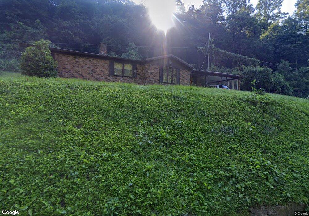
2032 Upper Mill Branch Rd Grundy, VA 24614
Estimated Value: $127,893 - $158,000
4
Beds
2
Baths
2,068
Sq Ft
$72/Sq Ft
Est. Value
About This Home
This home is located at 2032 Upper Mill Branch Rd, Grundy, VA 24614 and is currently estimated at $147,973, approximately $71 per square foot. 2032 Upper Mill Branch Rd is a home located in Buchanan County with nearby schools including Jm Bevins Elementary School, Riverview Elementary/Middle School, and Grundy High School.
Ownership History
Date
Name
Owned For
Owner Type
Purchase Details
Closed on
Apr 7, 2014
Sold by
Maynard Andy Ferrell
Bought by
Salmons Miles B and Salmons Melissa Lynn
Current Estimated Value
Home Financials for this Owner
Home Financials are based on the most recent Mortgage that was taken out on this home.
Original Mortgage
$85,714
Outstanding Balance
$63,347
Interest Rate
3.62%
Mortgage Type
New Conventional
Estimated Equity
$84,626
Create a Home Valuation Report for This Property
The Home Valuation Report is an in-depth analysis detailing your home's value as well as a comparison with similar homes in the area
Home Values in the Area
Average Home Value in this Area
Purchase History
| Date | Buyer | Sale Price | Title Company |
|---|---|---|---|
| Salmons Miles B | $84,000 | None Available |
Source: Public Records
Mortgage History
| Date | Status | Borrower | Loan Amount |
|---|---|---|---|
| Open | Salmons Miles B | $85,714 |
Source: Public Records
Tax History Compared to Growth
Tax History
| Year | Tax Paid | Tax Assessment Tax Assessment Total Assessment is a certain percentage of the fair market value that is determined by local assessors to be the total taxable value of land and additions on the property. | Land | Improvement |
|---|---|---|---|---|
| 2024 | $369 | $94,500 | $6,000 | $88,500 |
| 2023 | $369 | $94,500 | $6,000 | $88,500 |
| 2022 | $369 | $94,500 | $6,000 | $88,500 |
| 2021 | $369 | $94,500 | $6,000 | $88,500 |
| 2020 | $326 | $83,700 | $6,000 | $77,700 |
| 2019 | $326 | $83,700 | $6,000 | $77,700 |
| 2017 | $326 | $83,700 | $6,000 | $77,700 |
| 2016 | $326 | $83,700 | $6,000 | $77,700 |
| 2015 | -- | $63,200 | $8,400 | $54,800 |
Source: Public Records
Map
Nearby Homes
- 1470 Stone Coal Rd
- 1079 Highlawn Cir
- 1287 Turnbull Rd
- 2967 Elkins Branch Rd
- 1056 Pheasant Run Rd
- 2929 Slate Creek Rd
- 2553 Slate Creek Rd
- Tbd Old Wolf Rd
- 4913 Hurley Rd
- 1154 Fairview St
- 1122 Lee St
- 4137 Lesters Fork Rd
- TBD Home Creek Rd
- 1107 Russell Hill St
- 1104 Little Prater Rd
- 1178 Old Home Creek Rd
- 1434 Little Prater Rd
- 18775 Riverside Dr
- 1077 Navigator Rd
- 1025 White Birch Ln
- 2126 Upper Mill Branch Rd
- 2134 Upper Mill Branch Rd
- 2115 Upper Mill Branch Rd
- 2188 Upper Mill Branch Rd
- 2163 Upper Mill Branch Rd
- RT 83 W Upper Mill Branch Rd
- 0 Upper Mill Branch Rd
- 1723 Upper Mill Branch Rd
- 2192 Upper Mill Branch Rd
- 2245 Upper Mill Branch Rd
- 2261 Upper Mill Branch Rd
- 2275 Upper Mill Branch Rd
- 2344 Upper Mill Branch Rd
- 2293 Upper Mill Branch Rd
- 1791 Upper Mill Branch Rd
- 2355 Upper Mill Branch Rd
- 2352 Upper Mill Branch Rd
- 1727 Upper Mill Branch Rd
- 2381 Upper Mill Branch Rd
- 1680 Upper Mill Branch Rd