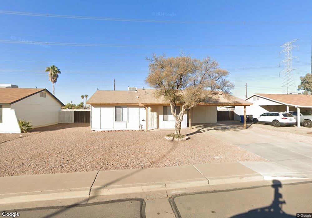
2032 W Western Dr Chandler, AZ 85224
Central Ridge NeighborhoodEstimated Value: $310,611 - $409,000
3
Beds
2
Baths
1,106
Sq Ft
$324/Sq Ft
Est. Value
About This Home
This home is located at 2032 W Western Dr, Chandler, AZ 85224 and is currently estimated at $358,653, approximately $324 per square foot. 2032 W Western Dr is a home located in Maricopa County with nearby schools including Pomeroy Elementary School, Franklin at Brimhall Elementary School, and Franklin Accelerated Academy Jordan Campus.
Ownership History
Date
Name
Owned For
Owner Type
Purchase Details
Closed on
Jan 20, 2005
Sold by
Hud
Bought by
Lint John C and Lint Treva E
Current Estimated Value
Purchase Details
Closed on
Nov 12, 2004
Sold by
Wells Fargo Bank Na
Bought by
Hud
Purchase Details
Closed on
Aug 24, 2004
Sold by
Harwood April M
Bought by
Wells Fargo Bank Na
Purchase Details
Closed on
Jun 11, 2001
Sold by
Morris Claude
Bought by
Harwood April M
Home Financials for this Owner
Home Financials are based on the most recent Mortgage that was taken out on this home.
Original Mortgage
$107,935
Interest Rate
7.14%
Mortgage Type
FHA
Purchase Details
Closed on
Dec 16, 1997
Sold by
Kenney Viviane and Rodrigue Jacques
Bought by
Morris Claude
Home Financials for this Owner
Home Financials are based on the most recent Mortgage that was taken out on this home.
Original Mortgage
$80,777
Interest Rate
7.23%
Mortgage Type
FHA
Create a Home Valuation Report for This Property
The Home Valuation Report is an in-depth analysis detailing your home's value as well as a comparison with similar homes in the area
Home Values in the Area
Average Home Value in this Area
Purchase History
| Date | Buyer | Sale Price | Title Company |
|---|---|---|---|
| Lint John C | -- | First Southwestern Title | |
| Hud | -- | First American Title Ins Co | |
| Wells Fargo Bank Na | $123,362 | -- | |
| Harwood April M | $108,900 | Capital Title Agency | |
| Morris Claude | $81,000 | Ati Title Agency |
Source: Public Records
Mortgage History
| Date | Status | Borrower | Loan Amount |
|---|---|---|---|
| Previous Owner | Harwood April M | $107,935 | |
| Previous Owner | Morris Claude | $80,777 |
Source: Public Records
Tax History Compared to Growth
Tax History
| Year | Tax Paid | Tax Assessment Tax Assessment Total Assessment is a certain percentage of the fair market value that is determined by local assessors to be the total taxable value of land and additions on the property. | Land | Improvement |
|---|---|---|---|---|
| 2025 | $1,223 | $12,191 | -- | -- |
| 2024 | $1,232 | $11,611 | -- | -- |
| 2023 | $1,232 | $28,010 | $5,600 | $22,410 |
| 2022 | $1,201 | $21,210 | $4,240 | $16,970 |
| 2021 | $1,194 | $19,430 | $3,880 | $15,550 |
| 2020 | $1,181 | $17,580 | $3,510 | $14,070 |
| 2019 | $1,097 | $15,260 | $3,050 | $12,210 |
| 2018 | $1,069 | $14,110 | $2,820 | $11,290 |
| 2017 | $1,031 | $12,960 | $2,590 | $10,370 |
| 2016 | $1,008 | $11,600 | $2,320 | $9,280 |
| 2015 | $803 | $10,100 | $2,020 | $8,080 |
Source: Public Records
Map
Nearby Homes
- 2018 W Western Dr
- 2014 W Summit Place
- 3121 N Morino St
- 2334 W Peralta Ave
- 2136 W Portobello Ave
- 3105 N Carriage Ln
- 1821 W Curry Dr
- 2030 W Portobello Ave
- 2334 W Pecos Ave
- 2344 W Pecos Ave
- 2207 W Bentrup St
- 2439 W Peralta Cir
- 2044 W Plata Ave
- 3107 N Pennington Dr
- 1800 W Elliot Rd Unit 146
- 1708 W Cortez Cir Unit 6
- 1633 W Peralta Ave
- 2309 W Naranja Ave
- 2223 W Nopal Cir
- 2671 W Bentrup St
- 2100 W Western Dr
- 2030 W Western Dr
- 2102 W Western Dr
- 2028 W Western Dr
- 2031 W Western Dr
- 2101 W Western Dr
- 2026 W Western Dr
- 2104 W Western Dr
- 2029 W Western Dr
- 2103 W Western Dr
- 2027 W Western Dr
- 2024 W Western Dr
- 2106 W Western Dr
- 3313 N Morino St
- 3308 N Morino St
- 2105 W Western Dr
- 2025 W Western Dr
- 2108 W Cortez Place
- 2022 W Western Dr
- 2108 W Western Dr Unit 4