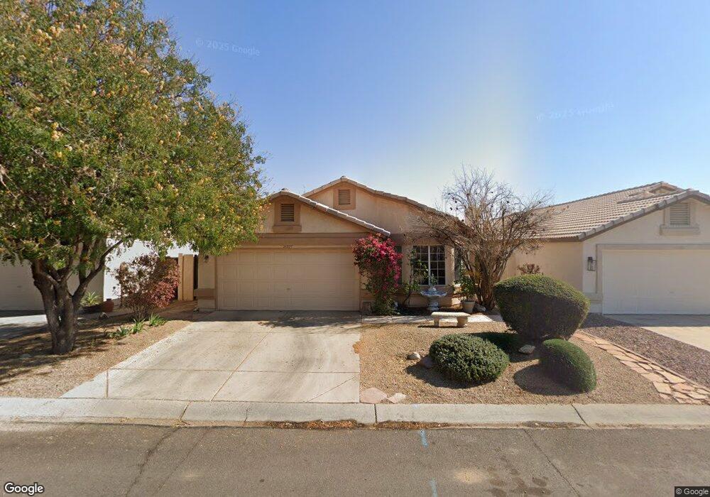
20327 N 106th Ave Peoria, AZ 85382
Estimated Value: $326,926 - $430,000
--
Bed
3
Baths
1,475
Sq Ft
$264/Sq Ft
Est. Value
About This Home
This home is located at 20327 N 106th Ave, Peoria, AZ 85382 and is currently estimated at $388,732, approximately $263 per square foot. 20327 N 106th Ave is a home located in Maricopa County with nearby schools including Parkridge Elementary School, Sunrise Mountain High School, and Guidepost Montessori at Peoria.
Ownership History
Date
Name
Owned For
Owner Type
Purchase Details
Closed on
Mar 25, 2021
Sold by
Webster William G and Webster Betty B
Bought by
Webster Family Trust and Webster
Current Estimated Value
Purchase Details
Closed on
Oct 26, 2000
Sold by
Corbin Thomas R and Corbin Carole M
Bought by
Webster William G and Webster Betty B
Purchase Details
Closed on
Jan 6, 1999
Sold by
Rubin Jay and Rubin Sheila Lynn
Bought by
Corbin Thomas R and Corbin Carole M
Home Financials for this Owner
Home Financials are based on the most recent Mortgage that was taken out on this home.
Original Mortgage
$137,505
Interest Rate
6.79%
Mortgage Type
VA
Create a Home Valuation Report for This Property
The Home Valuation Report is an in-depth analysis detailing your home's value as well as a comparison with similar homes in the area
Home Values in the Area
Average Home Value in this Area
Purchase History
| Date | Buyer | Sale Price | Title Company |
|---|---|---|---|
| Webster Family Trust | -- | None Listed On Document | |
| Webster William G | $140,650 | Stewart Title & Trust | |
| Corbin Thomas R | $133,500 | First American Title |
Source: Public Records
Mortgage History
| Date | Status | Borrower | Loan Amount |
|---|---|---|---|
| Previous Owner | Corbin Thomas R | $137,505 |
Source: Public Records
Tax History Compared to Growth
Tax History
| Year | Tax Paid | Tax Assessment Tax Assessment Total Assessment is a certain percentage of the fair market value that is determined by local assessors to be the total taxable value of land and additions on the property. | Land | Improvement |
|---|---|---|---|---|
| 2025 | $1,460 | $18,632 | -- | -- |
| 2024 | $1,586 | -- | -- | -- |
| 2023 | $1,586 | $29,560 | $5,910 | $23,650 |
| 2022 | $1,059 | $12,100 | $2,420 | $9,680 |
| 2021 | $1,190 | $22,470 | $4,490 | $17,980 |
| 2020 | $1,261 | $19,680 | $3,930 | $15,750 |
| 2019 | $1,221 | $18,680 | $3,730 | $14,950 |
| 2018 | $1,039 | $12,100 | $2,420 | $9,680 |
| 2017 | $1,049 | $12,100 | $2,420 | $9,680 |
| 2016 | $1,061 | $12,100 | $2,420 | $9,680 |
| 2015 | $1,020 | $12,100 | $2,420 | $9,680 |
Source: Public Records
Map
Nearby Homes
- 10659 W Yukon Dr
- 20274 N 104th Ave
- 10630 W Mohawk Ln
- 20615 N 105th Ave
- 20360 N 106th Ln
- 10379 W Tonopah Dr
- 20670 N 105th Dr
- 10347 W Mohawk Ln
- 20017 N 101st Ave
- 10763 W Runion Dr
- 20769 N 106th Ln
- 19845 N Welk Dr
- 10528 W Potter Dr
- 10722 W Irma Ln
- 10344 W Burnett Rd
- 10728 W Irma Ln
- 19832 N Cherry Tree Ln
- 19822 N Turquoise Hills Dr
- 20056 N 107th Ln
- 19820 N Cherry Tree Ln
- 20333 N 106th Ave
- 20309 N 106th Ave
- 20328 N 106th Ave
- 20334 N 106th Ave
- 20322 N 106th Ave
- 20303 N 106th Ave
- 20340 N 106th Ave
- 20316 N 106th Ave
- 10529 W Tonopah Dr
- 20346 N 106th Ave
- 20310 N 106th Ave
- 10534 W Yukon Dr
- 10525 W Tonopah Dr
- 20304 N 106th Ave
- 10530 W Yukon Dr
- 10521 W Tonopah Dr
- 10526 W Yukon Dr
- 10530 W Tonopah Dr
- 10522 W Yukon Dr
- 10517 W Tonopah Dr