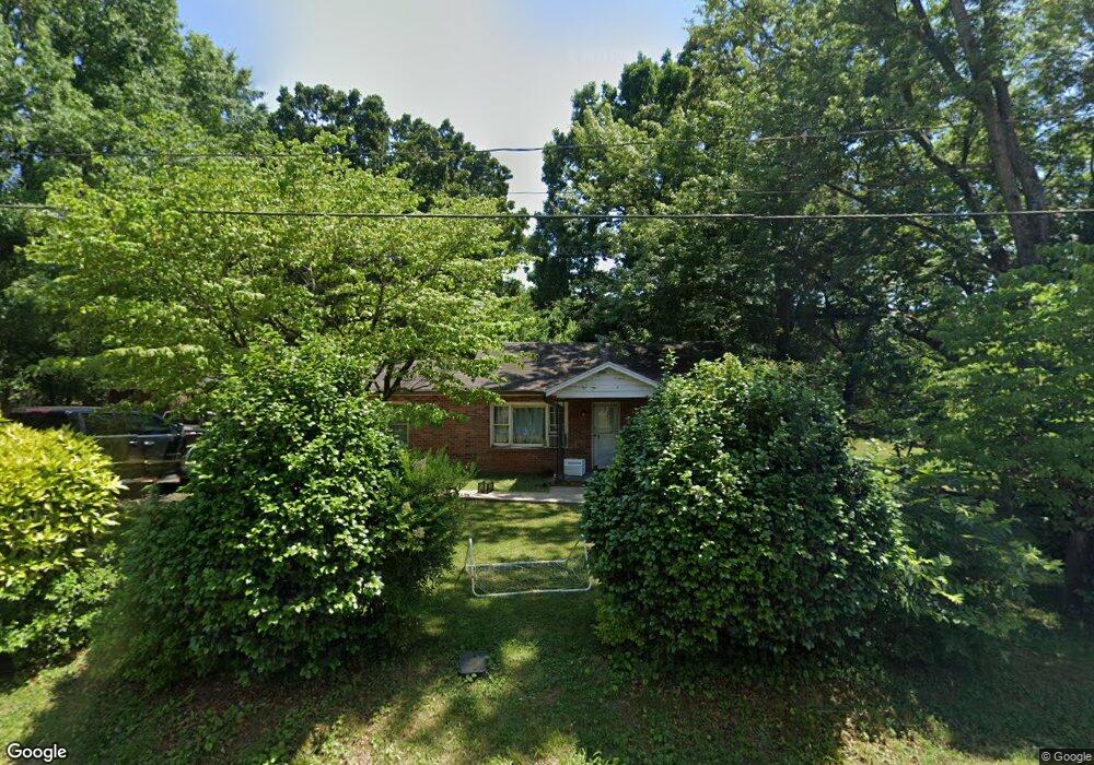
2033 Bristol Rd Statesville, NC 28677
Estimated Value: $151,000 - $195,000
3
Beds
1
Bath
1,185
Sq Ft
$148/Sq Ft
Est. Value
About This Home
This home is located at 2033 Bristol Rd, Statesville, NC 28677 and is currently estimated at $174,845, approximately $147 per square foot. 2033 Bristol Rd is a home located in Iredell County with nearby schools including N.B. Mills Elementary School, West Iredell Middle School, and West Iredell High School.
Ownership History
Date
Name
Owned For
Owner Type
Purchase Details
Closed on
Mar 4, 2002
Sold by
Baity Bill J
Bought by
Vang Chongcha N and Vang Maisoua Yang
Current Estimated Value
Home Financials for this Owner
Home Financials are based on the most recent Mortgage that was taken out on this home.
Original Mortgage
$38,400
Interest Rate
6.81%
Purchase Details
Closed on
Dec 1, 1990
Purchase Details
Closed on
Apr 1, 1987
Purchase Details
Closed on
Oct 1, 1986
Purchase Details
Closed on
Jun 1, 1981
Create a Home Valuation Report for This Property
The Home Valuation Report is an in-depth analysis detailing your home's value as well as a comparison with similar homes in the area
Home Values in the Area
Average Home Value in this Area
Purchase History
| Date | Buyer | Sale Price | Title Company |
|---|---|---|---|
| Vang Chongcha N | $49,000 | -- | |
| -- | -- | -- | |
| -- | -- | -- | |
| -- | -- | -- | |
| -- | -- | -- |
Source: Public Records
Mortgage History
| Date | Status | Borrower | Loan Amount |
|---|---|---|---|
| Closed | Vang Chongcha N | $38,400 |
Source: Public Records
Tax History Compared to Growth
Tax History
| Year | Tax Paid | Tax Assessment Tax Assessment Total Assessment is a certain percentage of the fair market value that is determined by local assessors to be the total taxable value of land and additions on the property. | Land | Improvement |
|---|---|---|---|---|
| 2024 | $565 | $85,660 | $16,500 | $69,160 |
| 2023 | $565 | $85,660 | $16,500 | $69,160 |
| 2022 | $359 | $48,230 | $7,150 | $41,080 |
| 2021 | $359 | $48,230 | $7,150 | $41,080 |
| 2020 | $359 | $48,230 | $7,150 | $41,080 |
| 2019 | $354 | $48,230 | $7,150 | $41,080 |
| 2018 | $283 | $38,610 | $5,500 | $33,110 |
| 2017 | $283 | $38,610 | $5,500 | $33,110 |
| 2016 | $283 | $38,610 | $5,500 | $33,110 |
| 2015 | $283 | $38,610 | $5,500 | $33,110 |
| 2014 | -- | $44,730 | $5,500 | $39,230 |
Source: Public Records
Map
Nearby Homes
- 1716 Younger Ave
- 2321 Cline St
- 1709 Younger Ave
- 1713 Forest Dr
- 3 Williams Ave
- 1309 Williams Rd
- 1120 Rita Ave
- 1129 Rita Ave
- 417 Central Dr
- 407 Central Dr
- 812 Candy Dr
- 818 Candy Dr
- 50 S Miller Ave Unit A
- 50 S Miller Ave Unit B
- Robie Plan at Bristol Terrace
- Penwell Plan at Bristol Terrace
- Hayden Plan at Bristol Terrace
- 119 Mary Locke Way
- Cali Plan at Bristol Terrace
- Aria Plan at Bristol Terrace
- 2060 Bristol Rd
- 2058 Bristol Rd
- 2023 Bristol Rd
- 2024 Bristol Rd
- 2102 Bristol Rd
- 2020 Bristol Rd
- 2017 Bristol Rd
- 703 Grier St
- 662 Grier St
- 2007 Bristol Rd
- 2109 Bristol Rd
- 2001 Bristol Rd
- 2116 Bristol Rd
- 2006 Bristol Rd
- 660 Grier St
- 2127 Bristol Rd
- 2127 Bristol Rd
- 2124 Bristol Rd
- 830 Knox Ave
- 2021 Rayon St