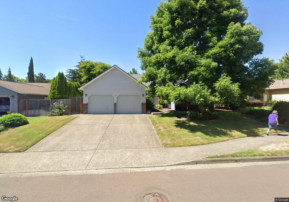
2033 NE Jamie Dr Hillsboro, OR 97124
Northwest Hillsboro NeighborhoodEstimated Value: $644,000 - $701,000
3
Beds
2
Baths
2,424
Sq Ft
$279/Sq Ft
Est. Value
About This Home
This home is located at 2033 NE Jamie Dr, Hillsboro, OR 97124 and is currently estimated at $676,360, approximately $279 per square foot. 2033 NE Jamie Dr is a home located in Washington County with nearby schools including Jackson Elementary School, Evergreen Jr High School, and Glencoe High School.
Ownership History
Date
Name
Owned For
Owner Type
Purchase Details
Closed on
Apr 7, 2014
Sold by
Allen Jerald G and Allen Margaret C
Bought by
Jorgenson Thomas L and Jorgenson Barbara J
Current Estimated Value
Purchase Details
Closed on
Aug 27, 2007
Sold by
Allen Jerald G and Allen Margaret C
Bought by
Allen Jerald G and Allen Margaret C
Home Financials for this Owner
Home Financials are based on the most recent Mortgage that was taken out on this home.
Original Mortgage
$318,400
Interest Rate
6.67%
Mortgage Type
New Conventional
Purchase Details
Closed on
Apr 17, 1997
Sold by
Scrivner Jerald D
Bought by
Allen Jerald G and Allen Celeste
Home Financials for this Owner
Home Financials are based on the most recent Mortgage that was taken out on this home.
Original Mortgage
$176,000
Interest Rate
7.86%
Create a Home Valuation Report for This Property
The Home Valuation Report is an in-depth analysis detailing your home's value as well as a comparison with similar homes in the area
Home Values in the Area
Average Home Value in this Area
Purchase History
| Date | Buyer | Sale Price | Title Company |
|---|---|---|---|
| Jorgenson Thomas L | $375,000 | First American | |
| Allen Jerald G | -- | Rockwood Title & Settlement | |
| Allen Jerald G | $220,000 | Stewart Title Company |
Source: Public Records
Mortgage History
| Date | Status | Borrower | Loan Amount |
|---|---|---|---|
| Previous Owner | Allen Jerald G | $318,400 | |
| Previous Owner | Allen Jerald G | $176,000 |
Source: Public Records
Tax History Compared to Growth
Tax History
| Year | Tax Paid | Tax Assessment Tax Assessment Total Assessment is a certain percentage of the fair market value that is determined by local assessors to be the total taxable value of land and additions on the property. | Land | Improvement |
|---|---|---|---|---|
| 2025 | $6,725 | $411,420 | -- | -- |
| 2024 | $6,534 | $399,440 | -- | -- |
| 2023 | $6,534 | $387,810 | $0 | $0 |
| 2022 | $6,356 | $387,810 | $0 | $0 |
| 2021 | $6,229 | $365,560 | $0 | $0 |
| 2020 | $6,095 | $354,920 | $0 | $0 |
| 2019 | $5,919 | $344,590 | $0 | $0 |
| 2018 | $5,666 | $334,560 | $0 | $0 |
| 2017 | $5,461 | $324,820 | $0 | $0 |
| 2016 | $5,311 | $315,360 | $0 | $0 |
| 2015 | $5,097 | $306,180 | $0 | $0 |
| 2014 | $5,068 | $297,270 | $0 | $0 |
Source: Public Records
Map
Nearby Homes
- 2011 NE Josephine Dr
- 2795 NE Lorie Dr
- 1900 NE Harewood Place
- 2878 NE Aurora Dr
- 773 NE Kathryn St
- 1722 NE Jackson School Rd
- 1425 NE Glen Ellen Dr
- 1670 NE Jackson School Rd
- 729 NE Rogahn St
- 175 NE Chancellor Ct
- 795 NE Rogahn St
- 2643 NE 2nd Dr
- 2525 NE Charlois Dr
- 2619 NE Charlois Dr
- 1676 NE 2nd Ave
- 553 NE Buena Vista St
- 3215 NE 4th Ave
- 876 NE Hood St
- 555 NW Hertel St
- 802 NE Brennan Ln
- 2059 NE Jamie Dr
- 2009 NE Jamie Dr
- 2046 NE Josephine Dr
- 2001 NE Jamie Dr
- 2087 NE Jamie Dr
- 2034 NE Josephine Dr
- 2002 NE Josephine Dr
- 612 NE Kathleen Ct
- 2012 NE Jamie Dr
- 2074 NE Josephine Dr
- 2000 NE Jamie Dr
- 2026 NE Josephine Dr
- 2135 NE Jamie Dr
- 2088 NE Joshephine Dr
- 2088 NE Josephine Dr
- 620 NE Kathleen Ct
- 2124 NE Jamie Dr
- 623 NE Josephine Ct
- 2041 NE Josephine Dr
- 2059 NE Josephine Dr