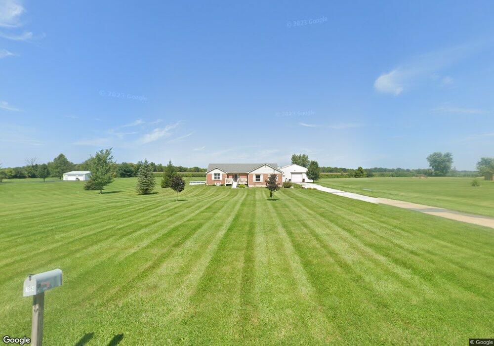
2033 Port William Rd Jamestown, OH 45335
Estimated Value: $285,000 - $416,000
3
Beds
2
Baths
1,570
Sq Ft
$226/Sq Ft
Est. Value
About This Home
This home is located at 2033 Port William Rd, Jamestown, OH 45335 and is currently estimated at $354,494, approximately $225 per square foot. 2033 Port William Rd is a home located in Clinton County with nearby schools including East End Elementary School, Denver Place Elementary School, and Roy E. Holmes Elementary School.
Ownership History
Date
Name
Owned For
Owner Type
Purchase Details
Closed on
Apr 13, 2022
Sold by
Young Lorraine and Stonerock Richard P
Bought by
Stonerock Richard P
Current Estimated Value
Purchase Details
Closed on
Sep 24, 2021
Sold by
Zeckser Jason G and Zeckser Kimberly A
Bought by
Young Lorraine and Stonerock Richard P
Purchase Details
Closed on
Mar 6, 1998
Bought by
Zeckser Jason G and Zeckser Kimberly A
Create a Home Valuation Report for This Property
The Home Valuation Report is an in-depth analysis detailing your home's value as well as a comparison with similar homes in the area
Home Values in the Area
Average Home Value in this Area
Purchase History
| Date | Buyer | Sale Price | Title Company |
|---|---|---|---|
| Stonerock Richard P | $166 | None Listed On Document | |
| Stonerock Richard P | $166 | None Listed On Document | |
| Young Lorraine | $16,666 | None Listed On Document | |
| Young Lorraine | $16,666 | None Listed On Document | |
| Zeckser Jason G | -- | -- |
Source: Public Records
Tax History Compared to Growth
Tax History
| Year | Tax Paid | Tax Assessment Tax Assessment Total Assessment is a certain percentage of the fair market value that is determined by local assessors to be the total taxable value of land and additions on the property. | Land | Improvement |
|---|---|---|---|---|
| 2024 | $3,366 | $93,170 | $19,460 | $73,710 |
| 2023 | $3,366 | $93,170 | $19,460 | $73,710 |
| 2022 | $2,759 | $77,300 | $11,600 | $65,700 |
| 2021 | $2,732 | $77,300 | $11,600 | $65,700 |
| 2020 | $2,646 | $77,300 | $11,600 | $65,700 |
| 2019 | $2,467 | $66,970 | $10,120 | $56,850 |
| 2018 | $2,235 | $66,970 | $10,120 | $56,850 |
| 2017 | $1,084 | $66,970 | $10,120 | $56,850 |
| 2016 | $1,764 | $54,180 | $10,780 | $43,400 |
| 2015 | $1,764 | $54,180 | $10,780 | $43,400 |
| 2013 | $1,781 | $53,410 | $10,780 | $42,630 |
Source: Public Records
Map
Nearby Homes
- 3915 U S 68
- 3863 S Old Us Rt 68
- 2268 E Spring Valley Paintersville Rd
- 241 Raycon Dr
- 2594 Irvin Rd
- 2676 Waynesville Jamestown Rd
- 5469 Davis Rd
- 668 New Burlington Rd
- 3222 Maysville St
- 6355 Zimmerman Rd
- 1861 Oh-72
- 1697 Oglesbee Rd
- 3710 N Lakeshore Dr
- 01 Jasper Rd
- 1253 Us Route 68
- 0 US Route 68 Unit 1792385
- 0 US Route 68 Unit 1831183
- 815 Oneida Trail
- 0 Apache Trail Unit 941961
- 4206 N Lakeshore Dr
- 1973 Port William Rd
- 1960 Port William Rd
- 2099 Port William Rd
- 2104 Port William Rd
- 2099 Port William Rd
- 2146 Port William Rd
- 2211 Port William Rd
- 2297 Port William Rd
- 1743 Port William Rd
- 1766 Port William Rd
- 9899 Port William Rd
- 2407 Port William Rd
- 157 Mason Rd
- 1358 Hiney Rd
- 1446 Port William Rd
- 1414 Port William Rd
- 1378 Port William Rd
- 1323 Port William Rd
- 2.2300ac Bone Rd
- 1004 Hiney Rd