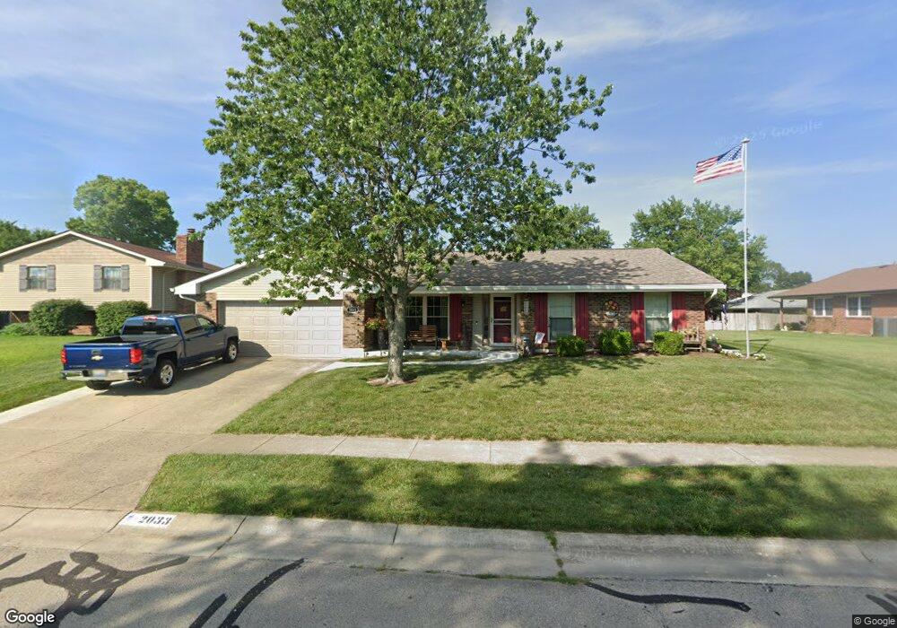
2033 Robinhood Dr Miamisburg, OH 45342
Estimated Value: $268,000 - $318,000
3
Beds
3
Baths
1,722
Sq Ft
$170/Sq Ft
Est. Value
About This Home
This home is located at 2033 Robinhood Dr, Miamisburg, OH 45342 and is currently estimated at $291,931, approximately $169 per square foot. 2033 Robinhood Dr is a home located in Montgomery County with nearby schools including Miamisburg High School and Bethel Baptist School.
Ownership History
Date
Name
Owned For
Owner Type
Purchase Details
Closed on
May 7, 2018
Sold by
Terry L Manson
Bought by
Doyle Leroy and Doyle Karen
Current Estimated Value
Home Financials for this Owner
Home Financials are based on the most recent Mortgage that was taken out on this home.
Original Mortgage
$152,000
Outstanding Balance
$131,326
Interest Rate
4.55%
Estimated Equity
$160,605
Purchase Details
Closed on
May 4, 2018
Sold by
Manson Terry L
Bought by
Doyle Leroy J Ad
Home Financials for this Owner
Home Financials are based on the most recent Mortgage that was taken out on this home.
Original Mortgage
$152,000
Outstanding Balance
$131,326
Interest Rate
4.55%
Estimated Equity
$160,605
Purchase Details
Closed on
Apr 10, 2017
Sold by
Estate Of Terry J Manson
Bought by
Manson Beverly A
Purchase Details
Closed on
Mar 13, 2009
Sold by
Deweese Michael G and Deweese Brooke Sargent
Bought by
Manson Terry J
Home Financials for this Owner
Home Financials are based on the most recent Mortgage that was taken out on this home.
Original Mortgage
$80,000
Interest Rate
5.11%
Mortgage Type
Purchase Money Mortgage
Purchase Details
Closed on
Aug 28, 2003
Sold by
Deutsche Bank National Trust Co
Bought by
Deweese Michael G and Sargent Brooke J
Home Financials for this Owner
Home Financials are based on the most recent Mortgage that was taken out on this home.
Original Mortgage
$82,500
Interest Rate
4.99%
Mortgage Type
Purchase Money Mortgage
Purchase Details
Closed on
Jun 24, 2003
Sold by
Bowles Ronald
Bought by
Deutsche Bank National Trust Co and Long Beach Mortgage Loan Trust 2001-1
Purchase Details
Closed on
Dec 19, 2000
Sold by
Hoaja Richard N and Hoaja Darlene A
Bought by
Bowles Ronald and Bowles Jennifer
Home Financials for this Owner
Home Financials are based on the most recent Mortgage that was taken out on this home.
Original Mortgage
$136,000
Interest Rate
10.95%
Purchase Details
Closed on
Dec 17, 1996
Sold by
Fortkamp Lavern and Fortkamp Elaine
Bought by
Hoaja Richard N and Hoaja Darlene A
Create a Home Valuation Report for This Property
The Home Valuation Report is an in-depth analysis detailing your home's value as well as a comparison with similar homes in the area
Home Values in the Area
Average Home Value in this Area
Purchase History
| Date | Buyer | Sale Price | Title Company |
|---|---|---|---|
| Doyle Leroy | $149,900 | -- | |
| Doyle Leroy J Ad | $149,900 | -- | |
| Manson Beverly A | -- | None Available | |
| Manson Terry J | $122,000 | Attorney | |
| Deweese Michael G | $117,900 | Midland Title Security Inc | |
| Deutsche Bank National Trust Co | $110,000 | -- | |
| Bowles Ronald | $136,500 | -- | |
| Hoaja Richard N | $134,900 | Lawyers Title Insurance Corp |
Source: Public Records
Mortgage History
| Date | Status | Borrower | Loan Amount |
|---|---|---|---|
| Open | Doyle Leroy J Ad | $152,000 | |
| Closed | Doyle Leroy J Ad | -- | |
| Closed | Doyle Leroy J Ad | -- | |
| Previous Owner | Manson Terry J | $80,000 | |
| Previous Owner | Deweese Michael G | $82,500 | |
| Previous Owner | Bowles Ronald | $136,000 |
Source: Public Records
Tax History Compared to Growth
Tax History
| Year | Tax Paid | Tax Assessment Tax Assessment Total Assessment is a certain percentage of the fair market value that is determined by local assessors to be the total taxable value of land and additions on the property. | Land | Improvement |
|---|---|---|---|---|
| 2024 | $4,140 | $72,820 | $14,490 | $58,330 |
| 2023 | $4,140 | $72,820 | $14,490 | $58,330 |
| 2022 | $4,017 | $60,680 | $12,080 | $48,600 |
| 2021 | $3,520 | $59,970 | $12,080 | $47,890 |
| 2020 | $3,514 | $59,970 | $12,080 | $47,890 |
| 2019 | $3,323 | $53,070 | $10,500 | $42,570 |
| 2018 | $3,716 | $49,680 | $10,500 | $39,180 |
| 2017 | $3,694 | $49,680 | $10,500 | $39,180 |
| 2016 | $3,408 | $44,030 | $10,500 | $33,530 |
| 2015 | $3,348 | $44,030 | $10,500 | $33,530 |
| 2014 | $3,348 | $44,030 | $10,500 | $33,530 |
| 2012 | -- | $46,820 | $13,300 | $33,520 |
Source: Public Records
Map
Nearby Homes
- 2125 Sherwood Forest Dr
- 1803 Cudgell Dr
- 1100 S Elm St
- 429 Wilson Park Dr
- 838 Maid Marion Ct
- 1000 Skyview Dr
- 2302 King Richard Pkwy
- 609 Kings Cross Ct
- 432 Crusader Dr
- 500 Lincoln Green Dr
- 857 Lea Castle Place
- 722 Peach Orchard Dr
- 700 N Gebhart Church Rd
- 257 Ironwood Dr
- 250 Grantwood Dr
- 1109 Sundance Dr
- 703 Friar Tuck Ct
- 00 Heincke Rd
- 275 Orchard Hill Dr
- 1153 King Richard Pkwy
- 2105 Sherwood Forest Dr
- 2101 Sherwood Forest Dr
- 2109 Sherwood Forest Dr
- 2019 Robinhood Dr
- 2032 Robinhood Dr
- 2030 Robinhood Dr
- 2039 Sherwood Forest Dr
- 2111 Sherwood Forest Dr
- 2007 Robinhood Dr
- 2101 Robinhood Dr
- 2112 Sherwood Forest Dr
- 1950 Cudgell Dr
- 2027 Sherwood Forest Dr
- 2040 Sherwood Forest Dr
- 2113 Sherwood Forest Dr
- 1945 Robinhood Dr
- 2114 Sherwood Forest Dr
- 2105 Robinhood Dr
- 1946 Robinhood Dr
- 1940 Cudgell Dr