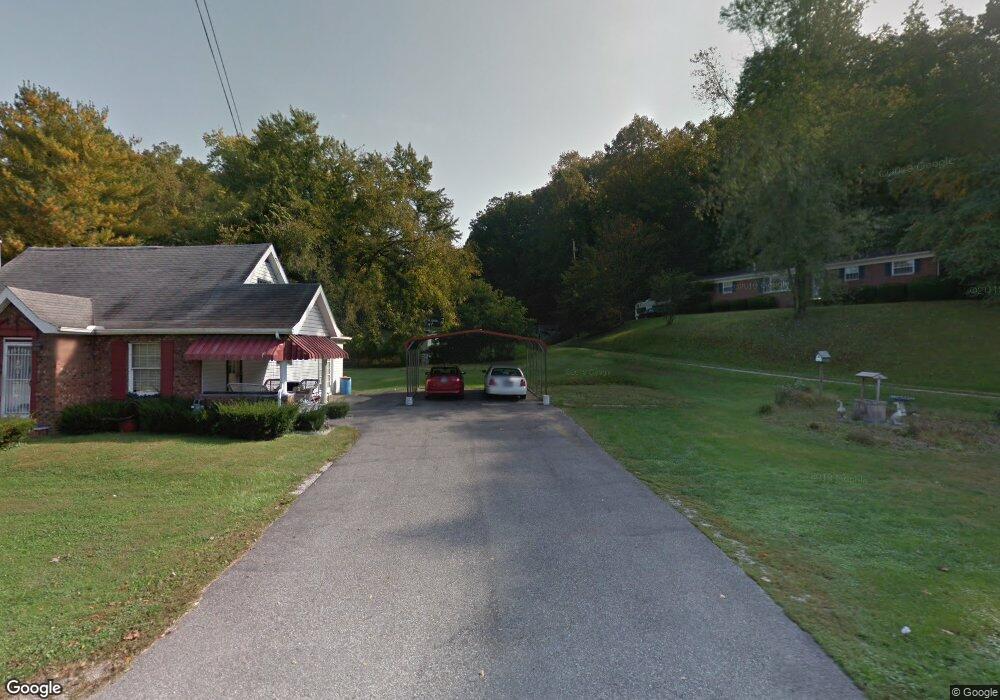
2033 State Route 243 Ironton, OH 45638
Estimated Value: $107,938 - $165,000
3
Beds
2
Baths
1,530
Sq Ft
$94/Sq Ft
Est. Value
About This Home
This home is located at 2033 State Route 243, Ironton, OH 45638 and is currently estimated at $144,485, approximately $94 per square foot. 2033 State Route 243 is a home located in Lawrence County with nearby schools including Dawson-Bryant Elementary School, Dawson-Bryant Middle School, and Dawson-Bryant High School.
Ownership History
Date
Name
Owned For
Owner Type
Purchase Details
Closed on
Oct 20, 2005
Sold by
Murdock Judy Kay
Bought by
Murdock Judy Kay and Murdock David D
Current Estimated Value
Purchase Details
Closed on
Apr 11, 1995
Sold by
Murdock Judy Kay and Murdock David
Bought by
Murdock Judy Kay
Purchase Details
Closed on
Mar 26, 1990
Sold by
Ratliff Carl and Ratliff Mavis
Bought by
Murdock Judy Kay and Murdock David
Create a Home Valuation Report for This Property
The Home Valuation Report is an in-depth analysis detailing your home's value as well as a comparison with similar homes in the area
Home Values in the Area
Average Home Value in this Area
Purchase History
| Date | Buyer | Sale Price | Title Company |
|---|---|---|---|
| Murdock Judy Kay | -- | None Available | |
| Murdock Judy Kay | -- | -- | |
| Murdock Judy Kay | $43,500 | -- |
Source: Public Records
Tax History Compared to Growth
Tax History
| Year | Tax Paid | Tax Assessment Tax Assessment Total Assessment is a certain percentage of the fair market value that is determined by local assessors to be the total taxable value of land and additions on the property. | Land | Improvement |
|---|---|---|---|---|
| 2024 | -- | $24,840 | $3,310 | $21,530 |
| 2023 | $453 | $24,840 | $3,310 | $21,530 |
| 2022 | $464 | $24,840 | $3,310 | $21,530 |
| 2021 | $463 | $21,450 | $3,130 | $18,320 |
| 2020 | $374 | $21,450 | $3,130 | $18,320 |
| 2019 | $372 | $21,450 | $3,130 | $18,320 |
| 2018 | $378 | $21,500 | $3,130 | $18,370 |
| 2017 | $377 | $21,500 | $3,130 | $18,370 |
| 2016 | $346 | $21,500 | $3,130 | $18,370 |
| 2015 | $302 | $18,970 | $3,140 | $15,830 |
| 2014 | $299 | $18,970 | $3,140 | $15,830 |
| 2013 | $298 | $18,970 | $3,140 | $15,830 |
Source: Public Records
Map
Nearby Homes
- 2088 State Route 243
- 342 Township Road 296
- 156 Township Road 181
- 103 Carrico Dr
- 119 Remy St
- 519 Lane St
- 514 Lane St
- 135 Lane St
- 805 1/2 High St
- 125 Center St
- 309 High St
- 309 High St Unit LAO-5
- 0 Carter Ave
- 1824 Carter Ave
- 2135 Central Ave
- 0 Central Ave
- 0 18th Street & Central Ave
- 0 27th Block of Carter Ave
- 0 Central & Mlk
- 2829 Carter Ave
- 24 Pvt Dr 2057 State Route 243
- 2009 State Route 243
- 2052 State Route 243
- 2024 State Route 243
- 2068 State Route 243
- 1991 State Route 243
- 1992 State Route 243
- 1972 State Route 243
- 2108 State Route 243
- 1963 State Route 243
- 1948 State Route 243
- 1960 State Route 243
- 2124 State Route 243
- 2133 State Route 243
- 1930 State Route 243
- 1902 State Route 243
- 2124 Ohio 243
- 1921 State Route 243
- 1912 State Route 243
- 1884 State Route 243