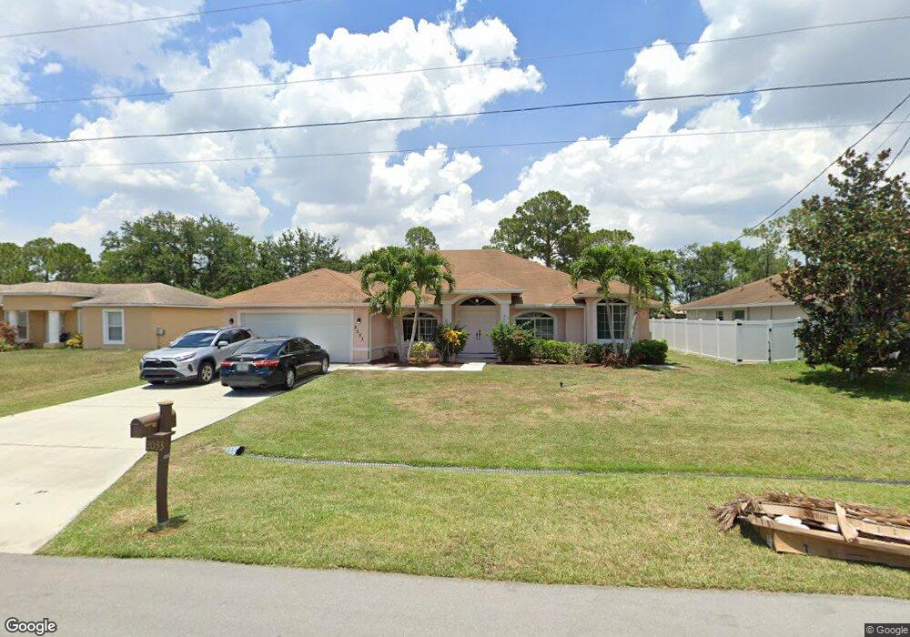
2033 SW Fears Ave Port Saint Lucie, FL 34953
Rosser Reserve NeighborhoodEstimated Value: $429,816 - $501,000
4
Beds
2
Baths
2,210
Sq Ft
$208/Sq Ft
Est. Value
About This Home
This home is located at 2033 SW Fears Ave, Port Saint Lucie, FL 34953 and is currently estimated at $459,704, approximately $208 per square foot. 2033 SW Fears Ave is a home located in St. Lucie County with nearby schools including Oak Hammock K-8 School, Windmill Point Elementary School, and Bayshore Elementary School.
Ownership History
Date
Name
Owned For
Owner Type
Purchase Details
Closed on
Nov 22, 2005
Sold by
Guillaume Murielle and Toussaint Yves
Bought by
Guillaume Murielle
Current Estimated Value
Home Financials for this Owner
Home Financials are based on the most recent Mortgage that was taken out on this home.
Original Mortgage
$290,000
Outstanding Balance
$181,603
Interest Rate
8.7%
Mortgage Type
Fannie Mae Freddie Mac
Estimated Equity
$278,101
Create a Home Valuation Report for This Property
The Home Valuation Report is an in-depth analysis detailing your home's value as well as a comparison with similar homes in the area
Home Values in the Area
Average Home Value in this Area
Purchase History
| Date | Buyer | Sale Price | Title Company |
|---|---|---|---|
| Guillaume Murielle | $92,800 | Cresent Title Agency Llc |
Source: Public Records
Mortgage History
| Date | Status | Borrower | Loan Amount |
|---|---|---|---|
| Open | Guillaume Murielle | $290,000 |
Source: Public Records
Tax History Compared to Growth
Tax History
| Year | Tax Paid | Tax Assessment Tax Assessment Total Assessment is a certain percentage of the fair market value that is determined by local assessors to be the total taxable value of land and additions on the property. | Land | Improvement |
|---|---|---|---|---|
| 2025 | $2,873 | $146,301 | -- | -- |
| 2024 | $2,799 | $142,178 | -- | -- |
| 2023 | $2,799 | $138,037 | $0 | $0 |
| 2022 | $2,668 | $134,017 | $0 | $0 |
| 2021 | $2,574 | $130,114 | $0 | $0 |
| 2020 | $2,582 | $128,318 | $0 | $0 |
| 2019 | $2,551 | $125,434 | $0 | $0 |
| 2018 | $2,419 | $123,096 | $0 | $0 |
| 2017 | $2,622 | $195,700 | $28,000 | $167,700 |
| 2016 | $2,585 | $180,300 | $24,000 | $156,300 |
| 2015 | $2,605 | $139,900 | $14,400 | $125,500 |
| 2014 | $2,491 | $116,335 | $0 | $0 |
Source: Public Records
Map
Nearby Homes
- 1939 SW Jamesport Dr
- 2177 SW Cape Cod Dr
- 2064 SW Newport Isles Blvd
- 2882 SW Cape Breton Dr
- 1924 SW Jamesport Dr
- 2030 SW Providence Place
- 3189 SW Curcuma St
- 3173 SW Fambrough St
- 3190 SW Armucher St
- 2544 SW Marshfield Ct
- 1855 SW Jamesport Dr
- 2205 SW Newport Isles Blvd
- 2245 SW Portsmouth Ln
- 2214 SW Marshfield Ct
- 2218 SW Marshfield Ct
- 1801 SW Dalmatian Ave
- 2049 SW Hayworth Ave
- 3259 SW Crumpacker St
- 3244 SW Hambrick St
- 2780 SW Buckhart St
- 2041 SW Fears Ave
- 2025 SW Fears Ave
- 2049 SW Fears Ave
- 3102 SW Blackmur St
- 2017 SW Fears Ave
- 1998 SW Jamesport Dr
- 2002 SW Jamesport Dr
- 1994 SW Jamesport Dr
- 2006 SW Jamesport Dr
- 3103 SW Blackmur St
- 2057 SW Fears Ave
- 2009 SW Fears Ave
- 3101 SW Curcuma St
- 1990 SW Jamesport Dr
- 1986 SW Jamesport Dr
- 2010 SW Jamesport Dr
- 1982 SW Jamesport Dr
- 3109 SW Curcuma St
- 3102 SW Dimattia St
- 2001 SW Fears Ave