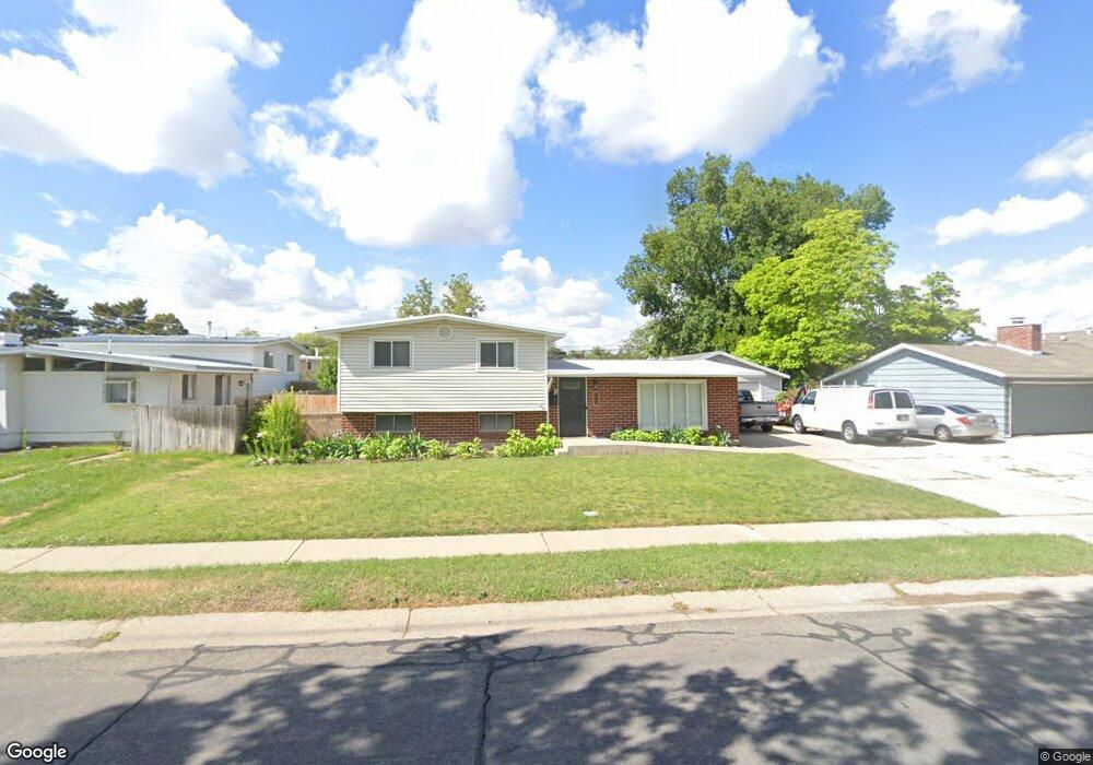
2033 W Kirkham Way Taylorsville, UT 84129
Estimated Value: $424,000 - $503,000
3
Beds
2
Baths
1,707
Sq Ft
$275/Sq Ft
Est. Value
About This Home
This home is located at 2033 W Kirkham Way, Taylorsville, UT 84129 and is currently estimated at $470,274, approximately $275 per square foot. 2033 W Kirkham Way is a home located in Salt Lake County with nearby schools including Taylorsville Elementary School, Eisenhower Jr High School, and Taylorsville High School.
Ownership History
Date
Name
Owned For
Owner Type
Purchase Details
Closed on
Oct 16, 2023
Sold by
Winrow Michael A
Bought by
Mair Steven Richard and Mair Kathy J
Current Estimated Value
Home Financials for this Owner
Home Financials are based on the most recent Mortgage that was taken out on this home.
Original Mortgage
$360,800
Outstanding Balance
$353,785
Interest Rate
7.18%
Mortgage Type
New Conventional
Estimated Equity
$116,489
Purchase Details
Closed on
Sep 8, 2014
Sold by
Winrow Michael Anthony and Winrow Mikelle D
Bought by
Winrow Michael A
Home Financials for this Owner
Home Financials are based on the most recent Mortgage that was taken out on this home.
Original Mortgage
$144,993
Interest Rate
4.09%
Mortgage Type
FHA
Purchase Details
Closed on
Mar 13, 2007
Sold by
Winrow Michael Anthony and Winrow Mikelle D
Bought by
Winrow Michael Anthony
Home Financials for this Owner
Home Financials are based on the most recent Mortgage that was taken out on this home.
Original Mortgage
$23,000
Interest Rate
6%
Mortgage Type
Stand Alone Second
Purchase Details
Closed on
Mar 12, 2007
Sold by
Winrow Michael Anthony
Bought by
Winrow Michael Anthony and Winrow Mikelle D
Home Financials for this Owner
Home Financials are based on the most recent Mortgage that was taken out on this home.
Original Mortgage
$23,000
Interest Rate
6%
Mortgage Type
Stand Alone Second
Purchase Details
Closed on
Aug 25, 2005
Sold by
Winrow Michael Anthony
Bought by
Winrow Michael Anthony and Winrow Mikelle D
Home Financials for this Owner
Home Financials are based on the most recent Mortgage that was taken out on this home.
Original Mortgage
$2,612
Interest Rate
5.61%
Mortgage Type
Stand Alone Second
Purchase Details
Closed on
Jan 13, 1994
Sold by
Hoffman Donald N and Hoffman Patricia R
Bought by
Hoffman Donald N and Hoffman Patricia R
Create a Home Valuation Report for This Property
The Home Valuation Report is an in-depth analysis detailing your home's value as well as a comparison with similar homes in the area
Home Values in the Area
Average Home Value in this Area
Purchase History
| Date | Buyer | Sale Price | Title Company |
|---|---|---|---|
| Mair Steven Richard | -- | None Listed On Document | |
| Winrow Michael A | -- | Advanced Title Slc | |
| Winrow Michael Anthony | -- | Meridian Title | |
| Winrow Michael Anthony | -- | Meridian Title | |
| Winrow Michael Anthony | -- | Meridian Title | |
| Winrow Michael Anthony | -- | Meridian Title | |
| Winrow Michael Anthony | -- | Meridian Title | |
| Hoffman Donald N | -- | -- |
Source: Public Records
Mortgage History
| Date | Status | Borrower | Loan Amount |
|---|---|---|---|
| Open | Mair Steven Richard | $360,800 | |
| Previous Owner | Winrow Michael A | $144,993 | |
| Previous Owner | Winrow Michael Anthony | $23,000 | |
| Previous Owner | Winrow Michael Anthony | $23,000 | |
| Previous Owner | Winrow Michael Anthony | $2,612 | |
| Previous Owner | Winrow Michael Anthony | $139,035 |
Source: Public Records
Tax History Compared to Growth
Tax History
| Year | Tax Paid | Tax Assessment Tax Assessment Total Assessment is a certain percentage of the fair market value that is determined by local assessors to be the total taxable value of land and additions on the property. | Land | Improvement |
|---|---|---|---|---|
| 2025 | -- | $402,800 | $102,700 | $300,100 |
| 2024 | -- | $387,300 | $98,300 | $289,000 |
| 2023 | $2,188 | $351,900 | $94,500 | $257,400 |
| 2022 | $2,134 | $346,200 | $92,700 | $253,500 |
| 2021 | $1,987 | $280,800 | $71,300 | $209,500 |
| 2020 | $1,856 | $248,200 | $63,400 | $184,800 |
| 2019 | $1,841 | $240,400 | $63,400 | $177,000 |
| 2018 | $1,674 | $210,800 | $63,400 | $147,400 |
| 2017 | $1,473 | $194,900 | $60,300 | $134,600 |
| 2016 | $1,318 | $174,300 | $60,300 | $114,000 |
| 2015 | $1,301 | $160,800 | $76,000 | $84,800 |
| 2014 | $1,241 | $150,600 | $72,100 | $78,500 |
Source: Public Records
Map
Nearby Homes
- 1901 Kirkham Way
- 1998 Theckston Rd
- 4257 S Morris St
- 2267 W 4240 S
- 4203 Morris St
- 4533 S Knightsbridge Rd
- 1762 Mantle Ave
- 4497 S Edgeware Ln
- 2258 W 4185 S
- 2318 W 4220 S
- 2221 W Davenshire Ln
- 4255 S Redwood Rd W
- 4631 S 1980 W
- 2121 W 4100 S
- 4188 S Oak Meadows Dr Unit 21
- 2409 W Hardrock Dr
- 2451 Hard Rock Cir S
- 1854 W 4100 S
- 2507 W Dutch Draw
- 4176 S Oak Meadows Dr Unit 10
- 2033 Kirkham Way
- 2051 Kirkham Way
- 2023 Kirkham Way
- 2054 W Todd Way
- 2054 Todd Way
- 2038 Todd Way
- 2038 1995 W
- 2066 W Todd Way
- 2066 W Todd Way
- 2066 Todd Way
- 2069 Kirkham Way
- 2008 W Todd Way
- 2008 Todd Way
- 2034 Kirkham Way
- 2034 W Kirkham Way
- 2022 Kirkham Way
- 2020 Todd Way
- 2046 Kirkham Way
- 2010 Kirkham Way
- 2083 Kirkham Way