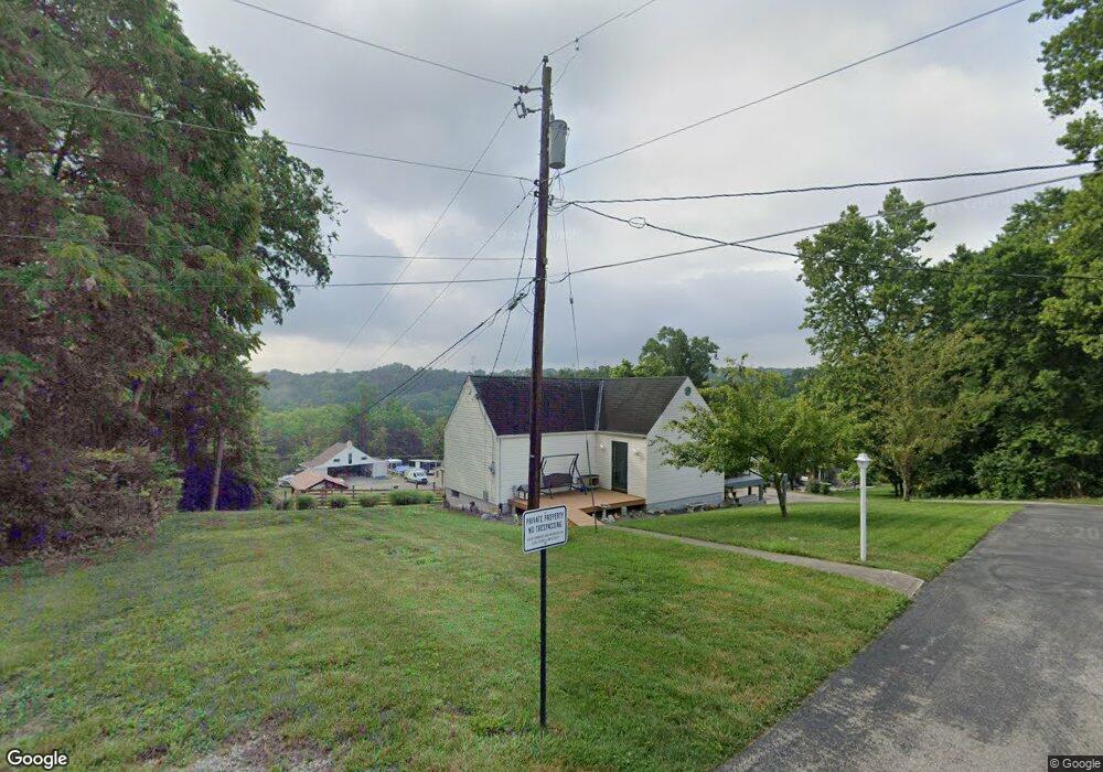
2033 Walnut St Loveland, OH 45140
Estimated Value: $152,702 - $282,000
1
Bed
2
Baths
704
Sq Ft
$295/Sq Ft
Est. Value
About This Home
This home is located at 2033 Walnut St, Loveland, OH 45140 and is currently estimated at $207,426, approximately $294 per square foot. 2033 Walnut St is a home located in Warren County with nearby schools including Kings Junior High School, Kings High School, and St. Margaret of York School.
Ownership History
Date
Name
Owned For
Owner Type
Purchase Details
Closed on
Oct 28, 2005
Sold by
Amrein Edwin J and Amrein Melissa
Bought by
Amrein Edwin J
Current Estimated Value
Home Financials for this Owner
Home Financials are based on the most recent Mortgage that was taken out on this home.
Original Mortgage
$61,000
Interest Rate
6.48%
Mortgage Type
New Conventional
Purchase Details
Closed on
Sep 5, 1991
Sold by
Doggett Doggett and Doggett Audrey W
Bought by
Herbert Paul and Herbert Rickey
Create a Home Valuation Report for This Property
The Home Valuation Report is an in-depth analysis detailing your home's value as well as a comparison with similar homes in the area
Home Values in the Area
Average Home Value in this Area
Purchase History
| Date | Buyer | Sale Price | Title Company |
|---|---|---|---|
| Amrein Edwin J | -- | None Available | |
| Herbert Paul | $23,000 | -- |
Source: Public Records
Mortgage History
| Date | Status | Borrower | Loan Amount |
|---|---|---|---|
| Closed | Amrein Edwin J | $61,000 |
Source: Public Records
Tax History Compared to Growth
Tax History
| Year | Tax Paid | Tax Assessment Tax Assessment Total Assessment is a certain percentage of the fair market value that is determined by local assessors to be the total taxable value of land and additions on the property. | Land | Improvement |
|---|---|---|---|---|
| 2024 | $1,575 | $30,510 | $8,820 | $21,690 |
| 2023 | $1,310 | $22,785 | $4,336 | $18,448 |
| 2022 | $1,289 | $22,785 | $4,337 | $18,449 |
| 2021 | $1,078 | $22,785 | $4,337 | $18,449 |
| 2020 | $1,086 | $19,310 | $3,675 | $15,635 |
| 2019 | $1,100 | $19,310 | $3,675 | $15,635 |
| 2018 | $1,104 | $19,310 | $3,675 | $15,635 |
| 2017 | $1,137 | $17,752 | $3,434 | $14,319 |
| 2016 | $1,166 | $17,752 | $3,434 | $14,319 |
| 2015 | $1,075 | $17,752 | $3,434 | $14,319 |
| 2014 | $1,075 | $16,910 | $3,270 | $13,640 |
| 2013 | $1,077 | $19,000 | $3,680 | $15,320 |
Source: Public Records
Map
Nearby Homes
- 1942 Walnut St
- 1312 Chestnut Dr
- 9613 Vine Dr
- 9653 Shore Dr
- 300 Oak Dr
- 2515 Hickory Rd
- 2513 Hickory Rd
- 2423 Hickory Rd
- 2612 Virgie Ct
- 0 Birch Dr
- 9785 Rich Rd
- 9023 Country View Ln
- 2680 Columbia Trail
- 9702 Amberwood Ct
- 9900 Miami Dr
- 2522 Fields Ertel Rd
- 9299 White Pine Dr
- 2845 Columbia Trail
- 12143 Cedar Dr
- 8384 Sibcy Rd
- 9359 Chestnut Dr
- 1152 Park Terrace
- 9399 Chestnut Dr
- 2054 Walnut St
- 0 Chestnut Dr Unit 1473143
- 0 Chestnut Dr Unit 1498117
- 0 Chestnut Dr Unit 1611283
- 2100 Pine Rd
- 1942 Walnut St
- 1942 Walnut Rd
- 9427 Park Terrace
- 9413 Chestnut Dr
- 9411 Birch Dr
- 9300 Miami Dr
- 9405 Cherry Dr
- 1315 Chestnut Dr
- 1313 Chestnut Dr
- 9414 Chestnut Dr
- 1853 Birch Dr
- Lot Birch Dr