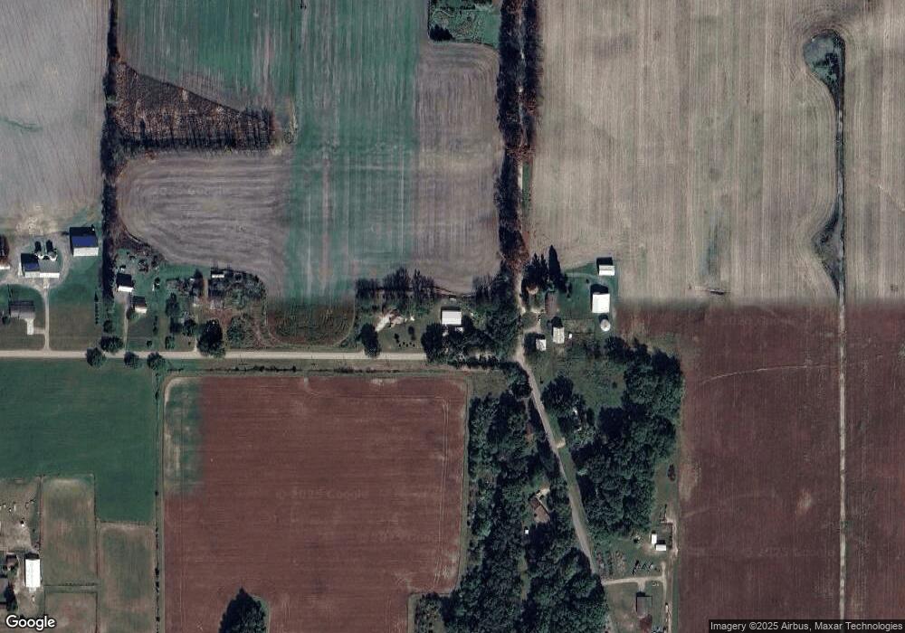
20330 Bulhand St Cassopolis, MI 49031
Estimated Value: $211,000 - $268,000
3
Beds
3
Baths
2,300
Sq Ft
$107/Sq Ft
Est. Value
About This Home
This home is located at 20330 Bulhand St, Cassopolis, MI 49031 and is currently estimated at $246,375, approximately $107 per square foot. 20330 Bulhand St is a home located in Cass County with nearby schools including Sam Adams Elementary School, Cassopolis Middle School, and Cassopolis Ross Beatty High School.
Ownership History
Date
Name
Owned For
Owner Type
Purchase Details
Closed on
Sep 15, 2006
Sold by
Strasbourg John T and Strasbourg Pamela Kay
Bought by
Keck Eric A
Current Estimated Value
Home Financials for this Owner
Home Financials are based on the most recent Mortgage that was taken out on this home.
Original Mortgage
$102,000
Outstanding Balance
$60,987
Interest Rate
6.59%
Estimated Equity
$185,388
Purchase Details
Closed on
Jul 7, 2006
Sold by
Strasbourg Pamela Kay
Bought by
Strasbourg John T
Home Financials for this Owner
Home Financials are based on the most recent Mortgage that was taken out on this home.
Original Mortgage
$8,000
Interest Rate
6.72%
Create a Home Valuation Report for This Property
The Home Valuation Report is an in-depth analysis detailing your home's value as well as a comparison with similar homes in the area
Home Values in the Area
Average Home Value in this Area
Purchase History
| Date | Buyer | Sale Price | Title Company |
|---|---|---|---|
| Keck Eric A | $109,000 | Meridian Title Corporation | |
| Strasbourg John T | -- | None Available |
Source: Public Records
Mortgage History
| Date | Status | Borrower | Loan Amount |
|---|---|---|---|
| Open | Keck Eric A | $102,000 | |
| Previous Owner | Strasbourg John T | $8,000 |
Source: Public Records
Tax History Compared to Growth
Tax History
| Year | Tax Paid | Tax Assessment Tax Assessment Total Assessment is a certain percentage of the fair market value that is determined by local assessors to be the total taxable value of land and additions on the property. | Land | Improvement |
|---|---|---|---|---|
| 2025 | $757 | $73,100 | $73,100 | $0 |
| 2024 | $301 | $72,000 | $72,000 | $0 |
| 2023 | $287 | $49,100 | $0 | $0 |
| 2022 | $274 | $46,500 | $0 | $0 |
| 2021 | $653 | $45,000 | $0 | $0 |
| 2020 | $263 | $34,600 | $0 | $0 |
| 2019 | $547 | $34,800 | $0 | $0 |
| 2018 | $252 | $35,300 | $0 | $0 |
| 2017 | $247 | $31,700 | $0 | $0 |
| 2016 | $245 | $26,600 | $0 | $0 |
| 2015 | -- | $22,700 | $0 | $0 |
| 2011 | -- | $41,200 | $0 | $0 |
Source: Public Records
Map
Nearby Homes
- 68456 Cassopolis Rd
- 68285 George Smith Ct
- 22455 Painter St
- 69312 Teter Trail
- 22214 Christiana St
- 65945 Calvin Center Rd
- 11 Ashley Rd
- 68570 Morton Dr Unit 206
- 22322 U S 12
- 68283 Park Shore Dr
- 00000 N Shore Dr
- 66082 Victoria Ln
- V/L U S 12
- 23684 N Shore Dr
- 23675 N Shore Dr
- 23650 S Shore Dr
- 23836 N Shore Dr
- 21932 Buffalo Ln
- 67354 Oil City Rd
- V/L 5 Points Rd
- 20456 Bulhand St
- 20494 Bulhand St
- 67695 Lost Rd
- 20245 Bulhand St
- 20239 Bulhand St
- 20239 Bulhand St
- 67483 Lamb Rd
- 67276 Lamb Rd
- 00000 Bulhand St
- 0 Bulhand St Unit 17054007
- 0 Bulhand St Unit 10027412
- 0 Bulhand St Unit 7012526
- 67741 Lost Rd
- 67741 Lost Rd
- 67606 Lost Rd
- 20222 Bulhand St
- 20225 Bulhand St
- 20536 Bulhand St
- 20171 Bulhand St
- 20147 Bulhand St
