Estimated Value: $325,747 - $370,000
3
Beds
2
Baths
1,488
Sq Ft
$232/Sq Ft
Est. Value
About This Home
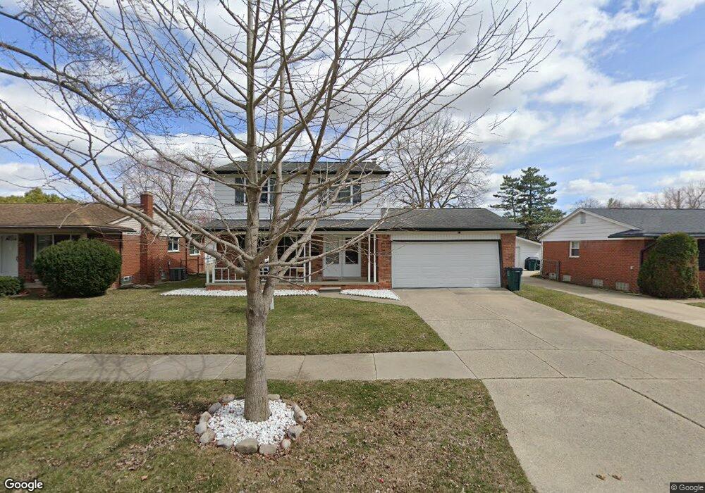
This home is located at 2034 Alexander Dr Unit Bldg-Unit, Troy, MI 48083 and is currently estimated at $345,437, approximately $232 per square foot. 2034 Alexander Dr Unit Bldg-Unit is a home located in Oakland County with nearby schools including Susick Elementary School, Grissom Middle School, and Sterling Heights Senior H.S..
Ownership History
Date
Name
Owned For
Owner Type
Purchase Details
Closed on
Jul 20, 2018
Sold by
Wilson Matthew R and Wilson Anne
Bought by
Danha Noor Sameer
Current Estimated Value
Home Financials for this Owner
Home Financials are based on the most recent Mortgage that was taken out on this home.
Original Mortgage
$166,400
Outstanding Balance
$144,529
Interest Rate
4.6%
Mortgage Type
New Conventional
Estimated Equity
$200,908
Purchase Details
Closed on
Apr 25, 2012
Sold by
Wilson Anne and Piche Anne
Bought by
Wilson Matthew R and Wilson Anne
Home Financials for this Owner
Home Financials are based on the most recent Mortgage that was taken out on this home.
Original Mortgage
$118,000
Interest Rate
3.99%
Mortgage Type
New Conventional
Purchase Details
Closed on
Apr 21, 2004
Sold by
Litchfield Paul G and Litchfield Andrea
Bought by
Piche Anne
Create a Home Valuation Report for This Property
The Home Valuation Report is an in-depth analysis detailing your home's value as well as a comparison with similar homes in the area
Home Values in the Area
Average Home Value in this Area
Purchase History
| Date | Buyer | Sale Price | Title Company |
|---|---|---|---|
| Danha Noor Sameer | $208,000 | Ata National Title Group Llc | |
| Wilson Matthew R | -- | Lsi | |
| Piche Anne | $183,500 | First American Title |
Source: Public Records
Mortgage History
| Date | Status | Borrower | Loan Amount |
|---|---|---|---|
| Open | Danha Noor Sameer | $166,400 | |
| Previous Owner | Wilson Matthew R | $118,000 |
Source: Public Records
Tax History
| Year | Tax Paid | Tax Assessment Tax Assessment Total Assessment is a certain percentage of the fair market value that is determined by local assessors to be the total taxable value of land and additions on the property. | Land | Improvement |
|---|---|---|---|---|
| 2022 | $3,859 | $110,930 | $0 | $0 |
| 2015 | $3,611 | $76,690 | $0 | $0 |
| 2014 | -- | $69,290 | $0 | $0 |
| 2011 | -- | $64,940 | $0 | $0 |
Source: Public Records
Map
Nearby Homes
- 2021 Castleton Dr
- 1853 Milverton Dr
- 2810 Rhodes Dr
- 2811 Rhodes Dr
- 2149 Isabell Dr
- 2850 Roundtree Dr Unit 184
- 1828 John R Rd
- 2926 Roundtree Dr
- 2684 Roundtree Dr
- 2808 Roundtree Dr
- 2731 Roundtree Dr
- 2703 Downey Dr
- 2109 Chesley Dr
- 80 S Trail Ct
- 000 Wisconsin Rd
- 1002 Minnesota Rd
- 2448 Oakcrest Rd
- 2983 Dashwood Dr
- 36311 Park Place Dr
- 36310 Park Place Dr
- 2034 Alexander Dr
- 2046 Alexander Dr
- 2022 Alexander Dr
- 2058 Alexander Dr
- 2010 Alexander Dr
- 2051 Atlas Dr
- 2063 Atlas Dr
- 2039 Atlas Dr
- 2075 Atlas Dr
- 2027 Atlas Dr
- 2033 Alexander Dr
- 2070 Alexander Dr
- 2045 Alexander Dr
- 2021 Alexander Dr
- 2015 Atlas Dr
- 2087 Atlas Dr
- 2057 Alexander Dr
- 2009 Alexander Dr
- 2106 Alexander Dr
- 1962 Alexander Dr
Your Personal Tour Guide
Ask me questions while you tour the home.