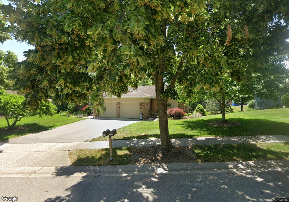
2034 Cranbrook Dr NE Unit 12 Grand Rapids, MI 49505
North East Citizens Action NeighborhoodEstimated Value: $265,924 - $287,000
2
Beds
2
Baths
1,841
Sq Ft
$150/Sq Ft
Est. Value
About This Home
This home is located at 2034 Cranbrook Dr NE Unit 12, Grand Rapids, MI 49505 and is currently estimated at $275,481, approximately $149 per square foot. 2034 Cranbrook Dr NE Unit 12 is a home located in Kent County with nearby schools including Kent Hills School, Riverside Middle School, and Union High School.
Ownership History
Date
Name
Owned For
Owner Type
Purchase Details
Closed on
Jun 10, 2024
Sold by
Reister John E
Bought by
Reister John E and Reister Family Trust
Current Estimated Value
Purchase Details
Closed on
Feb 14, 2023
Sold by
Reister Family Trust
Bought by
Reister John E and Reister Sallie J
Purchase Details
Closed on
May 8, 2014
Sold by
Reister John and Reister Sallie
Bought by
Reister Family Trust
Purchase Details
Closed on
Sep 24, 2007
Sold by
Lyonnais Revocabl Raymond E and Lyonnais Revocabl Beatrice E
Bought by
Reister John and Reister Sallie
Purchase Details
Closed on
Dec 21, 1995
Sold by
Lyonnais Raymond E
Bought by
Lyonnais Raymond E/Beatrice E Trust and Reister John Sallie
Create a Home Valuation Report for This Property
The Home Valuation Report is an in-depth analysis detailing your home's value as well as a comparison with similar homes in the area
Home Values in the Area
Average Home Value in this Area
Purchase History
| Date | Buyer | Sale Price | Title Company |
|---|---|---|---|
| Reister John E | -- | None Listed On Document | |
| Reister John E | -- | None Listed On Document | |
| Reister Family Trust | -- | None Available | |
| Reister John | $135,000 | None Available | |
| Lyonnais Raymond E/Beatrice E Trust | -- | -- | |
| Revocabl Raymond E | -- | None Available |
Source: Public Records
Tax History Compared to Growth
Tax History
| Year | Tax Paid | Tax Assessment Tax Assessment Total Assessment is a certain percentage of the fair market value that is determined by local assessors to be the total taxable value of land and additions on the property. | Land | Improvement |
|---|---|---|---|---|
| 2025 | $1,956 | $126,000 | $0 | $0 |
| 2024 | $1,956 | $124,900 | $0 | $0 |
| 2023 | $1,873 | $91,000 | $0 | $0 |
| 2022 | $1,884 | $89,500 | $0 | $0 |
| 2021 | $1,842 | $87,400 | $0 | $0 |
| 2020 | $1,805 | $83,600 | $0 | $0 |
| 2019 | $1,889 | $80,600 | $0 | $0 |
| 2018 | $1,825 | $70,600 | $0 | $0 |
| 2017 | $1,778 | $57,200 | $0 | $0 |
| 2016 | $1,755 | $51,500 | $0 | $0 |
| 2015 | $1,632 | $51,500 | $0 | $0 |
| 2013 | -- | $48,000 | $0 | $0 |
Source: Public Records
Map
Nearby Homes
- 2098 Cranbrook Dr NE Unit 51
- 1250 Walwood Dr NE
- 1420 Worcester Dr NE
- 1261 Banbury Ave NE
- 1336 Banbury Ave NE
- 2151 Chelsea Rd NE
- 2353 Midvale St NE
- 1410 Rothbury Dr NE
- 2225 Watertown Way
- 2223 Watertown Way
- 2229 Watertown Way
- 2275 Watertown Way
- 2243 Watertown Way
- 2269 Watertown Way
- 1455 Ball Ave NE
- 1010 Cherrywood Ln NE
- 2351 Watertown Way Unit 6
- 1659 Mason St NE
- 1250 Mayfield Ave NE
- 1518 Mayfield Ave NE
- 2040 Cranbrook Dr NE Unit 13
- 2022 Cranbrook Dr NE
- 2048 Cranbrook Dr NE
- 2048 Cranbrook Dr NE Unit 15
- 2016 Cranbrook Dr NE Unit 10
- 2031 Cranbrook Dr NE Unit 8
- 2054 Cranbrook Dr NE
- 2037 Cranbrook Dr NE
- 2021 Cranbrook Dr NE Unit 7
- 2015 Cranbrook Dr NE Unit 6
- 1289 Cranbrook Terrace NE Unit 19
- 2068 Cranbrook Dr NE
- 2068 Cranbrook Dr NE Unit 17
- 1295 Cranbrook Terrace NE
- 1295 Cranbrook Terrace NE Unit 20
- 2074 Cranbrook Dr NE
- 2074 Cranbrook Dr NE Unit 16
- 1301 Cranbrook Terrace NE
- 1301 Cranbrook Terrace NE Unit 21
- 1300 Perkins Ave NE