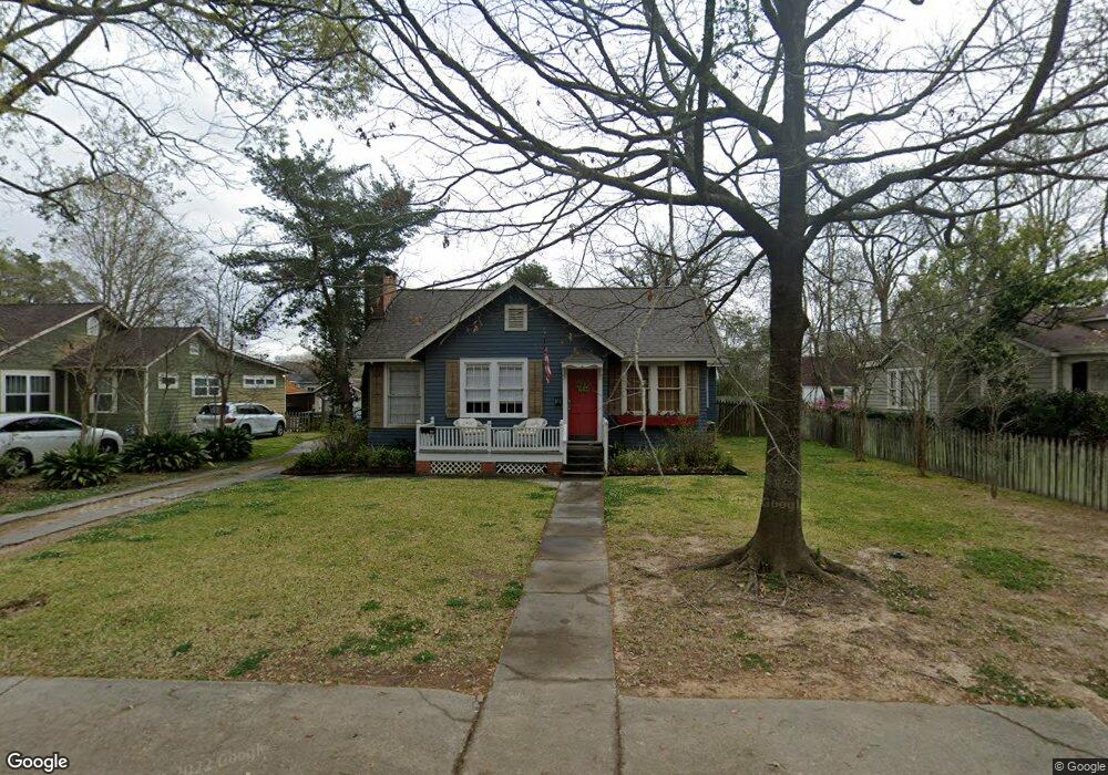
2034 Glendale Ave Baton Rouge, LA 70808
Highlands/Perkins NeighborhoodEstimated Value: $349,260 - $398,000
--
Bed
--
Bath
1,606
Sq Ft
$232/Sq Ft
Est. Value
About This Home
This home is located at 2034 Glendale Ave, Baton Rouge, LA 70808 and is currently estimated at $371,815, approximately $231 per square foot. 2034 Glendale Ave is a home located in East Baton Rouge Parish with nearby schools including Buchanan Elementary School, Glasgow Middle School, and Mckinley Senior High School.
Ownership History
Date
Name
Owned For
Owner Type
Purchase Details
Closed on
Dec 6, 2017
Sold by
The Estate Of Sue Larguier Spaht
Bought by
Hutchison Susan Elizabeth
Current Estimated Value
Home Financials for this Owner
Home Financials are based on the most recent Mortgage that was taken out on this home.
Original Mortgage
$273,500
Outstanding Balance
$230,263
Interest Rate
3.94%
Mortgage Type
New Conventional
Estimated Equity
$141,552
Create a Home Valuation Report for This Property
The Home Valuation Report is an in-depth analysis detailing your home's value as well as a comparison with similar homes in the area
Home Values in the Area
Average Home Value in this Area
Purchase History
| Date | Buyer | Sale Price | Title Company |
|---|---|---|---|
| Hutchison Susan Elizabeth | $282,000 | Partners Title |
Source: Public Records
Mortgage History
| Date | Status | Borrower | Loan Amount |
|---|---|---|---|
| Open | Hutchison Susan Elizabeth | $273,500 |
Source: Public Records
Tax History Compared to Growth
Tax History
| Year | Tax Paid | Tax Assessment Tax Assessment Total Assessment is a certain percentage of the fair market value that is determined by local assessors to be the total taxable value of land and additions on the property. | Land | Improvement |
|---|---|---|---|---|
| 2024 | $2,597 | $28,908 | $5,000 | $23,908 |
| 2023 | $2,597 | $28,110 | $5,000 | $23,110 |
| 2022 | $3,356 | $28,110 | $5,000 | $23,110 |
| 2021 | $3,279 | $28,110 | $5,000 | $23,110 |
| 2020 | $3,258 | $28,110 | $5,000 | $23,110 |
| 2019 | $3,245 | $26,790 | $5,000 | $21,790 |
| 2018 | $3,204 | $26,790 | $5,000 | $21,790 |
| 2017 | $742 | $6,200 | $5,000 | $1,200 |
| 2016 | $80 | $6,200 | $5,000 | $1,200 |
| 2015 | $81 | $6,200 | $5,000 | $1,200 |
| 2014 | $81 | $6,200 | $5,000 | $1,200 |
| 2013 | -- | $6,200 | $5,000 | $1,200 |
Source: Public Records
Map
Nearby Homes
- 2024 Myrtledale Ave
- 1937 Cedardale Ave
- 1824 Myrtledale Ave
- 3109 E Lakeshore Dr
- 2267 Cedardale Ave
- 2182 Stanford Ave
- 3147 E Lakeshore Dr
- 2198 Christian St
- 2192 Christian St
- 3381 E Lakeshore Dr
- 1828 Cloverdale Ave
- 2529 Fiero St
- 2247 Christian St
- 1509 Stanford Ave Unit A3
- 2603 E Lakeshore Dr
- 2619 E Lakeshore Dr
- 1542 S Eugene St
- 3027 S Eugene St
- 1525 Hood Ave
- 4025 Perkins Lane Alley
- 2050 Glendale Ave
- 2022 Glendale Ave
- 2037 Myrtledale Ave
- 2072 Glendale Ave
- 2010 Glendale Ave
- 2047 Myrtledale Ave
- 2021 Myrtledale Ave
- 2035 Glendale Ave
- 2021 Glendale Ave
- 2051 Glendale Ave
- 1975 Myrtledale Ave
- 2069 Myrtledale Ave
- 1970 Glendale Ave
- 2015 Glendale Ave
- 2067 Glendale Ave
- 2120 Glendale Ave
- 1961 Myrtledale Ave
- 1967 Glendale Ave
- 1956 Glendale Ave
- 2105 Glendale Ave