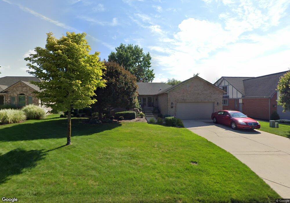
2034 Reagan Dr Unit Bldg-Unit Rochester Hills, MI 48309
Estimated Value: $522,000 - $563,000
3
Beds
4
Baths
2,230
Sq Ft
$247/Sq Ft
Est. Value
About This Home
This home is located at 2034 Reagan Dr Unit Bldg-Unit, Rochester Hills, MI 48309 and is currently estimated at $550,761, approximately $246 per square foot. 2034 Reagan Dr Unit Bldg-Unit is a home located in Oakland County with nearby schools including Deerfield Elementary School, Avondale Middle School, and Avondale High School.
Ownership History
Date
Name
Owned For
Owner Type
Purchase Details
Closed on
Jun 14, 2018
Sold by
Kessler Douglas A and Kessler Rosemary C
Bought by
Gallop Renee and Gallop Thomas
Current Estimated Value
Home Financials for this Owner
Home Financials are based on the most recent Mortgage that was taken out on this home.
Original Mortgage
$312,000
Outstanding Balance
$269,828
Interest Rate
4.5%
Mortgage Type
New Conventional
Estimated Equity
$280,933
Purchase Details
Closed on
Sep 13, 2002
Sold by
Becker Erich D
Bought by
Kessler Douglas A
Home Financials for this Owner
Home Financials are based on the most recent Mortgage that was taken out on this home.
Original Mortgage
$271,200
Interest Rate
6.29%
Purchase Details
Closed on
Feb 17, 1998
Sold by
Kranker William M
Bought by
Becker Erich D
Purchase Details
Closed on
Dec 3, 1997
Sold by
Kranker William M
Bought by
Kranker William M
Create a Home Valuation Report for This Property
The Home Valuation Report is an in-depth analysis detailing your home's value as well as a comparison with similar homes in the area
Home Values in the Area
Average Home Value in this Area
Purchase History
| Date | Buyer | Sale Price | Title Company |
|---|---|---|---|
| Gallop Renee | $393,850 | Title One Inc | |
| Kessler Douglas A | $339,000 | -- | |
| Becker Erich D | $280,000 | -- | |
| Kranker William M | -- | -- |
Source: Public Records
Mortgage History
| Date | Status | Borrower | Loan Amount |
|---|---|---|---|
| Open | Gallop Renee | $312,000 | |
| Previous Owner | Kessler Douglas A | $271,200 |
Source: Public Records
Tax History Compared to Growth
Tax History
| Year | Tax Paid | Tax Assessment Tax Assessment Total Assessment is a certain percentage of the fair market value that is determined by local assessors to be the total taxable value of land and additions on the property. | Land | Improvement |
|---|---|---|---|---|
| 2022 | $3,924 | $190,940 | $0 | $0 |
| 2018 | $4,768 | $167,850 | $0 | $0 |
| 2017 | $4,676 | $172,680 | $0 | $0 |
| 2015 | -- | $154,090 | $0 | $0 |
| 2014 | -- | $147,180 | $0 | $0 |
| 2011 | -- | $137,490 | $0 | $0 |
Source: Public Records
Map
Nearby Homes
- 2142 Kennedy Dr
- 1770 Christian Hills Dr
- 1931 Allenway Ct
- 1751 Trafalgar Square
- 1612 Bretton Dr N
- 1594 Streamwood Ct Unit 2
- 1570 Streamwood Ct Unit B8
- 1638 River View Dr
- 2600 S Christian Hills Dr
- 2137 Crystal Dr Unit S2
- 2191 Rochelle Park Dr Unit 63
- 253 Toucan St
- 2201 Siboney Ct
- 2283 Crystal Dr Unit Z38
- 432 Flamingo St
- 584 Kinglet St
- 1697 Riverside Dr Unit 15
- 1697 Riverside Dr Unit 18
- 1527 Charter Oak Dr Unit 143
- 236 Toucan St
- 2034 Reagan Dr
- 2028 Reagan Dr
- 2040 Reagan Dr
- 2022 Reagan Dr
- 2046 Reagan Dr
- 2029 Reagan Dr
- 2041 Reagan Dr
- 2102 Clinton View Cir
- 2052 Reagan Dr
- 2016 Reagan Dr
- 2047 Reagan Dr
- 2053 Reagan Dr
- 2106 Clinton View Cir
- 1976 Hutchins Dr
- 1980 Hutchins Dr
- 2058 Reagan Dr
- 1972 Hutchins Dr
- 2059 Reagan Dr
- 1968 Hutchins Dr
- 2110 Clinton View Cir