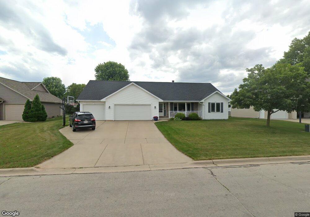
2034 Stone Silo Cir de Pere, WI 54115
Estimated Value: $396,000 - $497,000
--
Bed
--
Bath
--
Sq Ft
0.28
Acres
About This Home
This home is located at 2034 Stone Silo Cir, de Pere, WI 54115 and is currently estimated at $440,429. 2034 Stone Silo Cir is a home located in Brown County with nearby schools including Heritage Elementary School, De Pere Middle School, and Foxview Intermediate School.
Ownership History
Date
Name
Owned For
Owner Type
Purchase Details
Closed on
Jun 15, 2001
Sold by
Garot Keith E
Bought by
Wodzinski Diane Daul
Current Estimated Value
Home Financials for this Owner
Home Financials are based on the most recent Mortgage that was taken out on this home.
Original Mortgage
$30,600
Outstanding Balance
$11,707
Interest Rate
7.2%
Estimated Equity
$428,722
Create a Home Valuation Report for This Property
The Home Valuation Report is an in-depth analysis detailing your home's value as well as a comparison with similar homes in the area
Home Values in the Area
Average Home Value in this Area
Purchase History
| Date | Buyer | Sale Price | Title Company |
|---|---|---|---|
| Wodzinski Diane Daul | $34,000 | Bay Title & Abstract |
Source: Public Records
Mortgage History
| Date | Status | Borrower | Loan Amount |
|---|---|---|---|
| Open | Wodzinski Diane Daul | $30,600 |
Source: Public Records
Tax History Compared to Growth
Tax History
| Year | Tax Paid | Tax Assessment Tax Assessment Total Assessment is a certain percentage of the fair market value that is determined by local assessors to be the total taxable value of land and additions on the property. | Land | Improvement |
|---|---|---|---|---|
| 2024 | $4,712 | $320,300 | $54,100 | $266,200 |
| 2023 | $4,198 | $320,300 | $54,100 | $266,200 |
| 2022 | $3,837 | $320,300 | $54,100 | $266,200 |
| 2021 | $3,608 | $234,600 | $45,100 | $189,500 |
| 2020 | $3,576 | $234,600 | $45,100 | $189,500 |
| 2019 | $3,839 | $234,600 | $45,100 | $189,500 |
| 2018 | $3,930 | $234,600 | $45,100 | $189,500 |
| 2017 | $3,898 | $234,600 | $45,100 | $189,500 |
| 2016 | $3,552 | $181,200 | $39,100 | $142,100 |
| 2015 | $3,705 | $181,200 | $39,100 | $142,100 |
| 2014 | $3,616 | $181,200 | $39,100 | $142,100 |
| 2013 | $3,616 | $181,200 | $39,100 | $142,100 |
Source: Public Records
Map
Nearby Homes
- 2200 Dickinson Rd
- 3910 Monroe Rd
- 1960 Charles St
- 737 Desplaine Rd
- 3980 N Parker Way
- 658 Black Earth Dr
- 124 Shelley Ln
- 1871 Ledgeview Rd
- 1764 Other
- 1820 Ridgeway Dr Unit 11A
- 1820 Ridgeway Dr Unit 51A
- 1820 Ridgeway Dr Unit 11B
- 1144 Jordan Rd
- 1653 Remington Ridge Way Unit 1653
- 1655 Remington Ridge Way Unit 1655
- 1658 Remington Ridge Way Unit 1658
- 4011 Garrett St
- 7759 Sunstone Ct
- 240 Scout Way
- 1861 Chicago St
- 2022 Stone Silo Cir
- 2046 Stone Silo Cir
- 2043 Ledge Haven Ct
- 2058 Stone Silo Cir
- 2055 Ledge Haven Ct
- 2031 Ledge Haven Ct
- 1996 Stone Silo Cir
- 453 Windy Acres Way
- 2041 Stone Silo Cir
- 1986 Stone Silo Cir
- 2067 Ledge Haven Ct
- 2053 Stone Silo Cir
- 2070 Stone Silo Cir
- 1974 Stone Silo Cir
- 443 Windy Acres Way
- 2065 Stone Silo Cir
- 2077 Ledge Haven Ct
- 1966 Stone Silo Cir
- 2082 Stone Silo Cir
- 450 Windy Acres Way