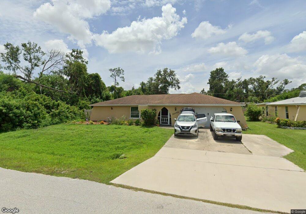
20345 Kinderkemac Ave Port Charlotte, FL 33952
Estimated Value: $245,283 - $293,000
3
Beds
2
Baths
2,470
Sq Ft
$110/Sq Ft
Est. Value
About This Home
This home is located at 20345 Kinderkemac Ave, Port Charlotte, FL 33952 and is currently estimated at $271,821, approximately $110 per square foot. 20345 Kinderkemac Ave is a home located in Charlotte County with nearby schools including Neil Armstrong Elementary School, Murdock Middle School, and Port Charlotte High School.
Ownership History
Date
Name
Owned For
Owner Type
Purchase Details
Closed on
Sep 9, 2015
Sold by
Sprenger Imogene M and The Imogene M Sprenger Revocab
Bought by
Dukes Michael and Dukes Kerri
Current Estimated Value
Home Financials for this Owner
Home Financials are based on the most recent Mortgage that was taken out on this home.
Original Mortgage
$100,000
Outstanding Balance
$78,837
Interest Rate
4.02%
Mortgage Type
New Conventional
Estimated Equity
$192,984
Purchase Details
Closed on
Nov 1, 2006
Sold by
Sprenger Imogene M and Sprenger Imogene
Bought by
Sprenger Imogene M and Sprenger Revocable T Imogene M
Purchase Details
Closed on
Mar 21, 2001
Sold by
Colonial Bk
Bought by
Sprenger Edgar and Sprenger Imogene M
Purchase Details
Closed on
Feb 2, 2001
Sold by
Clerk Circuit Court
Bought by
Colonial Bk Fl
Create a Home Valuation Report for This Property
The Home Valuation Report is an in-depth analysis detailing your home's value as well as a comparison with similar homes in the area
Home Values in the Area
Average Home Value in this Area
Purchase History
| Date | Buyer | Sale Price | Title Company |
|---|---|---|---|
| Dukes Michael | $125,000 | Florida Abstract & Security | |
| Sprenger Imogene M | -- | None Available | |
| Sprenger Edgar | $65,000 | -- | |
| Colonial Bk Fl | $65,100 | -- |
Source: Public Records
Mortgage History
| Date | Status | Borrower | Loan Amount |
|---|---|---|---|
| Open | Dukes Michael | $100,000 |
Source: Public Records
Tax History Compared to Growth
Tax History
| Year | Tax Paid | Tax Assessment Tax Assessment Total Assessment is a certain percentage of the fair market value that is determined by local assessors to be the total taxable value of land and additions on the property. | Land | Improvement |
|---|---|---|---|---|
| 2023 | $2,103 | $127,006 | $0 | $0 |
| 2022 | $2,013 | $123,307 | $0 | $0 |
| 2021 | $1,998 | $119,716 | $0 | $0 |
| 2020 | $4,275 | $118,063 | $0 | $0 |
| 2019 | $4,183 | $115,409 | $0 | $0 |
| 2018 | $1,705 | $113,257 | $0 | $0 |
| 2017 | $1,683 | $110,928 | $0 | $0 |
| 2016 | $1,668 | $108,646 | $0 | $0 |
| 2015 | $2,117 | $88,935 | $0 | $0 |
| 2014 | $1,912 | $80,850 | $0 | $0 |
Source: Public Records
Map
Nearby Homes
- 20190 Rutherford Ave
- 20297 Kinderkemac Ave
- 20296 Rutherford Ave
- 1469 Proper St
- 1357 Nimrod St
- 1381 Fargo St
- 1317 Arrow St
- 20246 Rutherford Ave
- 1358 Fargo St
- 20246 Hamilton Ave
- 20352 Astoria Ave
- 1302 Arrow St
- 20284 Emerald Ave
- 1366 Preston St
- 20330 Emerald Ave
- 20310 Lorenzo Ave
- 20214 Hamilton Ave
- 20390 Lorenzo Ave
- 20191 Rutherford Ave
- 20260 Tralee Dr
- 20337 Kinderkemac Ave
- 20344 Rutherford Ave
- 20344 Kinderkemac Ave
- 20336 Rutherford Ave
- 20361 Kinderkemac Ave
- 20329 Kinderkemac Ave
- 1390 Arrow St
- 20328 Rutherford Ave
- 20360 Rutherford Ave
- 20321 Kinderkemac Ave
- 1382 Arrow St
- 20368 Rutherford Ave
- 1389 Arrow St
- 20343 Rutherford Ave
- 1435 Proper St
- 1390 Preston St
- 20312 Rutherford Ave
- 1390 Street
- 1382 Preston St
- 20327 Rutherford Ave