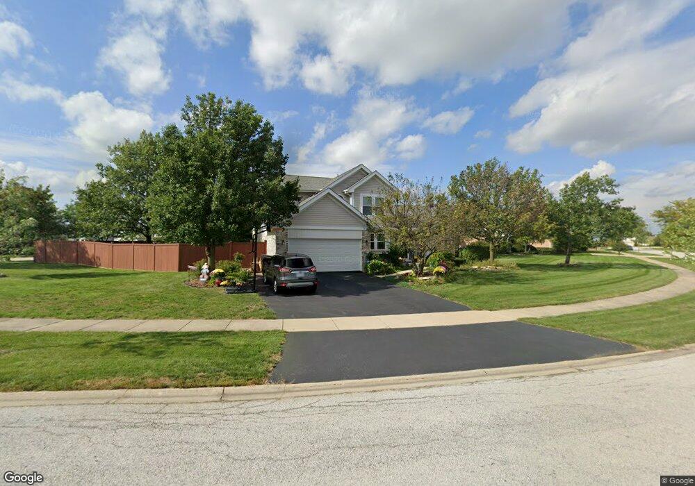
20348 Countryside Ln Frankfort, IL 60423
Frankfort Square NeighborhoodEstimated Value: $413,000 - $448,000
3
Beds
3
Baths
1,854
Sq Ft
$233/Sq Ft
Est. Value
About This Home
This home is located at 20348 Countryside Ln, Frankfort, IL 60423 and is currently estimated at $431,343, approximately $232 per square foot. 20348 Countryside Ln is a home located in Will County with nearby schools including Indian Trail Elementary School, Walker Intermediate School, and Summit Hill Junior High School.
Ownership History
Date
Name
Owned For
Owner Type
Purchase Details
Closed on
May 30, 2007
Sold by
Lipczynski Joseph S and Lipczynski Elaine A
Bought by
Sonne Charles and Rybka Leann
Current Estimated Value
Home Financials for this Owner
Home Financials are based on the most recent Mortgage that was taken out on this home.
Original Mortgage
$250,000
Interest Rate
6.54%
Mortgage Type
Purchase Money Mortgage
Create a Home Valuation Report for This Property
The Home Valuation Report is an in-depth analysis detailing your home's value as well as a comparison with similar homes in the area
Home Values in the Area
Average Home Value in this Area
Purchase History
| Date | Buyer | Sale Price | Title Company |
|---|---|---|---|
| Sonne Charles | $312,500 | Millennium Title Group |
Source: Public Records
Mortgage History
| Date | Status | Borrower | Loan Amount |
|---|---|---|---|
| Previous Owner | Sonne Charles | $250,000 |
Source: Public Records
Tax History Compared to Growth
Tax History
| Year | Tax Paid | Tax Assessment Tax Assessment Total Assessment is a certain percentage of the fair market value that is determined by local assessors to be the total taxable value of land and additions on the property. | Land | Improvement |
|---|---|---|---|---|
| 2024 | $10,270 | $129,758 | $28,800 | $100,958 |
| 2023 | $10,270 | $115,886 | $25,721 | $90,165 |
| 2022 | $10,066 | $105,552 | $23,427 | $82,125 |
| 2021 | $8,520 | $98,748 | $21,917 | $76,831 |
| 2020 | $8,514 | $95,965 | $21,299 | $74,666 |
| 2019 | $8,108 | $93,397 | $20,729 | $72,668 |
| 2018 | $7,810 | $90,712 | $20,133 | $70,579 |
| 2017 | $7,645 | $88,595 | $19,663 | $68,932 |
| 2016 | $7,408 | $85,558 | $18,989 | $66,569 |
| 2015 | $6,935 | $82,545 | $18,320 | $64,225 |
| 2014 | $6,935 | $81,972 | $18,193 | $63,779 |
| 2013 | $6,935 | $83,035 | $18,429 | $64,606 |
Source: Public Records
Map
Nearby Homes
- 8237 Auburn Ln
- 8250 Auburn Ln
- 20301 S Pine Hill Rd Unit 1D
- 20301 S Pine Hill Rd Unit 3A
- 8310 Auburn Ln
- 7752 W Almond Ct Unit 135
- 7639 W Juniper Ct
- 20552 S Frankfort Square Rd
- 20513 S Acorn Ridge Dr
- 7800 W Kingston Dr
- 20137 S Hampton Ct Unit A
- 20027 S Jessica Ln
- 20130 S Frankfort Square Rd
- 7758 W Kingston Dr
- 20206 S Frankfort Square Rd Unit A
- 20349 S Green Meadow Ln
- 20158 S Rosewood Dr
- 8131 W Evergreen Dr
- 20530 Torrey Ct
- 8510 W Saint Francis Rd
- 20338 Countryside Ln
- 5127 Parkside Dr
- 8020 Parkside Dr
- 20330 Countryside Ln
- 8009 Ryeland Dr
- 20413 Countryside Ln
- 20351 Countryside Ln
- 20339 Countryside Ln
- 20401 S Countryside Ln
- 20365 S Countryside Ln
- 20320 Countryside Ln
- 8019 Parkside Dr Unit I
- 8030 Parkside Dr
- 20331 Countryside Ln
- 8017 Ryeland Dr
- 8012 Ryeland Dr
- 8025 Parkside Dr
- 20323 Countryside Ln
- 20524 Timber Mill Dr
- 7953 Old Mill Rd