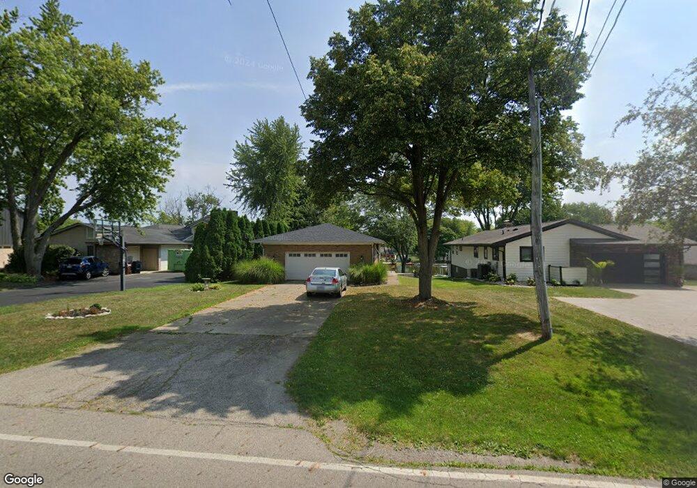
2035 Chickasaw Dr London, OH 43140
Estimated Value: $451,000 - $675,000
3
Beds
3
Baths
2,240
Sq Ft
$254/Sq Ft
Est. Value
About This Home
This home is located at 2035 Chickasaw Dr, London, OH 43140 and is currently estimated at $568,552, approximately $253 per square foot. 2035 Chickasaw Dr is a home located in Madison County with nearby schools including London Elementary School, London Middle School, and London High School.
Ownership History
Date
Name
Owned For
Owner Type
Purchase Details
Closed on
Jun 11, 2024
Sold by
Todd Brian P and Todd Nicole Elizabeth
Bought by
Todd Brian P and Todd Nicole Elizabeth
Current Estimated Value
Purchase Details
Closed on
May 9, 1995
Sold by
Markely Herbert C
Bought by
Tood Brian P and Schnell Janet L
Home Financials for this Owner
Home Financials are based on the most recent Mortgage that was taken out on this home.
Original Mortgage
$119,500
Interest Rate
8.43%
Mortgage Type
New Conventional
Create a Home Valuation Report for This Property
The Home Valuation Report is an in-depth analysis detailing your home's value as well as a comparison with similar homes in the area
Home Values in the Area
Average Home Value in this Area
Purchase History
| Date | Buyer | Sale Price | Title Company |
|---|---|---|---|
| Todd Brian P | -- | None Listed On Document | |
| Tood Brian P | $169,500 | -- |
Source: Public Records
Mortgage History
| Date | Status | Borrower | Loan Amount |
|---|---|---|---|
| Previous Owner | Tood Brian P | $119,500 |
Source: Public Records
Tax History Compared to Growth
Tax History
| Year | Tax Paid | Tax Assessment Tax Assessment Total Assessment is a certain percentage of the fair market value that is determined by local assessors to be the total taxable value of land and additions on the property. | Land | Improvement |
|---|---|---|---|---|
| 2024 | $5,986 | $148,460 | $53,220 | $95,240 |
| 2023 | $5,986 | $148,460 | $53,220 | $95,240 |
| 2022 | $5,266 | $112,460 | $40,320 | $72,140 |
| 2021 | $5,054 | $112,460 | $40,320 | $72,140 |
| 2020 | $5,055 | $112,460 | $40,320 | $72,140 |
| 2019 | $4,679 | $95,470 | $41,580 | $53,890 |
| 2018 | $4,229 | $95,470 | $41,580 | $53,890 |
| 2017 | $2,744 | $95,470 | $41,580 | $53,890 |
| 2016 | $3,465 | $77,370 | $41,580 | $35,790 |
| 2015 | $3,133 | $77,370 | $41,580 | $35,790 |
| 2014 | $3,133 | $77,370 | $41,580 | $35,790 |
| 2013 | -- | $90,630 | $52,500 | $38,130 |
Source: Public Records
Map
Nearby Homes
- 2086 Palouse Dr
- 1865 Huron Dr
- 2020 Cherokee Dr
- 2460 Cherokee Dr
- 1730 W Choctaw Dr
- 1855 E Choctaw Dr
- 1495 W Choctaw Dr
- 1490 Itawamba Trail
- 1435 E Choctaw Dr
- 1405 Chickasaw Dr
- 1427 Itawamba Trail
- 1340 W Choctaw Dr
- 3211 Old Columbus Rd
- 2425 Old Us Highway 40 NW
- 2725 Old Us Highway 40 NW
- 4070 Tradersville-Brighton Rd
- 108 Markley Rd
- 2367 N Houston Pike
- 2321 N Houston
- 2206 State Route 56 SW
- 2045 Chickasaw Dr
- 2031 Chickasaw Dr
- 2055 Chickasaw Dr
- 2025 Chickasaw Dr
- 2065 Chickasaw Dr
- 1940 Palouse Dr
- 2030 Chickasaw Dr
- 2040 Chickasaw Dr
- 2920 Twana Dr
- 2050 Chickasaw Dr
- 1960 Palouse Dr
- 2060 Chickasaw Dr
- 2895 Twana Dr
- 2090 Chickasaw Dr
- 2111 Chickasaw Dr
- 1990 Palouse Dr
- 2010 Palouse Dr
- 1922 Chickasaw Dr
- 2014 Palouse Dr
- 2105 Huron Dr