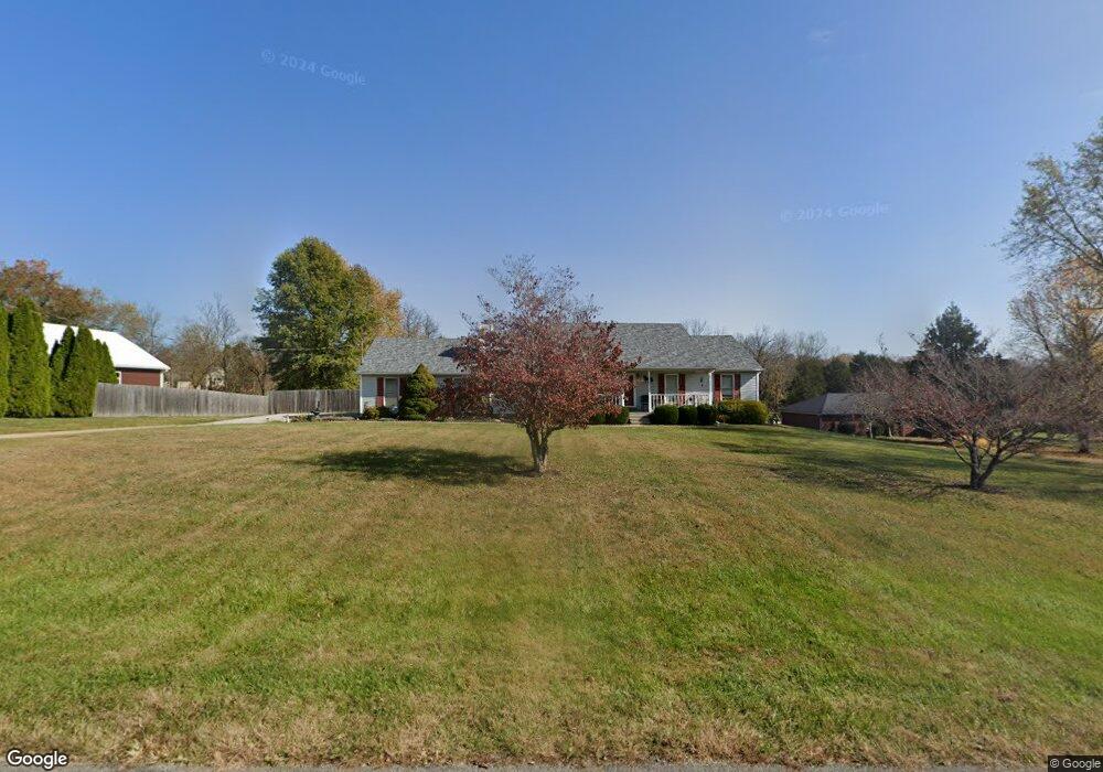
2035 Currys Fork Dr La Grange, KY 40031
Estimated Value: $476,257
3
Beds
4
Baths
2,781
Sq Ft
$171/Sq Ft
Est. Value
About This Home
This home is located at 2035 Currys Fork Dr, La Grange, KY 40031 and is currently estimated at $476,257, approximately $171 per square foot. 2035 Currys Fork Dr is a home located in Oldham County with nearby schools including Centerfield Elementary School, East Oldham Middle School, and Oldham County High School.
Ownership History
Date
Name
Owned For
Owner Type
Purchase Details
Closed on
Mar 27, 2009
Sold by
Primacy Closing Corporation
Bought by
Hornig Lisa M and Huber Dolores
Current Estimated Value
Home Financials for this Owner
Home Financials are based on the most recent Mortgage that was taken out on this home.
Original Mortgage
$171,200
Interest Rate
5.1%
Mortgage Type
New Conventional
Purchase Details
Closed on
May 27, 2005
Sold by
Hardt Ronald A and Hardt Rita J
Bought by
Lamb Scott G and Lamb Katri L
Home Financials for this Owner
Home Financials are based on the most recent Mortgage that was taken out on this home.
Original Mortgage
$184,800
Interest Rate
4.75%
Mortgage Type
Assumption
Create a Home Valuation Report for This Property
The Home Valuation Report is an in-depth analysis detailing your home's value as well as a comparison with similar homes in the area
Home Values in the Area
Average Home Value in this Area
Purchase History
| Date | Buyer | Sale Price | Title Company |
|---|---|---|---|
| Hornig Lisa M | $214,000 | First American Title Ins Co | |
| Hornig Lisa M | $214,000 | First American Title Insuran | |
| Lamb Scott G | $231,000 | None Available |
Source: Public Records
Mortgage History
| Date | Status | Borrower | Loan Amount |
|---|---|---|---|
| Previous Owner | Hornig Lisa M | $171,200 | |
| Previous Owner | Lamb Scott G | $184,800 |
Source: Public Records
Tax History Compared to Growth
Tax History
| Year | Tax Paid | Tax Assessment Tax Assessment Total Assessment is a certain percentage of the fair market value that is determined by local assessors to be the total taxable value of land and additions on the property. | Land | Improvement |
|---|---|---|---|---|
| 2024 | $3,074 | $245,000 | $40,000 | $205,000 |
| 2023 | $3,089 | $245,000 | $40,000 | $205,000 |
| 2022 | $3,074 | $245,000 | $40,000 | $205,000 |
| 2021 | $3,055 | $245,000 | $40,000 | $205,000 |
| 2020 | $3,000 | $240,000 | $35,000 | $205,000 |
| 2019 | $2,972 | $240,000 | $35,000 | $205,000 |
| 2018 | $2,974 | $240,000 | $0 | $0 |
| 2017 | $2,600 | $211,000 | $0 | $0 |
| 2013 | $2,318 | $211,000 | $35,000 | $176,000 |
Source: Public Records
Map
Nearby Homes
- 4541 Northridge Cir
- 2005 Fox Trail Dr
- 4405 Carolyn Ct
- 4601 Sunny Hill Dr
- 1805 Wildbriar Ct
- 5003 Fairview Dr
- 5270 Payton Ln
- 1008 E Mailback Way
- 2915 W State Highway 22
- 3903 Clarke Place
- 3517 E Dogwood Cir
- 3203 Tara Ct
- 5517 Farmhouse Dr
- 2302 Forrest Park Dr
- 2907 Carden Ln
- 4023 Mosswood Ln
- 4021 Mosswood Ln
- 4020 Mosswood Ln
- 4017 Mosswood Ln
- 4007 Mosswood Ln
- 2037 Currys Fork Dr
- 2033 Currys Fork Dr
- 2034 Currys Fork Dr
- 2036 Currys Fork Dr
- 2125 Fox Trail Dr
- 2034 Curry''S Fork Dr
- 2032 Currys Fork Dr
- 2031 Currys Fork Dr
- 2123 Fox Trail Dr
- 2129 Fox Trail Dr
- 2043 Fox Trail Dr
- 2030 Currys Fork Dr
- 2117 Fox Trail Dr
- 2041 Fox Trail Dr
- 2045 Fox Trail Dr
- 2113 Fox Trail Dr
- 111 Fox Trail Dr
- 0 Fox Trail Dr
- 2124 Fox Trail Dr
- 2115 Fox Trail Dr