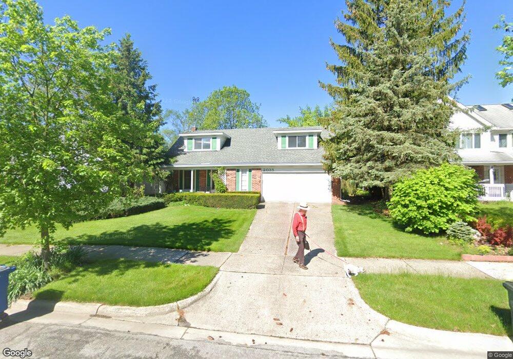
2035 Georgetown Blvd Ann Arbor, MI 48105
Orchard Hills-Maplewood NeighborhoodEstimated Value: $580,221 - $633,000
4
Beds
3
Baths
2,274
Sq Ft
$264/Sq Ft
Est. Value
About This Home
This home is located at 2035 Georgetown Blvd, Ann Arbor, MI 48105 and is currently estimated at $600,305, approximately $263 per square foot. 2035 Georgetown Blvd is a home located in Washtenaw County with nearby schools including Thurston Elementary School, Clague Middle School, and Huron High School.
Ownership History
Date
Name
Owned For
Owner Type
Purchase Details
Closed on
Nov 7, 2007
Sold by
Payne Peter E and Payne Janet V
Bought by
Specht Robert D
Current Estimated Value
Home Financials for this Owner
Home Financials are based on the most recent Mortgage that was taken out on this home.
Original Mortgage
$149,500
Outstanding Balance
$94,882
Interest Rate
6.44%
Mortgage Type
Stand Alone Refi Refinance Of Original Loan
Estimated Equity
$505,423
Create a Home Valuation Report for This Property
The Home Valuation Report is an in-depth analysis detailing your home's value as well as a comparison with similar homes in the area
Home Values in the Area
Average Home Value in this Area
Purchase History
| Date | Buyer | Sale Price | Title Company |
|---|---|---|---|
| Specht Robert D | $249,500 | Metropolitan Title Company | |
| Specht Robert D | -- | Metropolitan Title Company |
Source: Public Records
Mortgage History
| Date | Status | Borrower | Loan Amount |
|---|---|---|---|
| Open | Specht Robert D | $149,500 |
Source: Public Records
Tax History Compared to Growth
Tax History
| Year | Tax Paid | Tax Assessment Tax Assessment Total Assessment is a certain percentage of the fair market value that is determined by local assessors to be the total taxable value of land and additions on the property. | Land | Improvement |
|---|---|---|---|---|
| 2025 | $7,964 | $263,200 | $0 | $0 |
| 2024 | $7,416 | $248,800 | $0 | $0 |
| 2023 | $6,838 | $221,700 | $0 | $0 |
| 2022 | $7,451 | $207,600 | $0 | $0 |
| 2021 | $7,276 | $201,600 | $0 | $0 |
| 2020 | $7,129 | $190,900 | $0 | $0 |
| 2019 | $6,784 | $172,900 | $172,900 | $0 |
| 2018 | $6,689 | $159,400 | $0 | $0 |
| 2017 | $6,507 | $160,700 | $0 | $0 |
| 2016 | $5,542 | $130,112 | $0 | $0 |
| 2015 | $5,978 | $129,723 | $0 | $0 |
| 2014 | $5,978 | $125,671 | $0 | $0 |
| 2013 | -- | $125,671 | $0 | $0 |
Source: Public Records
Map
Nearby Homes
- 2182 Yorktown Dr
- 4990 Saddleridge
- 4763 Curtis
- 2656 Shefman Terrace
- 2605 Nadia Ct Unit 8
- 3024 Bolgos Cir Unit 303
- 2626 Traver Blvd
- 3629 Frederick Dr
- 0000 Nixon Rd
- 1 Westbury Ct
- 4 Haverhill Ct
- 3367 Burbank Dr
- 3252 Bolgos Cir
- 2901 Corston Rd
- 2782 Maitland Dr
- 2824 Ridington Rd
- 2759 Bristol Ridge Dr
- 3427 E Dobson Place
- 2805 Rathmore Ln
- 3600 Windemere Dr
- 2027 Georgetown Blvd
- 2043 Georgetown Blvd
- 2019 Georgetown Blvd
- 2051 Georgetown Blvd
- 2011 Georgetown Blvd
- 2024 Georgetown Blvd
- 2050 Yorktown Dr
- 2110 Ardenne Dr
- 2014 Georgetown Blvd
- 2059 Georgetown Blvd
- 2056 Yorktown Dr
- 2067 Georgetown Blvd
- 3127 Plymouth Rd
- 2053 Yorktown Dr
- 2075 Georgetown Blvd
- 2062 Yorktown Dr
- 2072 Georgetown Blvd
- 3139 Plymouth Rd
- 2120 Ardenne Dr
- 2100 Ardenne Dr