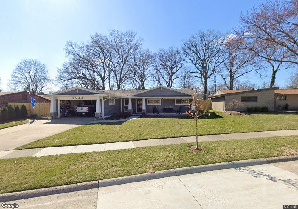
2035 Laurome Dr Royal Oak, MI 48073
Estimated Value: $476,000 - $597,000
3
Beds
2
Baths
1,775
Sq Ft
$289/Sq Ft
Est. Value
About This Home
This home is located at 2035 Laurome Dr, Royal Oak, MI 48073 and is currently estimated at $513,511, approximately $289 per square foot. 2035 Laurome Dr is a home located in Oakland County with nearby schools including Northwood Elementary School, Royal Oak Middle School, and Royal Oak High School.
Ownership History
Date
Name
Owned For
Owner Type
Purchase Details
Closed on
Mar 24, 2006
Sold by
Hoemke Kevin and Hoemke Mary K
Bought by
Hoemke Kevin A and The Kevin A Hoemke Trust
Current Estimated Value
Purchase Details
Closed on
Nov 3, 2000
Sold by
Tokie Gail R
Bought by
Dixon A
Home Financials for this Owner
Home Financials are based on the most recent Mortgage that was taken out on this home.
Original Mortgage
$149,500
Outstanding Balance
$55,009
Interest Rate
7.86%
Estimated Equity
$458,502
Purchase Details
Closed on
Aug 15, 2000
Sold by
Vanderbeck Dorothy F
Bought by
Tokie Gail R
Create a Home Valuation Report for This Property
The Home Valuation Report is an in-depth analysis detailing your home's value as well as a comparison with similar homes in the area
Home Values in the Area
Average Home Value in this Area
Purchase History
| Date | Buyer | Sale Price | Title Company |
|---|---|---|---|
| Hoemke Kevin A | -- | None Available | |
| Dixon A | $219,500 | -- | |
| Tokie Gail R | -- | -- |
Source: Public Records
Mortgage History
| Date | Status | Borrower | Loan Amount |
|---|---|---|---|
| Open | Dixon A | $149,500 |
Source: Public Records
Tax History Compared to Growth
Tax History
| Year | Tax Paid | Tax Assessment Tax Assessment Total Assessment is a certain percentage of the fair market value that is determined by local assessors to be the total taxable value of land and additions on the property. | Land | Improvement |
|---|---|---|---|---|
| 2024 | $4,815 | $214,980 | $0 | $0 |
| 2022 | $5,689 | $191,040 | $0 | $0 |
| 2020 | $4,679 | $173,640 | $0 | $0 |
| 2018 | $5,689 | $113,660 | $0 | $0 |
| 2017 | $3,696 | $113,660 | $0 | $0 |
| 2015 | -- | $102,150 | $0 | $0 |
| 2014 | -- | $94,770 | $0 | $0 |
| 2011 | -- | $85,870 | $0 | $0 |
Source: Public Records
Map
Nearby Homes
- 2015 Alicia Ln
- 1211 Smith Ave
- 1507 Roseland Ave
- 1721 Forestdale Ct
- 2423 Crooks Rd
- 1631 Roseland Ave
- 817 Magnolia Ave
- 1630 W 12 Mile Rd
- 2438 Evergreen Dr
- 1718 W 12 Mile Rd
- 719 W 12 Mile Rd
- 912 Woodsboro Dr
- 1319 Woodsboro Dr
- 1828 W 12 Mile Rd
- 1915 Northwood Blvd
- 508 W Houstonia Ave
- 2432 Maplewood Ave
- 2115 Marywood Dr
- 2456 Maplewood Ave
- 1123 Royal Ave
- 2025 Laurome Dr
- 2109 Laurome Dr
- 2026 Alicia Ln
- 2032 Alicia Ln
- 2020 Alicia Ln
- 2038 Alicia Ln
- 2014 Alicia Ln
- 1214 W Houstonia Ave
- 1224 W Houstonia Ave
- 2019 Laurome Dr
- 2121 Laurome Dr
- 2102 Alicia Ln
- 2046 Laurome Dr
- 2008 Alicia Ln
- 2110 Laurome Dr
- 2036 Laurome Dr
- 2108 Alicia Ln
- 2004 Alicia Ln
- 2131 Laurome Dr
- 2031 Alicia Ln