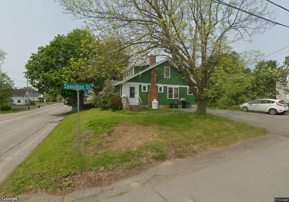
2035 N Belfast Ave Augusta, ME 04330
Estimated Value: $238,107 - $280,000
3
Beds
2
Baths
1,498
Sq Ft
$173/Sq Ft
Est. Value
About This Home
This home is located at 2035 N Belfast Ave, Augusta, ME 04330 and is currently estimated at $259,027, approximately $172 per square foot. 2035 N Belfast Ave is a home located in Kennebec County with nearby schools including Cony Middle School, Cony School, and Maine Virtual Academy.
Ownership History
Date
Name
Owned For
Owner Type
Purchase Details
Closed on
May 3, 2010
Sold by
Cport Cu
Bought by
Oneill Daniel J
Current Estimated Value
Home Financials for this Owner
Home Financials are based on the most recent Mortgage that was taken out on this home.
Original Mortgage
$94,752
Outstanding Balance
$64,254
Interest Rate
5.37%
Mortgage Type
FHA
Estimated Equity
$194,773
Purchase Details
Closed on
Mar 5, 2010
Sold by
Roggio Amanda S and Cport Credit Union
Bought by
Cport Credit Union
Home Financials for this Owner
Home Financials are based on the most recent Mortgage that was taken out on this home.
Original Mortgage
$94,752
Outstanding Balance
$64,254
Interest Rate
5.37%
Mortgage Type
FHA
Estimated Equity
$194,773
Create a Home Valuation Report for This Property
The Home Valuation Report is an in-depth analysis detailing your home's value as well as a comparison with similar homes in the area
Home Values in the Area
Average Home Value in this Area
Purchase History
| Date | Buyer | Sale Price | Title Company |
|---|---|---|---|
| Oneill Daniel J | -- | -- | |
| Oneill Daniel J | -- | -- | |
| Oneill Daniel J | -- | -- | |
| Cport Credit Union | -- | -- | |
| Cport Credit Union | -- | -- |
Source: Public Records
Mortgage History
| Date | Status | Borrower | Loan Amount |
|---|---|---|---|
| Open | Oneill Daniel J | $94,752 | |
| Closed | Cport Credit Union | $94,752 |
Source: Public Records
Tax History Compared to Growth
Tax History
| Year | Tax Paid | Tax Assessment Tax Assessment Total Assessment is a certain percentage of the fair market value that is determined by local assessors to be the total taxable value of land and additions on the property. | Land | Improvement |
|---|---|---|---|---|
| 2024 | $2,363 | $99,300 | $28,200 | $71,100 |
| 2023 | $2,280 | $99,300 | $28,200 | $71,100 |
| 2022 | $2,177 | $99,300 | $28,200 | $71,100 |
| 2021 | $2,079 | $99,300 | $28,200 | $71,100 |
| 2020 | $2,079 | $99,300 | $28,200 | $71,100 |
| 2019 | $2,082 | $99,300 | $28,200 | $71,100 |
| 2018 | $2,082 | $99,300 | $28,200 | $71,100 |
| 2017 | $2,024 | $99,300 | $28,200 | $71,100 |
| 2016 | $1,965 | $99,300 | $28,200 | $71,100 |
| 2015 | $1,732 | $99,300 | $28,200 | $71,100 |
| 2014 | $1,854 | $99,300 | $28,200 | $71,100 |
Source: Public Records
Map
Nearby Homes
- 133 Riverside Dr
- 2058 N Belfast Ave
- 11 Allen St
- 8 Newland Ave
- 12 Lilac Ln
- 14 Highland Ave
- 16 Murray St
- 32 Murray St
- 23 Greenwood St
- 120 Purinton Ave
- 30 Patterson St
- 132 Purinton Ave
- 48 Patterson St
- 31 Greenlief St
- 9 Gannett St
- 106 S Belfast Ave
- 121 Cony St
- 33 Washington St
- 25 Washington St
- 191 Cony St
- 2 Spaulding St
- 2031 N Belfast Ave
- 2039 N Belfast Ave
- 4 Spaulding St
- 2043 N Belfast Ave
- 2027 N Belfast Ave
- 2042 N Belfast Ave
- 2026 N Belfast Ave
- 2043 N Belfast Ave
- 12 Spaulding St
- 6 Albee St
- 8 Albee St
- 1 Fletcher St
- 2021 N Belfast Ave
- 5 Fletcher St
- 2022 N Belfast Ave
- 14 Spaulding St
- 15 N Pearl St
- 2046 N Belfast Ave
- 28 Elm Ave