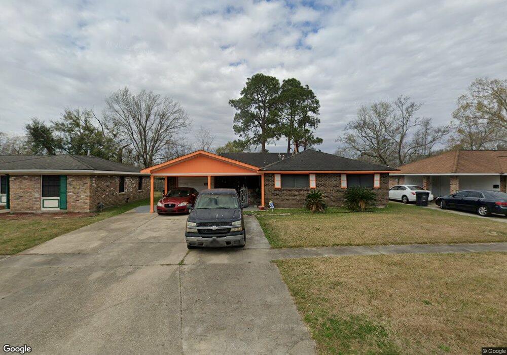
2035 N Little John Dr Baton Rouge, LA 70815
Park Forest/LA North NeighborhoodEstimated Value: $129,843 - $155,000
3
Beds
2
Baths
1,294
Sq Ft
$113/Sq Ft
Est. Value
About This Home
This home is located at 2035 N Little John Dr, Baton Rouge, LA 70815 and is currently estimated at $145,711, approximately $112 per square foot. 2035 N Little John Dr is a home located in East Baton Rouge Parish with nearby schools including LaBelle Aire Elementary School, Park Forest Middle School, and Belaire High School.
Ownership History
Date
Name
Owned For
Owner Type
Purchase Details
Closed on
Apr 16, 2004
Sold by
Trinh Hieu
Bought by
Woods Gloria
Current Estimated Value
Home Financials for this Owner
Home Financials are based on the most recent Mortgage that was taken out on this home.
Original Mortgage
$81,500
Outstanding Balance
$37,602
Interest Rate
5.38%
Mortgage Type
New Conventional
Estimated Equity
$108,109
Purchase Details
Closed on
Apr 16, 2001
Sold by
Soileau Henry
Bought by
Trinh Hieu
Create a Home Valuation Report for This Property
The Home Valuation Report is an in-depth analysis detailing your home's value as well as a comparison with similar homes in the area
Home Values in the Area
Average Home Value in this Area
Purchase History
| Date | Buyer | Sale Price | Title Company |
|---|---|---|---|
| Woods Gloria | $81,500 | -- | |
| Trinh Hieu | $30,000 | -- |
Source: Public Records
Mortgage History
| Date | Status | Borrower | Loan Amount |
|---|---|---|---|
| Open | Woods Gloria | $81,500 |
Source: Public Records
Tax History Compared to Growth
Tax History
| Year | Tax Paid | Tax Assessment Tax Assessment Total Assessment is a certain percentage of the fair market value that is determined by local assessors to be the total taxable value of land and additions on the property. | Land | Improvement |
|---|---|---|---|---|
| 2024 | $177 | $10,000 | $1,200 | $8,800 |
| 2023 | $177 | $10,000 | $1,200 | $8,800 |
| 2022 | $1,369 | $10,000 | $1,200 | $8,800 |
| 2021 | $1,342 | $10,000 | $1,200 | $8,800 |
| 2020 | $1,181 | $10,000 | $1,200 | $8,800 |
| 2019 | $1,235 | $10,000 | $1,200 | $8,800 |
| 2018 | $1,220 | $10,000 | $1,200 | $8,800 |
| 2017 | $1,220 | $10,000 | $1,200 | $8,800 |
| 2016 | $394 | $10,000 | $1,200 | $8,800 |
| 2015 | $396 | $10,000 | $1,200 | $8,800 |
| 2014 | $395 | $10,000 | $1,200 | $8,800 |
| 2013 | -- | $10,000 | $1,200 | $8,800 |
Source: Public Records
Map
Nearby Homes
- 2043 Shady Oaks Dr
- 2148 Oak Knoll Dr
- 2135 Vickers Dr
- 11555 E Black Oak Dr
- 2150 N Sherwood Forest Dr
- 12013 Shannon Ave
- 11368 Pamela Dr
- 12424 Cate Ave Unit 12426
- 12547 Lorna Ave
- 1492,1486,1484 Marque Ann Dr
- 11755 Archery Dr
- 11625 Archery Dr
- 371 Kay Dr
- 346 Wilton Dr
- 12875 King John Place
- 379 Wilton Dr
- 10575 White Oak Dr
- 388 Wingate Dr
- 1053 Green Oak Dr
- 13070 Wallis St
- 2047 N Little John Dr
- 2023 N Little John Dr
- 2046 Oak Grove Dr
- 2011 N Little John Dr
- 2051 N Little John Dr
- 2024 Oak Grove Dr
- 2056 Oak Grove Dr
- 2038 N Little John Dr
- 2014 Oak Grove Dr
- 2116 Oak Grove Dr
- 2026 N Little John Dr
- 2048 N Little John Dr
- 2101 N Little John Dr
- 2003 N Little John Dr
- 2052 N Little John Dr
- 2126 Oak Grove Dr
- 2002 Oak Grove Dr
- 2113 N Little John Dr
- 2102 N Little John Dr
- 2006 N Little John Dr