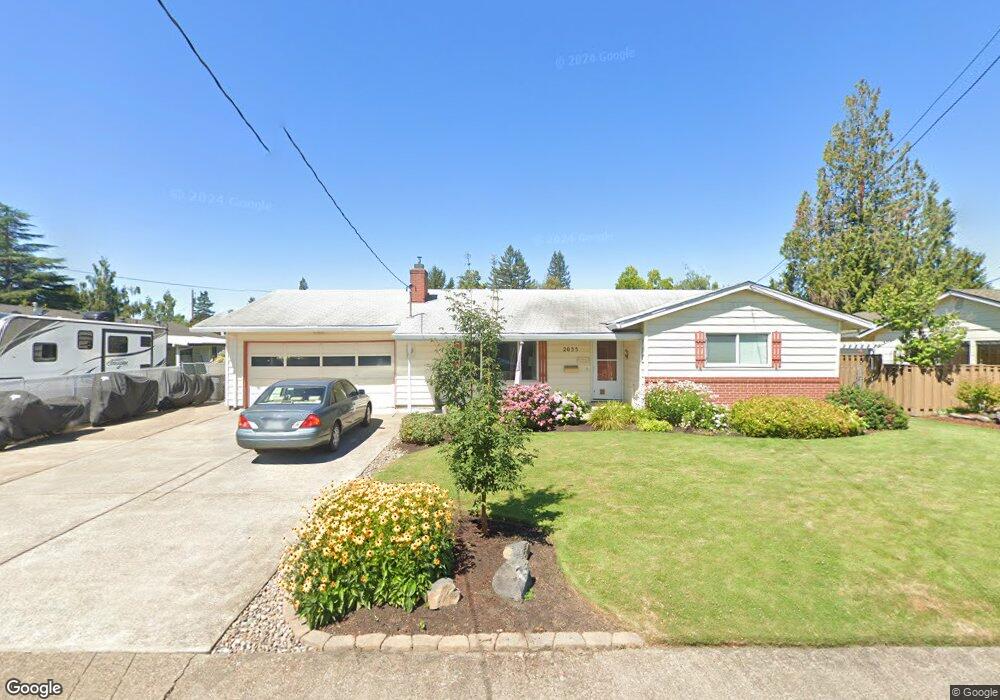
2035 NW Adams St McMinnville, OR 97128
Estimated Value: $434,000 - $467,490
3
Beds
2
Baths
1,720
Sq Ft
$259/Sq Ft
Est. Value
About This Home
This home is located at 2035 NW Adams St, McMinnville, OR 97128 and is currently estimated at $445,873, approximately $259 per square foot. 2035 NW Adams St is a home located in Yamhill County with nearby schools including Memorial Elementary School, Patton Middle School, and McMinnville High School.
Ownership History
Date
Name
Owned For
Owner Type
Purchase Details
Closed on
Apr 5, 2018
Sold by
Sherman Rihard C and Sherman Geneva N
Bought by
Heins Danny G and Heins Nancy W
Current Estimated Value
Home Financials for this Owner
Home Financials are based on the most recent Mortgage that was taken out on this home.
Original Mortgage
$240,000
Outstanding Balance
$206,204
Interest Rate
4.4%
Mortgage Type
Commercial
Estimated Equity
$239,669
Purchase Details
Closed on
Aug 4, 2016
Sold by
Sherman Richard C and Sherman Geneva N
Bought by
Sherman Richard C and Sherman Geneva N
Create a Home Valuation Report for This Property
The Home Valuation Report is an in-depth analysis detailing your home's value as well as a comparison with similar homes in the area
Home Values in the Area
Average Home Value in this Area
Purchase History
| Date | Buyer | Sale Price | Title Company |
|---|---|---|---|
| Heins Danny G | $240,000 | Western Title & Escrow | |
| Sherman Richard C | -- | None Available |
Source: Public Records
Mortgage History
| Date | Status | Borrower | Loan Amount |
|---|---|---|---|
| Open | Heins Danny G | $240,000 |
Source: Public Records
Tax History Compared to Growth
Tax History
| Year | Tax Paid | Tax Assessment Tax Assessment Total Assessment is a certain percentage of the fair market value that is determined by local assessors to be the total taxable value of land and additions on the property. | Land | Improvement |
|---|---|---|---|---|
| 2024 | $3,967 | $228,255 | -- | -- |
| 2023 | $3,746 | $221,607 | $0 | $0 |
| 2022 | $3,548 | $215,152 | $0 | $0 |
| 2021 | $3,464 | $208,885 | $0 | $0 |
| 2020 | $3,437 | $202,801 | $0 | $0 |
| 2019 | $3,344 | $196,894 | $0 | $0 |
| 2018 | $3,277 | $191,159 | $0 | $0 |
| 2017 | $3,163 | $185,591 | $0 | $0 |
| 2016 | $3,050 | $180,185 | $0 | $0 |
| 2015 | $2,976 | $174,938 | $0 | $0 |
| 2014 | $2,815 | $169,844 | $0 | $0 |
Source: Public Records
Map
Nearby Homes
- 1786 NW Landon St
- 1850 NW Landon St
- 149 NW 25th St
- 2221 NW Elm St
- 1672 NW Landon St
- 629 NE 19th St
- 1975 NE Galloway St
- 700 NW 18th Place
- 1970 NW Mercia St
- 2286 NW Michelbook Ln
- 929 NE Hide Away Dr
- 2420 NE Hembree St Unit 48
- 1139 NW Yamhill St
- 2735 NW Pinehurst Dr Unit 5
- 3192 NW Pinehurst Dr Unit 76
- 1564 NW Pinehurst Dr Unit 106
- 2799 NW Pinehurst Dr Unit 11
- 2787 NW Pinehurst Dr Unit 10
- 2897 NW Pinehurst Dr Unit 13
- 2719 NW Pinehurst Dr Unit 3
- 109 NW 20th St
- 2041 NW Adams St
- 2032 NE Adams St
- 2014 NE Adams St
- 116 NW 21st St
- 2024 NW Alder St
- 2002 NE Adams St
- 2008 NW Alder St
- 2048 NE Adams St
- 2040 NW Alder St
- 1937 NW Adams St
- 142 NW 21st St
- 128 NW 20th St
- 1932 NE Adams St
- 1945 NE Baker St
- 2049 NE Baker St
- 2109 NW Adams St
- 144 NW 20th St
- 115 NE 21st St
- 1915 NW Adams St