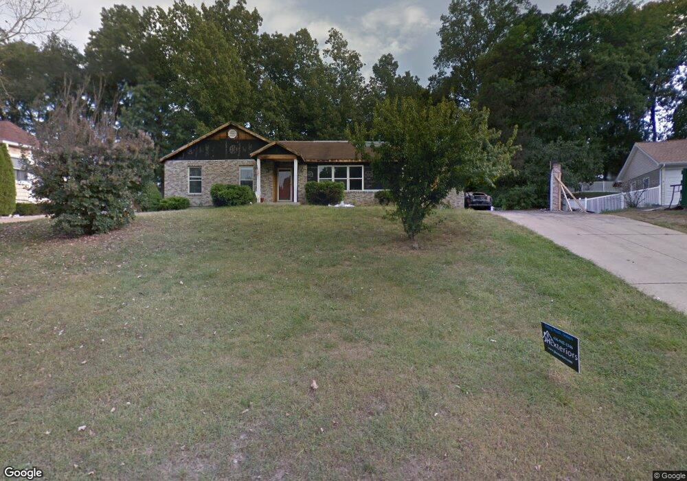
2035 The Woods Cir Barnhart, MO 63012
Estimated Value: $298,000 - $365,000
--
Bed
3
Baths
1,550
Sq Ft
$214/Sq Ft
Est. Value
About This Home
This home is located at 2035 The Woods Cir, Barnhart, MO 63012 and is currently estimated at $332,125, approximately $214 per square foot. 2035 The Woods Cir is a home located in Jefferson County with nearby schools including Windsor High School and St. Joseph Catholic School.
Ownership History
Date
Name
Owned For
Owner Type
Purchase Details
Closed on
Dec 14, 2007
Sold by
Rmd Investments Inc
Bought by
Butz Mark S and Butz Beverly K
Current Estimated Value
Home Financials for this Owner
Home Financials are based on the most recent Mortgage that was taken out on this home.
Original Mortgage
$178,600
Outstanding Balance
$112,812
Interest Rate
6.26%
Mortgage Type
Purchase Money Mortgage
Estimated Equity
$219,313
Purchase Details
Closed on
May 12, 2006
Sold by
Whaley Margarete J
Bought by
Rmd Investments Inc
Home Financials for this Owner
Home Financials are based on the most recent Mortgage that was taken out on this home.
Original Mortgage
$155,000
Interest Rate
6.36%
Mortgage Type
Purchase Money Mortgage
Purchase Details
Closed on
Apr 18, 2000
Sold by
Buehn Francis and Margaret
Bought by
Whaley Margaret J
Home Financials for this Owner
Home Financials are based on the most recent Mortgage that was taken out on this home.
Original Mortgage
$123,500
Interest Rate
8.24%
Create a Home Valuation Report for This Property
The Home Valuation Report is an in-depth analysis detailing your home's value as well as a comparison with similar homes in the area
Home Values in the Area
Average Home Value in this Area
Purchase History
| Date | Buyer | Sale Price | Title Company |
|---|---|---|---|
| Butz Mark S | -- | Investors Title Company | |
| Rmd Investments Inc | -- | Ust | |
| Whaley Margaret J | -- | Commonwealth Title |
Source: Public Records
Mortgage History
| Date | Status | Borrower | Loan Amount |
|---|---|---|---|
| Open | Butz Mark S | $178,600 | |
| Previous Owner | Rmd Investments Inc | $155,000 | |
| Previous Owner | Whaley Margaret J | $123,500 |
Source: Public Records
Tax History Compared to Growth
Tax History
| Year | Tax Paid | Tax Assessment Tax Assessment Total Assessment is a certain percentage of the fair market value that is determined by local assessors to be the total taxable value of land and additions on the property. | Land | Improvement |
|---|---|---|---|---|
| 2025 | $2,858 | $41,900 | $8,800 | $33,100 |
| 2024 | $2,858 | $39,000 | $8,800 | $30,200 |
| 2023 | $2,858 | $39,000 | $8,800 | $30,200 |
| 2022 | $2,560 | $35,000 | $4,800 | $30,200 |
| 2021 | $2,561 | $35,000 | $4,800 | $30,200 |
| 2020 | $2,368 | $31,400 | $4,200 | $27,200 |
| 2019 | $2,365 | $31,400 | $4,200 | $27,200 |
| 2018 | $2,333 | $31,400 | $4,200 | $27,200 |
| 2017 | $2,245 | $31,400 | $4,200 | $27,200 |
| 2016 | $2,081 | $29,000 | $4,000 | $25,000 |
| 2015 | $2,075 | $29,000 | $4,000 | $25,000 |
| 2013 | -- | $29,100 | $4,000 | $25,100 |
Source: Public Records
Map
Nearby Homes
- 0 New Highway M Unit MAR25024234
- 0 Hwy Mm Unit MAR24032005
- 1675 Old State Road M
- 7013 Wayles Dr
- 6625 Dry Creek Rd
- 7009 Albermarle Ct
- 7056 Albermarle Ct
- 2090 Birchwood Dr
- 7075 Metropolitan Blvd
- 2354 Fountain Dr
- 6788 Haven Hill Rd
- 0 Highland Terrace
- 7062 Tuckahoe Ct
- 2320 Castlegate Dr
- 1728 Fairfax Dr
- 7255 Meriwether Ct
- 2794 Red Maple Dr
- 6 Huntleigh Woods
- 7098 Ridge Dr
- 2110 Devonshire Dr
- 2039 The Woods Cir
- 2031 The Woods Cir
- 2034 The Woods Cir
- 2035 Parkton West Dr
- 2045 The Woods Cir
- 2035 Parkton Dr W
- 2034 Woods Cir
- 2031 Parkton West Dr
- 2029 Parkton West Dr
- 2027 The Woods Cir
- 2045 Woods Cir
- 2025 Parkton West Dr
- 2049 Parkton West Dr
- 2039 Parkton West Dr
- 2055 Parkton Dr W
- 2021 Parkton West Dr
- 2020 The Woods Cir
- 2055 Parkton West Dr
- 2038 The Woods Cir
- 2051 The Woods Cir