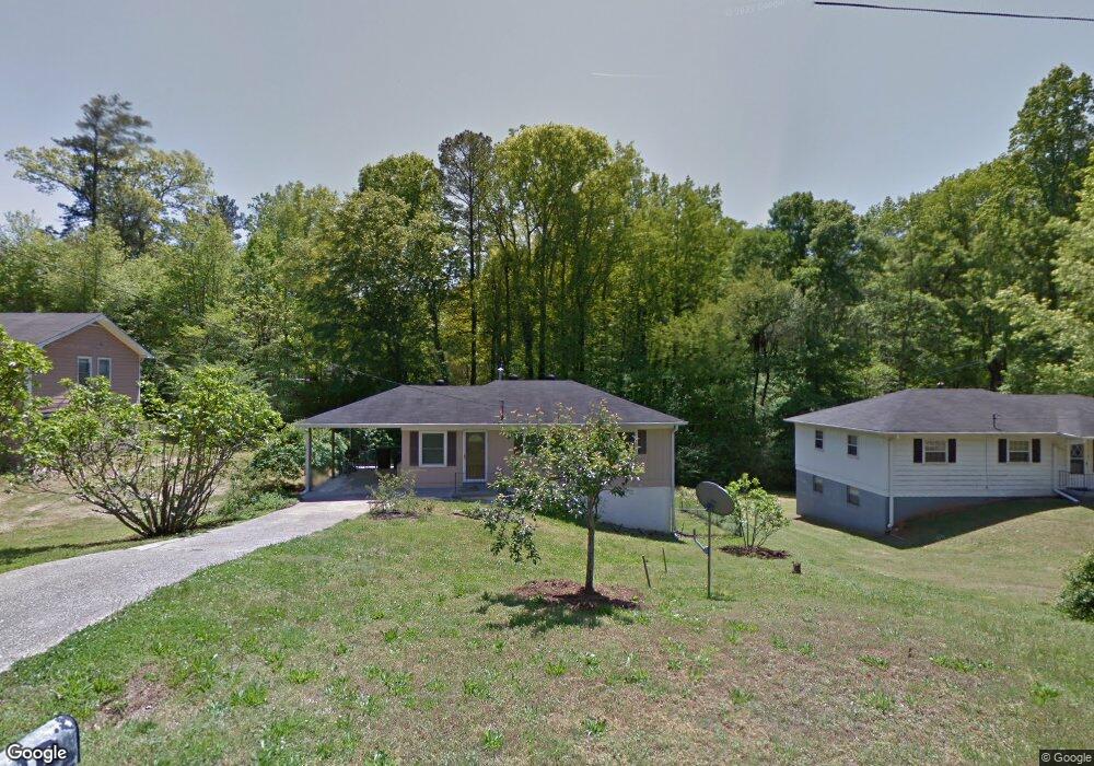
2035 Venesa Cir Austell, GA 30168
Estimated Value: $179,000 - $247,000
2
Beds
1
Bath
925
Sq Ft
$234/Sq Ft
Est. Value
About This Home
This home is located at 2035 Venesa Cir, Austell, GA 30168 and is currently estimated at $216,625, approximately $234 per square foot. 2035 Venesa Cir is a home located in Cobb County with nearby schools including Deerwood Elementary School, Mableton Elementary School, and Garrett Middle School.
Ownership History
Date
Name
Owned For
Owner Type
Purchase Details
Closed on
Nov 16, 2020
Sold by
Romanzo Marcus Modling and Barbosa Adelaide Albuquerque
Bought by
Romanzo Modling and Barbosa Adelaide Albuquerque
Current Estimated Value
Purchase Details
Closed on
Mar 11, 2000
Sold by
Farmer David S
Bought by
Romanzo Marcus M
Purchase Details
Closed on
Dec 23, 1998
Sold by
Stanford Candyse J
Bought by
Farmer David S
Home Financials for this Owner
Home Financials are based on the most recent Mortgage that was taken out on this home.
Original Mortgage
$64,468
Interest Rate
6.87%
Mortgage Type
FHA
Create a Home Valuation Report for This Property
The Home Valuation Report is an in-depth analysis detailing your home's value as well as a comparison with similar homes in the area
Home Values in the Area
Average Home Value in this Area
Purchase History
| Date | Buyer | Sale Price | Title Company |
|---|---|---|---|
| Romanzo Modling | -- | None Available | |
| Romanzo Marcus M | $77,000 | -- | |
| Farmer David S | $65,000 | -- |
Source: Public Records
Mortgage History
| Date | Status | Borrower | Loan Amount |
|---|---|---|---|
| Previous Owner | Farmer David S | $64,468 |
Source: Public Records
Tax History Compared to Growth
Tax History
| Year | Tax Paid | Tax Assessment Tax Assessment Total Assessment is a certain percentage of the fair market value that is determined by local assessors to be the total taxable value of land and additions on the property. | Land | Improvement |
|---|---|---|---|---|
| 2025 | $2,655 | $97,740 | $22,000 | $75,740 |
| 2024 | $2,236 | $82,344 | $18,000 | $64,344 |
| 2023 | $1,967 | $72,416 | $18,000 | $54,416 |
| 2022 | $1,573 | $57,508 | $12,000 | $45,508 |
| 2021 | $1,456 | $52,980 | $8,000 | $44,980 |
| 2020 | $965 | $35,092 | $8,000 | $27,092 |
| 2019 | $965 | $35,092 | $8,000 | $27,092 |
| 2018 | $736 | $26,768 | $8,000 | $18,768 |
| 2017 | $547 | $21,220 | $4,800 | $16,420 |
| 2016 | $547 | $21,220 | $4,800 | $16,420 |
| 2015 | $502 | $19,032 | $4,800 | $14,232 |
| 2014 | $400 | $15,008 | $0 | $0 |
Source: Public Records
Map
Nearby Homes
- 1984 Brenda Dr
- 1995 Matt Dr
- 1995 Oak Ct
- 2145 Venesa Cir
- 1155 Elowen Dr
- 1055 Elowen Dr
- 2335 Ravencliff Dr
- 2335 Ravencliff Dr Unit 91
- 2425 Ravencliff Dr Unit 88
- 2425 Ravencliff Dr
- The Norwood II Plan at Sanders Park
- The Greenbrier II Plan at Sanders Park
- The Ellison II Plan at Sanders Park
- The Buford II Plan at Sanders Park
- The Maddux II Plan at Sanders Park
- The Braselton II Plan at Sanders Park
- 2440 Ravencliff Dr Unit 145
- 2440 Ravencliff Dr
- 2430 Ravencliff Dr Unit 144
- 2420 Ravencliff Dr
- 2045 Venesa Cir
- 5862 Michael Rd
- 2046 Venesa Cir
- 2036 Venesa Cir
- 2026 Venesa Cir
- 2055 Venesa Cir
- 2056 Venesa Cir
- 2016 Venesa Cir
- 5870 Michael Rd
- 2005 Venesa Cir
- 2076 Venesa Cir Unit 2076
- 2076 Venesa Cir Unit 30
- 2076 Venesa Cir
- 2065 Venesa Cir
- 1994 Brenda Dr
- 2006 Venesa Cir
- 2025 Matt Dr
- 2075 Venesa Cir
- 2035 Matt Dr