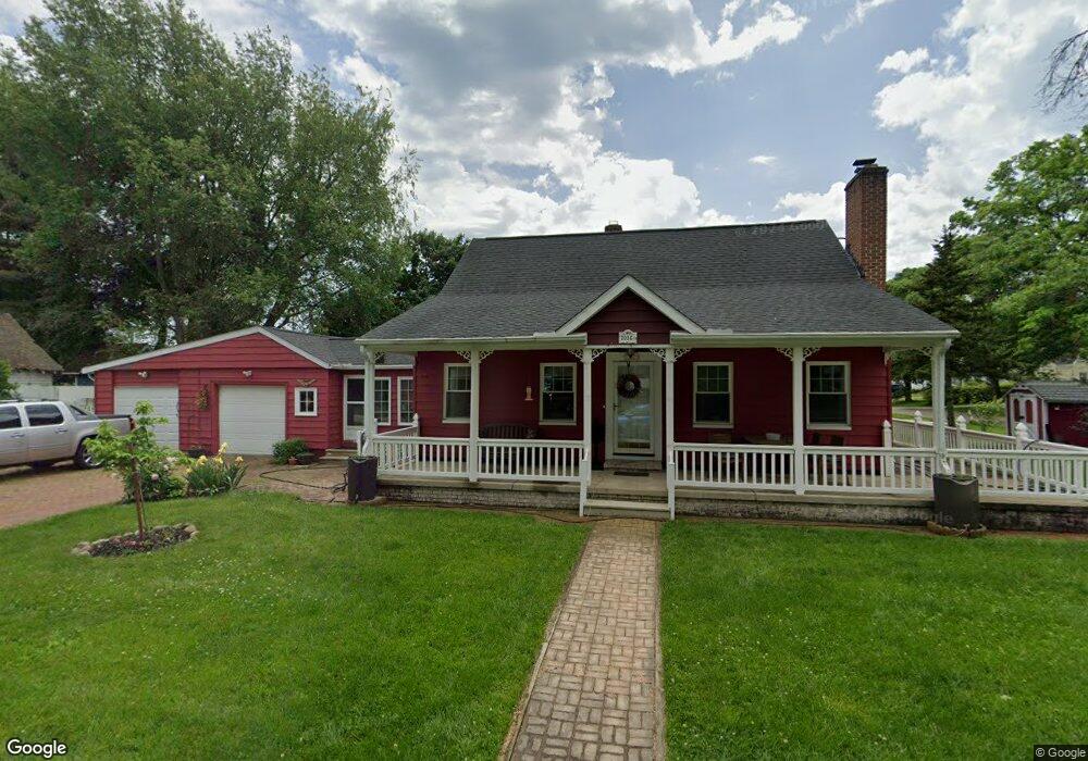
2036 Annetta Ave Akron, OH 44313
Fairlawn Heights NeighborhoodEstimated Value: $220,000 - $243,000
3
Beds
3
Baths
952
Sq Ft
$243/Sq Ft
Est. Value
About This Home
This home is located at 2036 Annetta Ave, Akron, OH 44313 and is currently estimated at $231,383, approximately $243 per square foot. 2036 Annetta Ave is a home located in Summit County with nearby schools including Summit Academy School, Our Lady Of The Elms Elementary School, and The Lippman School.
Ownership History
Date
Name
Owned For
Owner Type
Purchase Details
Closed on
Aug 25, 2017
Sold by
Tomlinson Sarah Ann
Bought by
Melver William N and Melver Virginia
Current Estimated Value
Home Financials for this Owner
Home Financials are based on the most recent Mortgage that was taken out on this home.
Original Mortgage
$100,000
Outstanding Balance
$54,170
Interest Rate
4.03%
Mortgage Type
New Conventional
Estimated Equity
$177,213
Purchase Details
Closed on
Aug 8, 2015
Sold by
Henretta Edna A
Bought by
Henretta Edna A and Edna A Henretta Revocable Trust
Create a Home Valuation Report for This Property
The Home Valuation Report is an in-depth analysis detailing your home's value as well as a comparison with similar homes in the area
Home Values in the Area
Average Home Value in this Area
Purchase History
| Date | Buyer | Sale Price | Title Company |
|---|---|---|---|
| Melver William N | $125,000 | None Available | |
| Henretta Edna A | -- | Attorney |
Source: Public Records
Mortgage History
| Date | Status | Borrower | Loan Amount |
|---|---|---|---|
| Open | Melver William N | $100,000 |
Source: Public Records
Tax History Compared to Growth
Tax History
| Year | Tax Paid | Tax Assessment Tax Assessment Total Assessment is a certain percentage of the fair market value that is determined by local assessors to be the total taxable value of land and additions on the property. | Land | Improvement |
|---|---|---|---|---|
| 2025 | $3,104 | $67,032 | $11,522 | $55,510 |
| 2024 | $3,104 | $67,032 | $11,522 | $55,510 |
| 2023 | $3,104 | $67,032 | $11,522 | $55,510 |
| 2022 | $2,646 | $47,205 | $8,113 | $39,092 |
| 2021 | $2,648 | $47,205 | $8,113 | $39,092 |
| 2020 | $2,609 | $47,200 | $8,110 | $39,090 |
| 2019 | $2,528 | $42,540 | $7,790 | $34,750 |
| 2018 | $2,392 | $41,060 | $7,790 | $33,270 |
| 2017 | $2,767 | $41,060 | $7,790 | $33,270 |
| 2016 | $2,841 | $36,210 | $7,790 | $28,420 |
| 2015 | $2,767 | $36,210 | $7,790 | $28,420 |
| 2014 | $2,745 | $36,210 | $7,790 | $28,420 |
| 2013 | $2,691 | $36,210 | $7,790 | $28,420 |
Source: Public Records
Map
Nearby Homes
- 0 White Pond Dr Unit 5156539
- 84 S Pershing Ave
- 2120 Ridgewood Rd
- 2166 Ridgewood Rd
- 2040 Braewick Dr
- 47 S Wheaton Rd
- 2285 Lancaster Rd
- 48 S Wheaton Rd
- V/L Idlewood Ave
- 2033 Wiltshire Rd
- 377 Village Pointe Dr Unit 4
- 635 Inverness Rd
- 1830 Tanglewood Dr
- 135 Southwood Rd
- 362 Village Pointe Dr
- 128 Overwood Rd
- 189 Wolcott Rd
- 344 Village Pointe Dr Unit D
- 1725 Liberty Dr Unit 1727
- 1529 Bryden Dr
- 243 Denby Ave
- 247 Denby Ave
- 204 White Pond Dr
- 2033 Annetta Ave
- 2045 Annetta Ave
- 194 White Pond Dr
- 2056 Annetta Ave
- 242 Denby Ave
- 248 Denby Ave
- 218 White Pond Dr
- 230 White Pond Dr Unit A
- 2051 Annetta Ave
- 188 White Pond Dr
- 254 Denby Ave
- 180 White Pond Dr
- 2057 Annetta Ave
- 260 Denby Ave
- 0 White Pond Dr Unit 3942881
- 0 White Pond Dr Unit 3405281
- V/L White Pond Dr