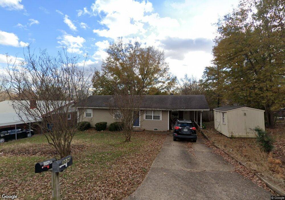
2036 Glendale Rd Poplar Bluff, MO 63901
Estimated Value: $96,159 - $148,000
Studio
--
Bath
1,225
Sq Ft
$102/Sq Ft
Est. Value
About This Home
This home is located at 2036 Glendale Rd, Poplar Bluff, MO 63901 and is currently estimated at $125,040, approximately $102 per square foot. 2036 Glendale Rd is a home with nearby schools including Eugene Field Elementary School, Poplar Bluff Fifth & Sixth Grade Center, and Poplar Bluff Junior High School.
Ownership History
Date
Name
Owned For
Owner Type
Purchase Details
Closed on
May 5, 2016
Sold by
Sanders Neal Brenda and Neal Thomas
Bought by
Taylor Charles Ray and Taylor Sharon Kay
Current Estimated Value
Home Financials for this Owner
Home Financials are based on the most recent Mortgage that was taken out on this home.
Original Mortgage
$40,530
Outstanding Balance
$32,317
Interest Rate
3.71%
Mortgage Type
Future Advance Clause Open End Mortgage
Estimated Equity
$92,723
Create a Home Valuation Report for This Property
The Home Valuation Report is an in-depth analysis detailing your home's value as well as a comparison with similar homes in the area
Home Values in the Area
Average Home Value in this Area
Purchase History
| Date | Buyer | Sale Price | Title Company |
|---|---|---|---|
| Taylor Charles Ray | -- | None Available |
Source: Public Records
Mortgage History
| Date | Status | Borrower | Loan Amount |
|---|---|---|---|
| Open | Taylor Charles Ray | $40,530 |
Source: Public Records
Tax History
| Year | Tax Paid | Tax Assessment Tax Assessment Total Assessment is a certain percentage of the fair market value that is determined by local assessors to be the total taxable value of land and additions on the property. | Land | Improvement |
|---|---|---|---|---|
| 2024 | $5 | $10,960 | $0 | $0 |
| 2023 | $529 | $10,960 | $0 | $0 |
| 2022 | $513 | $10,630 | $0 | $0 |
| 2021 | $513 | $10,630 | $0 | $0 |
| 2020 | $487 | $9,960 | $0 | $0 |
| 2019 | $487 | $9,960 | $0 | $0 |
| 2018 | $487 | $9,960 | $0 | $0 |
| 2017 | -- | $9,960 | $0 | $0 |
| 2016 | -- | $9,960 | $0 | $0 |
| 2015 | -- | $9,960 | $0 | $0 |
| 2014 | -- | $9,340 | $0 | $0 |
| 2012 | $398 | $9,340 | $0 | $0 |
Source: Public Records
Map
Nearby Homes
- 2718 Bedoll Ave
- 1931 Brentwood Rd
- 2801 Bedoll Ave
- 2057 Cravens Ln
- 2025 Wasson Dr
- 2324 Pike St
- 2325 Mangold St
- 912 Delano St
- 1000 W Victor St
- 2335 Cheshire Blvd
- 112 Kaylee Cir
- 0 County Road 301
- 792 County Road 466
- 625 Dewey St
- 518 W Victor St
- 925 Kendall Dr
- 1905 Kentucky Ave
- 816 Kendall Dr
- 1487 County Road 467
- 0 Lot # 23 Westwood Highlands Unit 22057612
- 2030 Glendale Rd
- 2040 Glendale Rd
- 2031 Glendale Rd
- 2518 Bedoll Ave
- 2612 Bedoll Ave
- 2037 Fernwood Rd
- 2025 Glendale Rd
- 2031 Fernwood Rd
- 2018 Glendale Rd
- 2041 Fernwood Rd
- 2025 Fernwood Rd
- 2019 Glendale Rd
- 2512 Bedoll Ave
- 2010 Glendale Rd
- 2036 Brentwood Rd
- 2013 Fernwood Rd
- 2036 Fernwood Rd
- 2745 Bedoll Ave-Option 4
- 2745 Bedoll Ave-Option 3
Your Personal Tour Guide
Ask me questions while you tour the home.