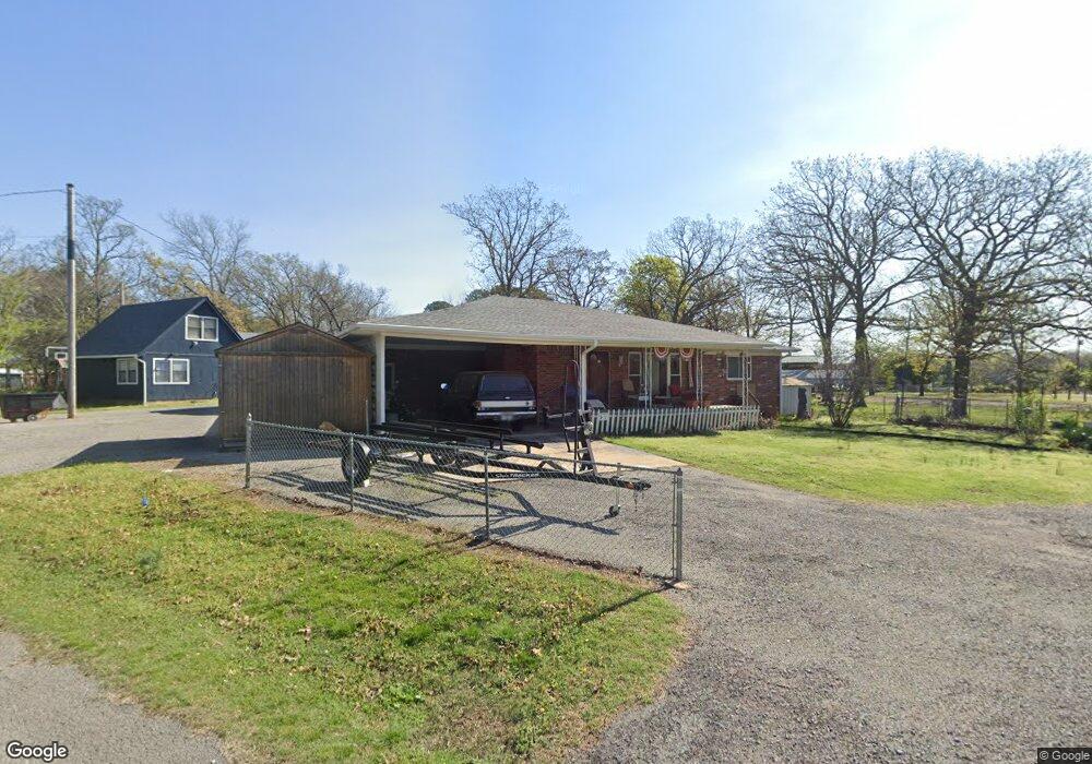
20362 W Cookson Bend Rd Cookson, OK 74427
Estimated Value: $193,378 - $266,000
3
Beds
2
Baths
1,388
Sq Ft
$166/Sq Ft
Est. Value
About This Home
This home is located at 20362 W Cookson Bend Rd, Cookson, OK 74427 and is currently estimated at $230,095, approximately $165 per square foot. 20362 W Cookson Bend Rd is a home located in Cherokee County.
Ownership History
Date
Name
Owned For
Owner Type
Purchase Details
Closed on
Nov 18, 2011
Sold by
Pierce Vernon D and Pierce Carolyn S
Bought by
Silk Chester
Current Estimated Value
Home Financials for this Owner
Home Financials are based on the most recent Mortgage that was taken out on this home.
Original Mortgage
$95,000
Outstanding Balance
$65,124
Interest Rate
4.13%
Mortgage Type
New Conventional
Estimated Equity
$164,971
Purchase Details
Closed on
Jul 7, 2007
Sold by
Brown Pamela Jean and Brown Randy L
Bought by
Pierce Vernon D and Pierce Carolyn S
Purchase Details
Closed on
Jun 18, 2003
Sold by
Joan Daves
Bought by
Harvey Daves
Purchase Details
Closed on
Dec 21, 1994
Sold by
Berkeley Fed Bank & Trust
Bought by
Harvey and Joan Daves
Create a Home Valuation Report for This Property
The Home Valuation Report is an in-depth analysis detailing your home's value as well as a comparison with similar homes in the area
Home Values in the Area
Average Home Value in this Area
Purchase History
| Date | Buyer | Sale Price | Title Company |
|---|---|---|---|
| Silk Chester | $100,000 | None Available | |
| Pierce Vernon D | $70,000 | Tahlequah Abstract Closing | |
| Harvey Daves | -- | -- | |
| Daves H | -- | -- | |
| Harvey | $30,000 | -- |
Source: Public Records
Mortgage History
| Date | Status | Borrower | Loan Amount |
|---|---|---|---|
| Open | Silk Chester | $95,000 |
Source: Public Records
Tax History Compared to Growth
Tax History
| Year | Tax Paid | Tax Assessment Tax Assessment Total Assessment is a certain percentage of the fair market value that is determined by local assessors to be the total taxable value of land and additions on the property. | Land | Improvement |
|---|---|---|---|---|
| 2024 | -- | $12,786 | $2,544 | $10,242 |
| 2023 | $0 | $12,786 | $2,544 | $10,242 |
| 2022 | $1,042 | $12,786 | $2,544 | $10,242 |
| 2021 | $1,042 | $12,786 | $2,544 | $10,242 |
| 2020 | $1,042 | $13,012 | $2,544 | $10,468 |
| 2019 | $1,020 | $12,733 | $2,489 | $10,244 |
| 2018 | $0 | $12,128 | $2,371 | $9,757 |
| 2017 | $0 | $11,550 | $2,258 | $9,292 |
| 2016 | -- | $11,000 | $332 | $10,668 |
| 2015 | $864 | $11,000 | $332 | $10,668 |
| 2014 | $862 | $11,000 | $332 | $10,668 |
Source: Public Records
Map
Nearby Homes
- 32174 S Boulder Rd
- 31720 S 533 Rd
- 31663 S 530 Rd
- 32256 S 528 Rd
- 32340 S Skyline Dr
- 19766 W 901 Rd
- 19542 W 905 Rd
- 21331 W Cookson Bend Rd
- 20717 W 888 Rd
- 32617 S 543 Rd
- 19460 W 925 Rd
- 19690 W 892 Rd
- 21245 W 888 Rd
- 32548 S Cookson Bluff Rd
- 21595 W 888 Rd
- 30981 S 520 Rd
- 18475 W Lakewood Dr
- 18697 W 903 Rd
- 0 Sugar Mountain Cir Unit 2540208
- 33959 S Terrapin Creek Rd
- 20396 W Cookson Bend Rd
- 31956 S 530 Rd
- 31979 S 530 Rd
- 32031 S Boulder Rd
- 32053 S 531 Rd
- 32048 S 531 Rd
- 31938 S 530 Rd
- 31923 S 530 Rd
- 20286 W Cookson Bend Rd
- 31970 S 533 Rd
- 32075 S 531 Rd
- 32086 S 531 Rd
- 32086 S 531 Rd
- 31897 S 530 Rd
- 31864 S 530 Rd
- 32123 S Boulder Rd
- 32125 S 531 Rd
- 31895 S 533 Rd
- 01 S Primrose Path
- 32153 S Boulder Rd