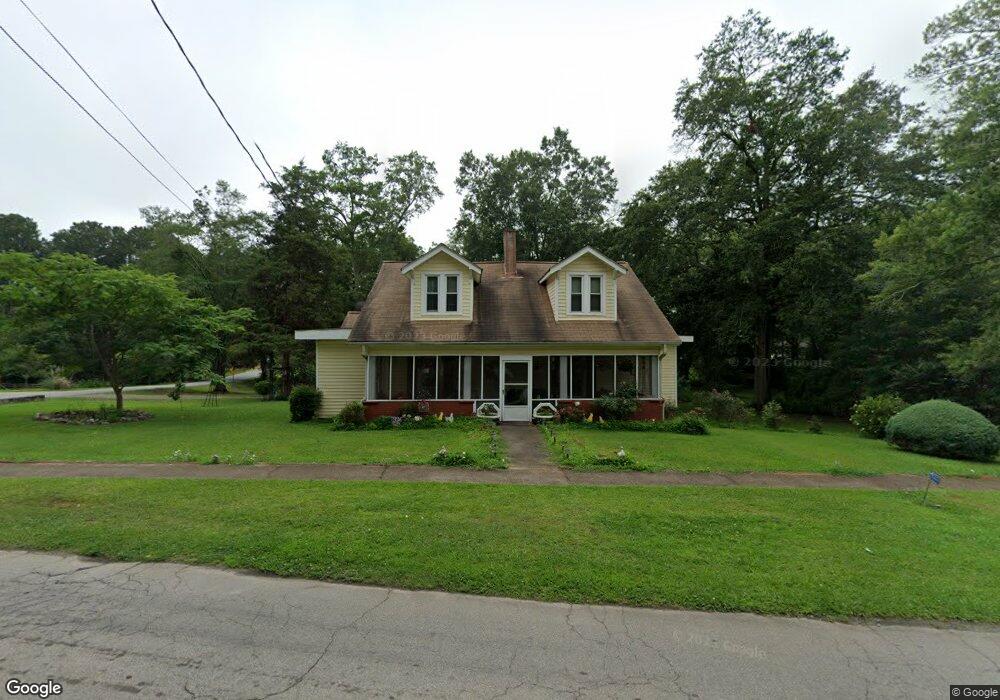
2037 Broad St Statham, GA 30666
Estimated Value: $304,352 - $371,000
4
Beds
3
Baths
1,999
Sq Ft
$169/Sq Ft
Est. Value
About This Home
This home is located at 2037 Broad St, Statham, GA 30666 and is currently estimated at $338,588, approximately $169 per square foot. 2037 Broad St is a home located in Barrow County with nearby schools including Statham Elementary School, Bear Creek Middle School, and Winder-Barrow High School.
Ownership History
Date
Name
Owned For
Owner Type
Purchase Details
Closed on
Dec 17, 2024
Sold by
Whitlock Rilla Faye
Bought by
Whitlock Seawright Michelle
Current Estimated Value
Purchase Details
Closed on
Sep 20, 2000
Sold by
'Whitlock Claude H
Bought by
Whitlock Rilla F
Purchase Details
Closed on
Jun 1, 1972
Bought by
Whitlock Claude Harm
Create a Home Valuation Report for This Property
The Home Valuation Report is an in-depth analysis detailing your home's value as well as a comparison with similar homes in the area
Home Values in the Area
Average Home Value in this Area
Purchase History
| Date | Buyer | Sale Price | Title Company |
|---|---|---|---|
| Whitlock Seawright Michelle | -- | -- | |
| Whitlock Rilla F | -- | -- | |
| Whitlock Claude Harm | $16,000 | -- |
Source: Public Records
Tax History
| Year | Tax Paid | Tax Assessment Tax Assessment Total Assessment is a certain percentage of the fair market value that is determined by local assessors to be the total taxable value of land and additions on the property. | Land | Improvement |
|---|---|---|---|---|
| 2025 | $2,617 | $81,968 | $20,000 | $61,968 |
| 2024 | $2,265 | $76,070 | $16,000 | $60,070 |
| 2023 | $250 | $76,070 | $16,000 | $60,070 |
| 2022 | $299 | $54,152 | $16,000 | $38,152 |
| 2021 | $287 | $47,006 | $12,000 | $35,006 |
| 2020 | $240 | $39,860 | $8,000 | $31,860 |
| 2019 | $251 | $39,860 | $8,000 | $31,860 |
| 2018 | $235 | $39,860 | $8,000 | $31,860 |
| 2017 | $1,193 | $34,192 | $8,000 | $26,192 |
| 2016 | $204 | $34,192 | $8,000 | $26,192 |
| 2015 | $467 | $34,192 | $8,000 | $26,192 |
| 2014 | $129 | $30,112 | $3,920 | $26,192 |
| 2013 | -- | $28,306 | $3,920 | $24,386 |
Source: Public Records
Map
Nearby Homes
- 619 Graham Campbell Ln
- 350 Graham Campbell Ln
- 32 Graham Campbell Ln
- 406 Ellerbe Dr Unit 3
- 1975 Broad St
- 139 Goldshore Way
- 38 Goldshore Way
- 585 Pendergrass Dr
- 2124 Broad St
- 2009 Euclid St
- 541 Moore Dr
- 1880 Oakley Trail
- 2641 Oakley Trail
- 2661 Oakley Trail
- 2540 Oakley Trail
- 2671 Oakley Trail
- 210 Charlotte Cir
- 1907 Broad St
- 174 Charlotte Cir
- 133 Charlotte Dr
- 2029 Broad St
- 2034 Broad St
- 2045 Broad St
- 2040 Railroad St
- 2040 Railroad St Unit S
- 2025 Broad St
- 2030 Broad St
- 2046 Railroad St
- 2034 Railroad St
- 2026 Broad St
- 2028 Railroad St
- 2021 Broad St
- 2022 Broad St
- 2820 Railroad St
- 2026 Railroad St
- 2017 Broad St
- 2018 Broad St
- 2020 Railroad St
- 326 Sixth St
- 2013 Broad St
Your Personal Tour Guide
Ask me questions while you tour the home.