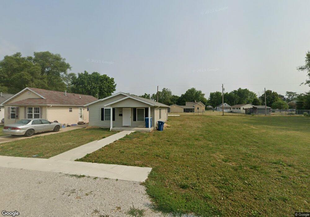
2037 E Cedar St Springfield, IL 62703
C Lee Carey Neighborhood Association NeighborhoodEstimated Value: $61,000 - $108,705
Studio
--
Bath
--
Sq Ft
6,055
Sq Ft Lot
About This Home
This home is located at 2037 E Cedar St, Springfield, IL 62703 and is currently estimated at $85,176. 2037 E Cedar St is a home located in Sangamon County with nearby schools including Southern View Elementary School, Benjamin Franklin Middle School, and Springfield Southeast High School.
Ownership History
Date
Name
Owned For
Owner Type
Purchase Details
Closed on
Mar 18, 2024
Sold by
Habitat/Humanity-Sangamon Cnty
Bought by
Lattin Shantell
Current Estimated Value
Home Financials for this Owner
Home Financials are based on the most recent Mortgage that was taken out on this home.
Original Mortgage
$105,409
Outstanding Balance
$102,788
Interest Rate
6.63%
Mortgage Type
Seller Take Back
Estimated Equity
-$17,612
Purchase Details
Closed on
Aug 1, 2017
Sold by
Coady Bernard T
Bought by
Habitat For Humanity & Sangamon
Purchase Details
Closed on
Feb 26, 2009
Purchase Details
Closed on
Mar 2, 2005
Purchase Details
Closed on
Dec 22, 2004
Purchase Details
Closed on
Dec 1, 2000
Purchase Details
Closed on
Jan 21, 1997
Create a Home Valuation Report for This Property
The Home Valuation Report is an in-depth analysis detailing your home's value as well as a comparison with similar homes in the area
Home Values in the Area
Average Home Value in this Area
Purchase History
| Date | Buyer | Sale Price | Title Company |
|---|---|---|---|
| Lattin Shantell | -- | None Listed On Document | |
| Habitat For Humanity & Sangamon | -- | Fernandes David A | |
| -- | $5,500 | -- | |
| -- | $10,300 | -- | |
| -- | $94,400 | -- | |
| -- | $145,000 | -- | |
| -- | -- | -- |
Source: Public Records
Mortgage History
| Date | Status | Borrower | Loan Amount |
|---|---|---|---|
| Open | Lattin Shantell | $105,409 |
Source: Public Records
Tax History
| Year | Tax Paid | Tax Assessment Tax Assessment Total Assessment is a certain percentage of the fair market value that is determined by local assessors to be the total taxable value of land and additions on the property. | Land | Improvement |
|---|---|---|---|---|
| 2024 | $2,341 | $33,876 | $1,655 | $32,221 |
| 2023 | $1,644 | $24,596 | $1,513 | $23,083 |
| 2022 | $2,091 | $23,331 | $1,435 | $21,896 |
| 2021 | $1,073 | $11,918 | $1,381 | $10,537 |
| 2020 | $122 | $1,385 | $1,385 | $0 |
| 2019 | $120 | $1,380 | $1,380 | $0 |
| 2018 | $116 | $1,373 | $1,373 | $0 |
| 2017 | $114 | $1,355 | $1,355 | $0 |
| 2016 | $111 | $1,335 | $1,335 | $0 |
| 2015 | $110 | $1,319 | $1,319 | $0 |
| 2014 | $109 | $1,310 | $1,310 | $0 |
| 2013 | $106 | $1,310 | $1,310 | $0 |
Source: Public Records
Map
Nearby Homes
- 1909 E Cedar St
- 2325 E Spruce St
- 1838 S 19th St
- 2238 E Stuart St
- 2051 Randall Ct
- 1848 Honeysuckle Ct
- 1105 Knoll Pointe Place
- 1622 E Cornell Ave
- 2160 S 14th St
- 2154 S 13th St
- 2212 S 14th St
- 1942 S 11th St
- 1529 E Edwards St
- 2128 E Capitol Ave
- 2216 S 13th St
- 1405 E Edwards St
- 2313 S 13th St
- 2236 E Adams St
- 725 E Spruce St
- Lot 1 & 2 Bunn Dr
- 2031 E Cedar St
- 2025 E Cedar St
- 2021 E Cedar St
- 2045 E Cedar St
- 2022 E Pine St
- 2032 E Cedar St
- 2030 E Pine St
- 2018 E Pine St
- 2104 E Pine St
- 2026 E Cedar St
- 2022 E Cedar St
- 2036 E Cedar St
- 2119 E Cedar St
- 2014 E Cedar St
- 2010 E Pine St
- 2010 E Cedar St
- 2129 E Cedar St
- 2006 E Pine St
- 2004 E Cedar St
- 2025 E Pine St
Your Personal Tour Guide
Ask me questions while you tour the home.