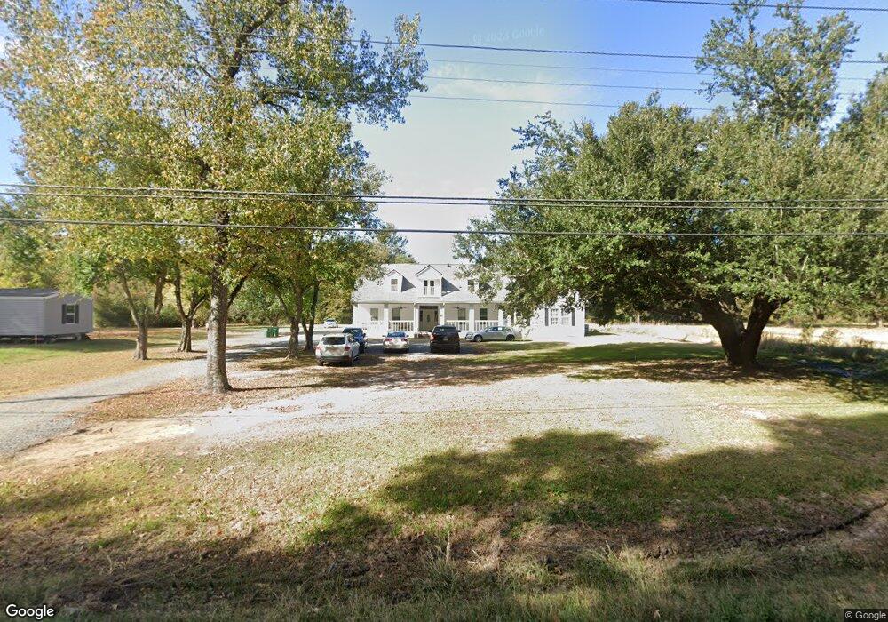
2037 Highway 594 Monroe, LA 71203
Estimated Value: $81,000 - $361,949
5
Beds
4
Baths
6,669
Sq Ft
$40/Sq Ft
Est. Value
About This Home
This home is located at 2037 Highway 594, Monroe, LA 71203 and is currently estimated at $266,237, approximately $39 per square foot. 2037 Highway 594 is a home located in Ouachita Parish with nearby schools including Lakeshore Elementary School, Ouachita Junior High School, and Ouachita Parish High School.
Ownership History
Date
Name
Owned For
Owner Type
Purchase Details
Closed on
Jun 25, 2014
Sold by
Fannie Mae
Bought by
Childs Leatha
Current Estimated Value
Purchase Details
Closed on
Jan 15, 2014
Sold by
Bice Robert Welborn and Bice Barbara Sue Calvit
Bought by
Jpmorgan Chase Bank Na
Purchase Details
Closed on
Mar 15, 2005
Sold by
Baskin Jessie Vester and Baskin Mary Blackwell
Bought by
Bice Robert Welborn and Bice Barbara Sue
Home Financials for this Owner
Home Financials are based on the most recent Mortgage that was taken out on this home.
Original Mortgage
$35,600
Interest Rate
5.66%
Mortgage Type
Seller Take Back
Create a Home Valuation Report for This Property
The Home Valuation Report is an in-depth analysis detailing your home's value as well as a comparison with similar homes in the area
Home Values in the Area
Average Home Value in this Area
Purchase History
| Date | Buyer | Sale Price | Title Company |
|---|---|---|---|
| Childs Leatha | $56,900 | None Available | |
| Jpmorgan Chase Bank Na | $196,969 | None Available | |
| Bice Robert Welborn | $178,000 | None Available |
Source: Public Records
Mortgage History
| Date | Status | Borrower | Loan Amount |
|---|---|---|---|
| Previous Owner | Bice Robert Welborn | $35,600 |
Source: Public Records
Tax History Compared to Growth
Tax History
| Year | Tax Paid | Tax Assessment Tax Assessment Total Assessment is a certain percentage of the fair market value that is determined by local assessors to be the total taxable value of land and additions on the property. | Land | Improvement |
|---|---|---|---|---|
| 2024 | $4,668 | $32,828 | $2,200 | $30,628 |
| 2023 | $4,668 | $24,753 | $2,200 | $22,553 |
| 2022 | $3,476 | $24,753 | $2,200 | $22,553 |
| 2021 | $3,504 | $25,401 | $2,200 | $23,201 |
| 2020 | $4,139 | $30,003 | $2,200 | $27,803 |
| 2019 | $2,135 | $15,693 | $2,200 | $13,493 |
| 2018 | $2,130 | $16,376 | $1,424 | $14,952 |
| 2017 | $2,182 | $16,376 | $1,424 | $14,952 |
| 2016 | $2,129 | $16,376 | $1,424 | $14,952 |
| 2015 | $2,126 | $16,376 | $1,424 | $14,952 |
| 2014 | $2,126 | $16,376 | $1,424 | $14,952 |
| 2013 | $2,121 | $16,376 | $1,424 | $14,952 |
Source: Public Records
Map
Nearby Homes
- 158 Barbara Dr
- 1870 Highway 594
- 0 Braebend Dr
- 2238 Highway 594
- 119 Daywood Dr
- 637 Rowland Rd
- 63 Forest Dr
- 30 Lake Dr
- 202 Daywood Dr
- 0 Rowland Rd
- 26 Forest Dr
- 15 Chauvin Dr
- 371 Rowland Dr
- 212 Wood Dr
- 158 Timberlane Dr
- 120 Donovan Cir
- 204 W Nelson Rd Unit 412 Allen, 413 n 23r
- 94 Nelson Rd
- 276 Clayton Dr
- 284 Connie Lynne Dr
- 2037 Highway 594
- 2037 Highway 594
- 2037 Highway 594
- 2037 Highway 594 Unit Love Road
- 2037 Highway 594
- 2037 Highway 594
- 2037 Highway 594
- 2037 Highway 594
- 2037 Highway 594 Unit Love Road
- 2037 Highway 594
- 2023 Louisiana 594
- 2008 Highway 594
- 1976 Highway 594
- 1967 Highway 594
- 882 Rowland Rd
- 854 Rowland Rd
- 1949 Highway 594
- 161 Rader Dr
- 840 Rowland Rd
- 1931 Highway 594