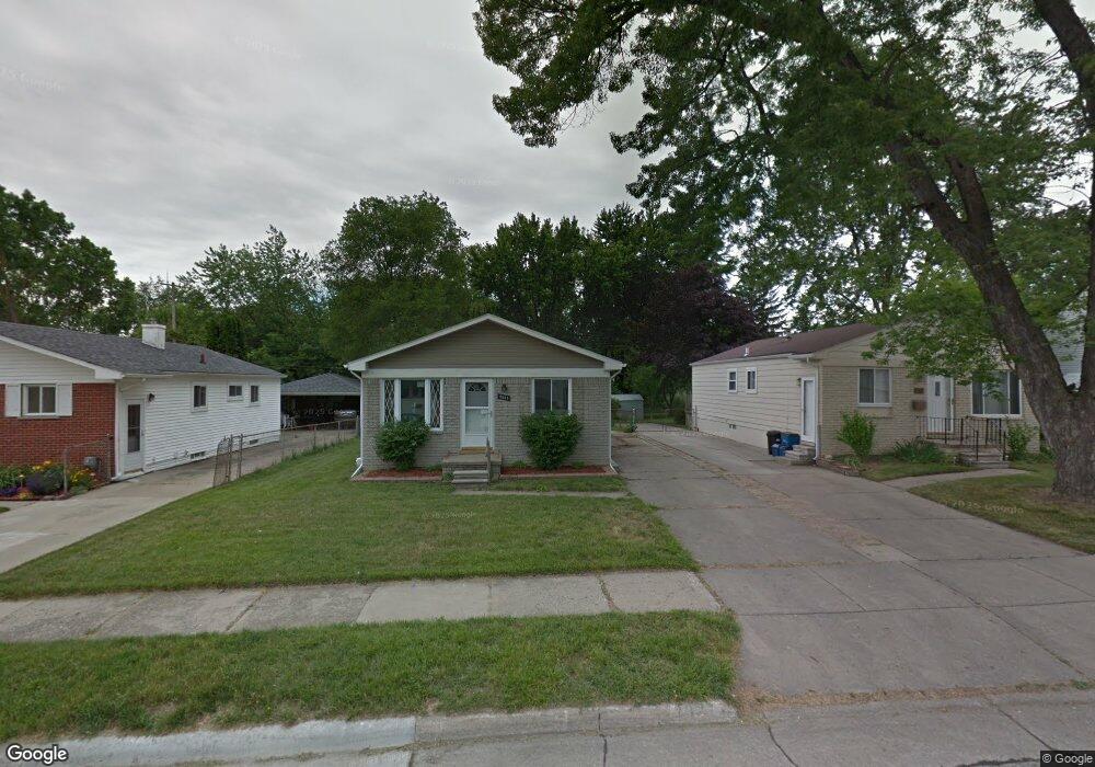
2037 Kipling Ave Unit Bldg-Unit Berkley, MI 48072
Estimated Value: $324,000 - $343,621
3
Beds
2
Baths
969
Sq Ft
$346/Sq Ft
Est. Value
About This Home
This home is located at 2037 Kipling Ave Unit Bldg-Unit, Berkley, MI 48072 and is currently estimated at $335,155, approximately $345 per square foot. 2037 Kipling Ave Unit Bldg-Unit is a home located in Oakland County with nearby schools including Angell Elementary School, Anderson Middle School, and Berkley High School.
Ownership History
Date
Name
Owned For
Owner Type
Purchase Details
Closed on
Mar 13, 2025
Sold by
Mcintosh Linda M
Bought by
Mcintosh Michael James and Mcintosh Bruce Burr
Current Estimated Value
Home Financials for this Owner
Home Financials are based on the most recent Mortgage that was taken out on this home.
Original Mortgage
$313,595
Outstanding Balance
$311,996
Interest Rate
6.89%
Mortgage Type
New Conventional
Estimated Equity
$23,159
Purchase Details
Closed on
Feb 13, 2025
Sold by
Peterson Jeffrey and Peterson Sarah
Bought by
Mcintosh Linda M
Home Financials for this Owner
Home Financials are based on the most recent Mortgage that was taken out on this home.
Original Mortgage
$313,595
Outstanding Balance
$311,996
Interest Rate
6.89%
Mortgage Type
New Conventional
Estimated Equity
$23,159
Purchase Details
Closed on
Jan 10, 2018
Sold by
Mahaffy Kyle R and Jepson Joseph C
Bought by
Peterson Jeffrey
Home Financials for this Owner
Home Financials are based on the most recent Mortgage that was taken out on this home.
Original Mortgage
$182,750
Interest Rate
3.9%
Mortgage Type
New Conventional
Purchase Details
Closed on
Jun 19, 2015
Sold by
Carrell Michael
Bought by
Mahaffy Kyle R and Jepson Joseph C
Home Financials for this Owner
Home Financials are based on the most recent Mortgage that was taken out on this home.
Original Mortgage
$156,750
Interest Rate
3.82%
Mortgage Type
New Conventional
Purchase Details
Closed on
Sep 14, 2012
Sold by
Ferraro James and Ferraro Laura
Bought by
Carrell Michael
Purchase Details
Closed on
May 18, 2010
Sold by
Wood Nicholas J
Bought by
Federal National Mortgage Association
Purchase Details
Closed on
Jun 28, 2006
Sold by
Wolfe Wilbur and Wilbur Wolfe Living Trust
Bought by
Wood Nicholas J
Home Financials for this Owner
Home Financials are based on the most recent Mortgage that was taken out on this home.
Original Mortgage
$144,000
Interest Rate
6.72%
Mortgage Type
Purchase Money Mortgage
Purchase Details
Closed on
Oct 26, 2000
Sold by
Wolfe Wilbur
Bought by
Wilbur Wolfe Tr
Create a Home Valuation Report for This Property
The Home Valuation Report is an in-depth analysis detailing your home's value as well as a comparison with similar homes in the area
Home Values in the Area
Average Home Value in this Area
Purchase History
| Date | Buyer | Sale Price | Title Company |
|---|---|---|---|
| Mcintosh Michael James | $330,100 | Sterling Title Agency | |
| Mcintosh Linda M | $330,100 | Ata National Title | |
| Mcintosh Linda M | $330,100 | Ata National Title | |
| Peterson Jeffrey | $215,000 | None Available | |
| Mahaffy Kyle R | $165,000 | Title Solutions Agency Llc | |
| Carrell Michael | $135,000 | Liberty Title | |
| Federal National Mortgage Association | $198,843 | None Available | |
| Wood Nicholas J | $180,000 | Philip R Seaver Title Co Inc | |
| Wilbur Wolfe Tr | -- | -- |
Source: Public Records
Mortgage History
| Date | Status | Borrower | Loan Amount |
|---|---|---|---|
| Open | Mcintosh Michael James | $313,595 | |
| Previous Owner | Peterson Jeffrey | $182,750 | |
| Previous Owner | Mahaffy Kyle R | $156,750 | |
| Previous Owner | Wood Nicholas J | $144,000 |
Source: Public Records
Tax History Compared to Growth
Tax History
| Year | Tax Paid | Tax Assessment Tax Assessment Total Assessment is a certain percentage of the fair market value that is determined by local assessors to be the total taxable value of land and additions on the property. | Land | Improvement |
|---|---|---|---|---|
| 2024 | $4,777 | $145,320 | $0 | $0 |
| 2023 | $4,305 | $133,980 | $0 | $0 |
| 2022 | $4,302 | $123,030 | $0 | $0 |
| 2021 | $4,206 | $117,950 | $0 | $0 |
| 2020 | $3,933 | $108,960 | $0 | $0 |
| 2019 | $4,129 | $102,140 | $0 | $0 |
| 2018 | $3,251 | $87,780 | $0 | $0 |
| 2017 | $3,210 | $84,430 | $0 | $0 |
| 2016 | $3,240 | $79,740 | $0 | $0 |
| 2015 | -- | $73,130 | $0 | $0 |
| 2014 | -- | $65,920 | $0 | $0 |
| 2011 | -- | $62,820 | $0 | $0 |
Source: Public Records
Map
Nearby Homes
- 2679 Columbia Rd
- 2085 Gardner Ave
- 2251 Harvard Rd
- 14421 Labelle St
- 2210 Cambridge Rd
- 3110 Catalpa Dr
- 2686 Wakefield Rd
- 13154 Kingston Ave
- 14480 Borgman St
- 3325 Catalpa Dr
- 2715 Kenmore Rd
- 2399 Royal Ave
- 13720 Nadine St
- 1799 Phillips Ave
- 14670 Talbot St
- 2827 Gardner Ave
- 1957 Columbia Rd
- 1977 Princeton Rd
- 13128 Talbot Ave
- 1896 Cambridge Rd
- 2011 Kipling Ave
- 2063 Kipling Ave
- 1989 Kipling Ave
- 2069 Kipling Ave
- 2873 Harvard Rd
- 1975 Kipling Ave
- 2079 Kipling Ave
- 2060 Kipling Ave
- 1963 Kipling Ave
- 2773 Harvard Rd
- 2040 Kipling Ave
- 2020 Kipling Ave
- 2893 Harvard Rd
- 1990 Kipling Ave
- 1953 Kipling Ave
- 2909 Harvard Rd
- 2890 Columbia Rd
- 1976 Kipling Ave
- 1939 Kipling Ave Unit Bldg-Unit
- 1939 Kipling Ave