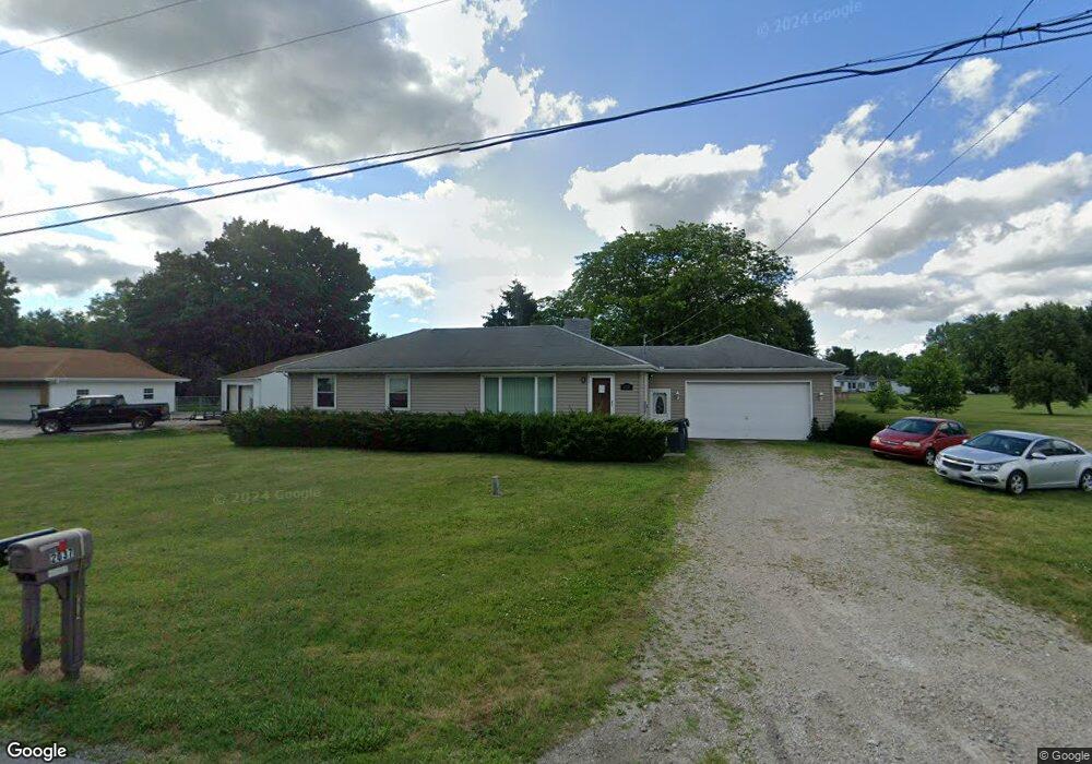
2037 N 5th St Fremont, OH 43420
Estimated Value: $176,000 - $196,000
3
Beds
1
Bath
1,344
Sq Ft
$138/Sq Ft
Est. Value
About This Home
This home is located at 2037 N 5th St, Fremont, OH 43420 and is currently estimated at $185,521, approximately $138 per square foot. 2037 N 5th St is a home located in Sandusky County with nearby schools including Fremont Ross High School, Bishop Hoffman Catholic School - This is St Joe's School now, and St. Joseph School.
Ownership History
Date
Name
Owned For
Owner Type
Purchase Details
Closed on
Jul 6, 2022
Sold by
Ismael Venegas
Bought by
Davis Earl G
Current Estimated Value
Home Financials for this Owner
Home Financials are based on the most recent Mortgage that was taken out on this home.
Original Mortgage
$110,000
Outstanding Balance
$104,652
Interest Rate
5.09%
Mortgage Type
New Conventional
Estimated Equity
$80,869
Purchase Details
Closed on
Sep 25, 2009
Sold by
Kluck Ronald R and Kluck Barbara
Bought by
Venegas Ismael
Home Financials for this Owner
Home Financials are based on the most recent Mortgage that was taken out on this home.
Original Mortgage
$87,878
Interest Rate
5.38%
Mortgage Type
FHA
Purchase Details
Closed on
Jan 1, 1989
Bought by
Venegas Ismael
Create a Home Valuation Report for This Property
The Home Valuation Report is an in-depth analysis detailing your home's value as well as a comparison with similar homes in the area
Home Values in the Area
Average Home Value in this Area
Purchase History
| Date | Buyer | Sale Price | Title Company |
|---|---|---|---|
| Davis Earl G | -- | First American Title | |
| Venegas Ismael | $89,500 | First Am Title | |
| Venegas Ismael | -- | -- |
Source: Public Records
Mortgage History
| Date | Status | Borrower | Loan Amount |
|---|---|---|---|
| Open | Davis Earl G | $110,000 | |
| Previous Owner | Venegas Ismael | $87,878 |
Source: Public Records
Tax History Compared to Growth
Tax History
| Year | Tax Paid | Tax Assessment Tax Assessment Total Assessment is a certain percentage of the fair market value that is determined by local assessors to be the total taxable value of land and additions on the property. | Land | Improvement |
|---|---|---|---|---|
| 2024 | $1,794 | $47,610 | $10,820 | $36,790 |
| 2023 | $1,794 | $38,090 | $8,650 | $29,440 |
| 2022 | $1,526 | $38,090 | $8,650 | $29,440 |
| 2021 | $1,574 | $38,090 | $8,650 | $29,440 |
| 2020 | $1,329 | $31,610 | $8,650 | $22,960 |
| 2019 | $1,327 | $31,610 | $8,650 | $22,960 |
| 2018 | $1,287 | $31,610 | $8,650 | $22,960 |
| 2017 | $1,245 | $29,510 | $8,650 | $20,860 |
| 2016 | $1,097 | $29,510 | $8,650 | $20,860 |
| 2015 | $1,079 | $29,510 | $8,650 | $20,860 |
| 2014 | $1,078 | $28,080 | $7,880 | $20,200 |
| 2013 | $1,055 | $28,080 | $7,880 | $20,200 |
Source: Public Records
Map
Nearby Homes
- 711 Bloom Rd
- 612 2nd St
- 263 Saint Paul Dr
- 251 Saint Paul Dr
- 533 Sandusky Ave Unit 535
- 315 Ethan Dr
- 318 Ethan Dr
- 1730 Port Clinton Rd Unit 41
- 1730 Port Clinton Rd
- 1730 Port Clinton Rd Unit 33
- 230 N Pennsylvania Ave
- 433 Sandusky Ave
- 199 Saint Thomas Dr
- 322 4th St
- 340 340 Sandusky Ave
- 714 E State St
- 224 Sandusky Ave Unit 226
- 2248 E State St
- 2100 Ohio 53
- 208 E State St
- 2037 N Fifth
- 1608 Edwards Dr
- 2053 N 5th St
- 2036 N 5th St
- 2042 N 5th St
- 2021 N 5th St
- 1532 Edwards Dr
- 1613 Edwards Dr
- 1621 Edwards Dr
- 1607 Edwards Dr
- 1524 Edwards Dr
- 1631 Edwards Dr
- 2100 N 5th St
- 1533 Edwards Dr
- 2001 N 5th St
- 1525 Edwards Dr
- 2119 N 5th St
- 1508 Edwards Dr
- 1515 Edwards Dr
- 2129 N 5th St