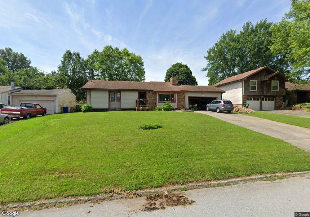
2038 E Lon St Springfield, MO 65803
Estimated Value: $220,000 - $234,000
3
Beds
2
Baths
1,422
Sq Ft
$158/Sq Ft
Est. Value
About This Home
This home is located at 2038 E Lon St, Springfield, MO 65803 and is currently estimated at $225,309, approximately $158 per square foot. 2038 E Lon St is a home located in Greene County with nearby schools including Fremont Elementary School, Pleasant View Elementary School, and Pleasant View K-8 School.
Ownership History
Date
Name
Owned For
Owner Type
Purchase Details
Closed on
May 20, 2005
Sold by
Gameron Fred W and Cameron Deborah Sue
Bought by
Fitzlaff Ernest D and Fitzlaff Phyllis J
Current Estimated Value
Home Financials for this Owner
Home Financials are based on the most recent Mortgage that was taken out on this home.
Original Mortgage
$97,693
Outstanding Balance
$51,036
Interest Rate
5.87%
Mortgage Type
FHA
Estimated Equity
$174,273
Create a Home Valuation Report for This Property
The Home Valuation Report is an in-depth analysis detailing your home's value as well as a comparison with similar homes in the area
Home Values in the Area
Average Home Value in this Area
Purchase History
| Date | Buyer | Sale Price | Title Company |
|---|---|---|---|
| Fitzlaff Ernest D | -- | None Available |
Source: Public Records
Mortgage History
| Date | Status | Borrower | Loan Amount |
|---|---|---|---|
| Open | Fitzlaff Ernest D | $97,693 |
Source: Public Records
Tax History Compared to Growth
Tax History
| Year | Tax Paid | Tax Assessment Tax Assessment Total Assessment is a certain percentage of the fair market value that is determined by local assessors to be the total taxable value of land and additions on the property. | Land | Improvement |
|---|---|---|---|---|
| 2025 | $1,271 | $26,430 | $8,320 | $18,110 |
| 2024 | $1,271 | $21,950 | $4,180 | $17,770 |
| 2023 | $1,264 | $21,950 | $4,180 | $17,770 |
| 2022 | $1,175 | $19,990 | $4,180 | $15,810 |
| 2021 | $1,124 | $19,990 | $4,180 | $15,810 |
| 2020 | $1,086 | $18,340 | $4,180 | $14,160 |
| 2019 | $1,055 | $18,340 | $4,180 | $14,160 |
| 2018 | $876 | $15,140 | $3,230 | $11,910 |
| 2017 | $868 | $15,140 | $3,230 | $11,910 |
| 2016 | $866 | $15,140 | $3,230 | $11,910 |
| 2015 | $860 | $15,140 | $3,230 | $11,910 |
| 2014 | $829 | $14,610 | $3,230 | $11,380 |
Source: Public Records
Map
Nearby Homes
- 3481 N Marwin Ave
- Lot 1 E Stoneridge Dr
- 3839 N Stewart Ave
- 4260 N State Highway H
- 3320 N Weller Ave
- 0 N State Highway H Unit 60272431
- 1439 E McClernon St
- 1425 E McClernon St
- 3749 N Pickwick Ave
- 3753 N Pickwick Ave
- 1464 E Burntwood St
- 1316 E Smith St
- 1255 E Smith St
- 4159 N Farm Road 173
- 3250 N National Ave
- 1234 E McClernon St
- 1338 E Burntwood St
- 3156 N National Ave
- 1270 E Ogorman Ct
- 2611 N Marlan Ave
- 2030 E Lon St
- 2046 E Lon St
- 2039 E Camorene St
- 2054 E Lon St
- 2031 E Camorene St
- 2047 E Camorene St
- 2055 E Camorene St
- 2039 E Lon St
- 2062 E Lon St
- 2047 E Lon St
- Lot 33 N Marwin Ave
- 2055 E Lon St
- 2025 E Lon St
- 2063 E Camorene St
- 2063 E Lon St
- 2106 E Lon St
- 3445 N Marwin Ave
- 3439 N Marwin Ave
- 2107 E Camorene St
- 3431 N Marwin Ave