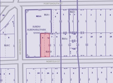
2038 Norfolk St Houston, TX 77098
Montrose NeighborhoodEstimated payment $4,475/month
Highlights
- 0.14 Acre Lot
- Poe Elementary School Rated A-
- Fenced
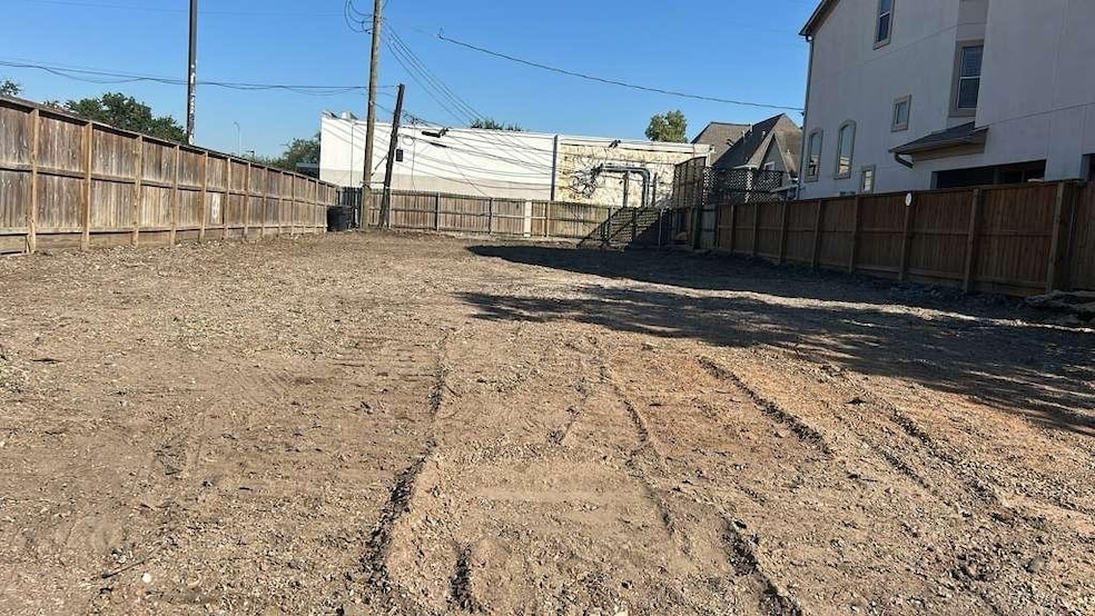
About This Lot
Situated in the heart of the coveted Montrose neighborhood, this rare 6,250-square-foot lot (50 ft x 125 ft) offers an exceptional opportunity for developers and investors. The property is surrounded by many of Houston’s premier destinations, with convenient access to Rice University, Rice Village, the Galleria, River Oaks, and a dynamic selection of shopping, dining, and entertainment venues.
Cleared and ready for construction, the lot is well-suited for a range of high-end residential projects, including an upscale single-family home or a luxury duplex. With strong buyer demand and limited land availability in the area, this site is ideally positioned for refined urban living.
Don’t miss the chance to bring a standout development to one of Houston’s most vibrant, walkable communities.
Listing Agent
Walzel Properties - Corporate Office License #0830124 Listed on: 11/18/2025

Property Details
Property Type
- Land
Est. Annual Taxes
- $12,594
Lot Details
- 6,250 Sq Ft Lot
- Fenced
- Cleared Lot
Schools
- Poe Elementary School
- Lanier Middle School
- Lamar High School
Utilities
- Phone Available
- Cable TV Available
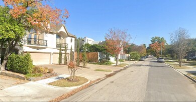
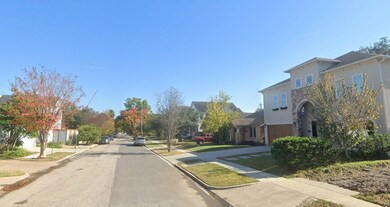
Community Details
- Albemarle Place Subdivision
Map
Home Values in the Area
Average Home Value in this Area
Tax History
| Year | Tax Paid | Tax Assessment Tax Assessment Total Assessment is a certain percentage of the fair market value that is determined by local assessors to be the total taxable value of land and additions on the property. | Land | Improvement |
|---|---|---|---|---|
| 2025 | $11,352 | $601,913 | $530,438 | $71,475 |
| 2024 | $11,352 | $542,523 | $471,500 | $71,023 |
| 2023 | $11,352 | $542,523 | $471,500 | $71,023 |
| 2022 | $11,076 | $503,000 | $471,500 | $31,500 |
| 2021 | $11,688 | $501,503 | $471,500 | $30,003 |
| 2020 | $12,147 | $501,633 | $471,500 | $30,133 |
| 2019 | $10,335 | $408,408 | $408,308 | $100 |
| 2018 | $9,949 | $393,188 | $393,088 | $100 |
| 2017 | $10,433 | $393,188 | $393,088 | $100 |
| 2016 | $12,188 | $459,291 | $393,088 | $66,203 |
| 2015 | $8,690 | $360,000 | $359,900 | $100 |
| 2014 | $8,690 | $338,062 | $253,995 | $84,067 |
Property History
| Date | Event | Price | List to Sale | Price per Sq Ft |
|---|---|---|---|---|
| 11/18/2025 11/18/25 | For Sale | $649,995 | 0.0% | -- |
| 12/30/2021 12/30/21 | Off Market | $995 | -- | -- |
| 04/16/2018 04/16/18 | Rented | $995 | -0.5% | -- |
| 03/17/2018 03/17/18 | Under Contract | -- | -- | -- |
| 07/05/2017 07/05/17 | For Rent | $1,000 | -- | -- |
Purchase History
| Date | Type | Sale Price | Title Company |
|---|---|---|---|
| Warranty Deed | -- | Fidelity National Title | |
| Special Warranty Deed | -- | None Listed On Document | |
| Warranty Deed | -- | Stewart Title |
Source: Houston Association of REALTORS®
MLS Number: 8787037
APN: 0540600040006
Disclaimer: Certain information contained herein is derived from information provided by parties other than Homes.com. All information provided is deemed reliable, but is not guaranteed to be accurate and should be independently verified.
![]() Copyright 2025, Houston REALTORS® Information Service, Inc.
Copyright 2025, Houston REALTORS® Information Service, Inc.
The information provided is exclusively for consumers’ personal, non-commercial use, and may not be used for any purpose other than to identify prospective properties consumers may be interested in purchasing.
Information is deemed reliable but not guaranteed.
- 1964 Norfolk St
- 1947 Portsmouth St
- 1944 Portsmouth St
- 1959 Lexington St
- 1955 Lexington St
- 1933 Lexington St
- 1925 Lexington St
- 2034 Colquitt St Unit A
- 4509 Hazard St
- 1849 Portsmouth St
- 2102 Banks St
- 2124 Banks St
- 2107 W Main St
- 2027 Branard St
- 1826 Portsmouth St
- 1844 Colquitt St
- 1849 W Main St Unit 15
- 2230 Richmond Ave
- 2201 W Main St
- 2044 Branard St
- 3817 S Shepherd Dr Unit 2
- 2038 Lexington St
- 1955 Portsmouth St
- 1947 Richmond Ave Unit A
- 1947 Richmond Ave Unit B
- 2115 Lexington St
- 1939 Richmond Ave Unit 2
- 1919 Portsmouth St
- 2025 Colquitt St Unit ID1257741P
- 1903 Portsmouth St
- 1901 Richmond Ave Unit 34
- 1920 Richmond Ave Unit 13
- 1920 Richmond Ave Unit 14
- 1920 Richmond Ave Unit 6
- 1920 Richmond Ave Unit 16
- 2209 Portsmouth St
- 1919 Colquitt St Unit E
- 4405 Hazard St Unit B
- 2039 W Main St
- 4116 Mcduffie St