Estimated Value: $178,000 - $189,000
3
Beds
1
Bath
1,116
Sq Ft
$165/Sq Ft
Est. Value
About This Home
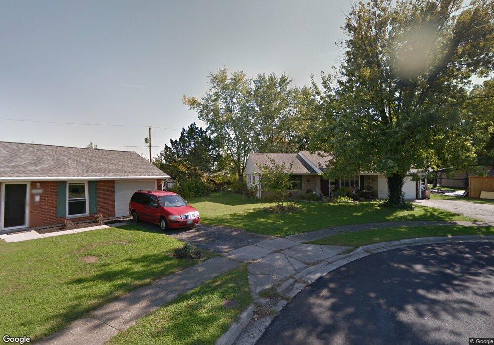
This home is located at 2038 Oxward Ct, Xenia, OH 45385 and is currently estimated at $184,009, approximately $164 per square foot. 2038 Oxward Ct is a home located in Greene County with nearby schools including Xenia High School, Summit Academy Community School for Alternative Learners - Xenia, and Legacy Christian Academy.
Ownership History
Date
Name
Owned For
Owner Type
Purchase Details
Closed on
Nov 26, 2014
Sold by
Secretary Of Hud
Bought by
Ohio Valley Property Management Llc
Current Estimated Value
Purchase Details
Closed on
Mar 25, 2014
Sold by
Gmac Mortgage Llc
Bought by
Secretary Of Hud
Purchase Details
Closed on
Mar 7, 2014
Sold by
Kurowski Gerald and Laprairie Jennifer M
Bought by
Gmac Mortgage Llc
Purchase Details
Closed on
May 25, 2000
Sold by
Blair Jeffrey S and Blair Jeanette L
Bought by
Laprairie Jennifer M and Kurowski Gerald
Home Financials for this Owner
Home Financials are based on the most recent Mortgage that was taken out on this home.
Original Mortgage
$75,511
Interest Rate
8.18%
Mortgage Type
FHA
Create a Home Valuation Report for This Property
The Home Valuation Report is an in-depth analysis detailing your home's value as well as a comparison with similar homes in the area
Home Values in the Area
Average Home Value in this Area
Purchase History
| Date | Buyer | Sale Price | Title Company |
|---|---|---|---|
| Ohio Valley Property Management Llc | $29,900 | None Available | |
| Secretary Of Hud | -- | None Available | |
| Gmac Mortgage Llc | $63,643 | None Available | |
| Laprairie Jennifer M | $76,500 | Buckeye Title Agency |
Source: Public Records
Mortgage History
| Date | Status | Borrower | Loan Amount |
|---|---|---|---|
| Previous Owner | Laprairie Jennifer M | $75,511 |
Source: Public Records
Tax History Compared to Growth
Tax History
| Year | Tax Paid | Tax Assessment Tax Assessment Total Assessment is a certain percentage of the fair market value that is determined by local assessors to be the total taxable value of land and additions on the property. | Land | Improvement |
|---|---|---|---|---|
| 2024 | $2,019 | $47,180 | $13,520 | $33,660 |
| 2023 | $2,019 | $47,180 | $13,520 | $33,660 |
| 2022 | $1,657 | $33,020 | $7,950 | $25,070 |
| 2021 | $1,679 | $33,020 | $7,950 | $25,070 |
| 2020 | $1,608 | $33,020 | $7,950 | $25,070 |
| 2019 | $1,312 | $25,360 | $7,820 | $17,540 |
| 2018 | $1,317 | $25,360 | $7,820 | $17,540 |
| 2017 | $1,279 | $25,360 | $7,820 | $17,540 |
| 2016 | $1,202 | $22,700 | $7,820 | $14,880 |
| 2015 | $605 | $22,700 | $7,820 | $14,880 |
| 2014 | -- | $22,700 | $7,820 | $14,880 |
Source: Public Records
Map
Nearby Homes
- 1255 Colorado Dr
- 1866 Roxbury Dr
- 1107 Arkansas Dr
- 2499 Jenny Marie Dr
- 1908 Whitt St
- 2540 Jenny Marie Dr
- 2540 Cornwall Dr
- 2421 Louisiana Dr
- 1403 Texas Dr
- 1829 Gayhart Dr
- 0 Berkshire Dr Unit 942854
- 1769 Gayhart Dr
- 2345 Tennessee Dr
- 910 Wright Ave
- 2144 Tandem Dr
- 1778 Arapaho Dr
- 2257 Maryland Dr
- 2102 High Wheel Dr
- 2784 Greystoke Dr
- 920 Wright Cycle Blvd
- 2052 Oxward Ct
- 2156 Bellbrook Ave
- 2140 Bellbrook Ave
- 2126 Bellbrook Ave
- 2066 Oxward Ct
- 1479 Colorado Dr
- 2107 Drummond Dr
- 2110 Bellbrook Ave
- 2096 Bellbrook Ave
- 2095 Drummond Dr
- 2130 Drummond Dr
- 2104 Drummond Dr
- 2082 Bellbrook Ave
- 2081 Drummond Dr
- 2152 Drummond Dr
- 2086 Drummond Dr
- 2095 Commonwealth Dr
- 2068 Bellbrook Ave
- 2067 Drummond Dr
- 2083 Commonwealth Dr