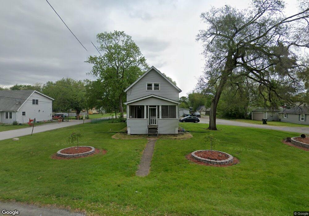
2038 Thornton Lansing Rd Lansing, IL 60438
Estimated Value: $170,034
3
Beds
2
Baths
1,789
Sq Ft
$95/Sq Ft
Est. Value
About This Home
This home is located at 2038 Thornton Lansing Rd, Lansing, IL 60438 and is currently estimated at $170,034, approximately $95 per square foot. 2038 Thornton Lansing Rd is a home located in Cook County with nearby schools including Oak Glen Elementary School, Memorial Jr High School, and Thornton Fractnl So High School.
Ownership History
Date
Name
Owned For
Owner Type
Purchase Details
Closed on
Jun 20, 2022
Sold by
Dykstra Todd
Bought by
Rico Olivia J and Mojica Luz M
Current Estimated Value
Purchase Details
Closed on
Apr 28, 2006
Sold by
Dykstra Todd
Bought by
The Village Of Lansing
Purchase Details
Closed on
Jul 27, 2004
Sold by
Holste Dan
Bought by
Dykstra Todd
Home Financials for this Owner
Home Financials are based on the most recent Mortgage that was taken out on this home.
Original Mortgage
$208,000
Interest Rate
6.1%
Mortgage Type
Commercial
Purchase Details
Closed on
Feb 27, 2002
Sold by
Lasalle Bank National Assn
Bought by
Graham Hugh and Graham Tracy L
Home Financials for this Owner
Home Financials are based on the most recent Mortgage that was taken out on this home.
Original Mortgage
$93,000
Interest Rate
7.03%
Mortgage Type
Commercial
Create a Home Valuation Report for This Property
The Home Valuation Report is an in-depth analysis detailing your home's value as well as a comparison with similar homes in the area
Home Values in the Area
Average Home Value in this Area
Purchase History
| Date | Buyer | Sale Price | Title Company |
|---|---|---|---|
| Rico Olivia J | $160,000 | None Listed On Document | |
| The Village Of Lansing | -- | Chicago Title Insurance Co | |
| Dykstra Todd | $260,000 | Cti | |
| Graham Hugh | $115,000 | Rei Title |
Source: Public Records
Mortgage History
| Date | Status | Borrower | Loan Amount |
|---|---|---|---|
| Previous Owner | Dykstra Todd | $208,000 | |
| Previous Owner | Graham Hugh | $93,000 |
Source: Public Records
Tax History Compared to Growth
Tax History
| Year | Tax Paid | Tax Assessment Tax Assessment Total Assessment is a certain percentage of the fair market value that is determined by local assessors to be the total taxable value of land and additions on the property. | Land | Improvement |
|---|---|---|---|---|
| 2024 | $19,838 | $41,000 | $21,713 | $19,287 |
| 2023 | $25,916 | $41,000 | $21,713 | $19,287 |
| 2022 | $25,916 | $39,880 | $12,084 | $27,796 |
| 2021 | $25,209 | $39,877 | $12,082 | $27,795 |
| 2020 | $23,396 | $39,877 | $12,082 | $27,795 |
| 2019 | $24,140 | $42,402 | $26,370 | $16,032 |
| 2018 | $23,693 | $42,402 | $26,370 | $16,032 |
| 2017 | $23,924 | $42,402 | $26,370 | $16,032 |
| 2016 | $26,636 | $48,713 | $23,073 | $25,640 |
| 2015 | $24,749 | $48,713 | $23,073 | $25,640 |
| 2014 | $24,408 | $48,713 | $23,073 | $25,640 |
| 2013 | $24,609 | $54,654 | $23,073 | $31,581 |
Source: Public Records
Map
Nearby Homes
- 2036 Thornton Lansing Rd
- 17934 Locust St
- 2201 Thornton Lansing Rd
- 17871 Locust St
- 17750 Clyde Ave
- 18038 Whitman Ln
- 2290 182nd Place
- 1943 182nd St
- 2216 177th St
- 2307 177th St
- 17001 Glen Oak Ave
- 18309 Bock Rd
- 18307 Locust St
- 2306 Holiday Terrace Unit 144
- 2306 Holiday Terrace Unit 163
- 2306 Holiday Terrace Unit 146
- 18005 Arcadia Ave
- 18020 Ridgeland Ave
- 2237 175th St Unit 2B
- 18311 Holland Rd
- 2014 Thornton Lansing Rd
- 2012 Thornton Lansing Rd
- 2042 Thornton Lansing Rd
- 2019 Thornton Lansing Rd
- 2149 Thornton Lansing Rd
- 2010 Thornton Rd
- 2010 Thornton Lansing Rd
- 2161 Thornton Lansing Rd
- 17958 Locust St
- 2048 Thornton Lansing Rd
- 2015 Thornton Lansing Rd
- 17950 Locust St
- 17943 Bock Rd
- 2169 Thornton Lansing Rd
- 2013 Thornton Lansing Rd
- 2171 Thornton Lansing Rd
- 17942 Bock Rd
- 2200 Thornton Lansing Rd
- 17941 Bock Rd
- 2060 Indiana Ave