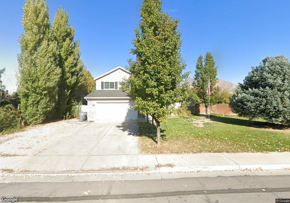
2038 W 130 S Mapleton, UT 84664
Estimated Value: $607,000 - $656,000
4
Beds
3
Baths
1,711
Sq Ft
$370/Sq Ft
Est. Value
About This Home
This home is located at 2038 W 130 S, Mapleton, UT 84664 and is currently estimated at $632,948, approximately $369 per square foot. 2038 W 130 S is a home located in Utah County with nearby schools including Maple Ridge Elementary, Mapleton Junior High School, and Maple Mountain High School.
Ownership History
Date
Name
Owned For
Owner Type
Purchase Details
Closed on
Apr 7, 2021
Sold by
Smith Carlin
Bought by
Smith Carlin J and Smith April H
Current Estimated Value
Home Financials for this Owner
Home Financials are based on the most recent Mortgage that was taken out on this home.
Original Mortgage
$479,750
Outstanding Balance
$432,457
Interest Rate
2.9%
Mortgage Type
New Conventional
Estimated Equity
$200,491
Purchase Details
Closed on
Apr 2, 2021
Sold by
Daines Matthew and Daines Afua
Bought by
Smith Carlin
Home Financials for this Owner
Home Financials are based on the most recent Mortgage that was taken out on this home.
Original Mortgage
$479,750
Outstanding Balance
$432,457
Interest Rate
2.9%
Mortgage Type
New Conventional
Estimated Equity
$200,491
Purchase Details
Closed on
Aug 26, 2016
Sold by
Daines Matthew and Daines Afua
Bought by
Daines Afua and Daines Matthew
Home Financials for this Owner
Home Financials are based on the most recent Mortgage that was taken out on this home.
Original Mortgage
$1,251,938
Interest Rate
3.45%
Mortgage Type
FHA
Purchase Details
Closed on
Nov 18, 2015
Sold by
Woodhouse Michael and Woodhouse Yvonne
Bought by
Daines Matthew and Daines Afua
Home Financials for this Owner
Home Financials are based on the most recent Mortgage that was taken out on this home.
Original Mortgage
$252,345
Interest Rate
3.75%
Mortgage Type
FHA
Purchase Details
Closed on
Jan 28, 2011
Sold by
Mmd Investment Corp
Bought by
Woodhouse Michael and Woodhouse Yvonne
Purchase Details
Closed on
Sep 29, 2010
Sold by
Johnson Michael T and Johnson Wendy
Bought by
Mmd Investment Corp
Purchase Details
Closed on
Jan 23, 2003
Sold by
Johnson Michael T
Bought by
Johnson Michael T and Johnson Wendy
Home Financials for this Owner
Home Financials are based on the most recent Mortgage that was taken out on this home.
Original Mortgage
$156,000
Interest Rate
5.97%
Purchase Details
Closed on
Nov 5, 1999
Sold by
Salisbury Development Lc
Bought by
Johnson Michael T
Create a Home Valuation Report for This Property
The Home Valuation Report is an in-depth analysis detailing your home's value as well as a comparison with similar homes in the area
Home Values in the Area
Average Home Value in this Area
Purchase History
| Date | Buyer | Sale Price | Title Company |
|---|---|---|---|
| Smith Carlin J | -- | Accommodation | |
| Smith Carlin | -- | Hickman Land Title Co | |
| Daines Afua | -- | Frontier Title Ins Ageny | |
| Daines Matthew | -- | First American | |
| Woodhouse Michael | -- | Us Title Insurance Agency | |
| Mmd Investment Corp | -- | Accommodation | |
| Johnson Michael T | -- | Sundance Title Insurance Ag | |
| Johnson Michael T | -- | Provo Land Title Company |
Source: Public Records
Mortgage History
| Date | Status | Borrower | Loan Amount |
|---|---|---|---|
| Open | Smith Carlin J | $479,750 | |
| Previous Owner | Daines Afua | $1,251,938 | |
| Previous Owner | Daines Matthew | $252,345 | |
| Previous Owner | Johnson Michael T | $156,000 | |
| Closed | Johnson Michael T | $29,250 |
Source: Public Records
Tax History
| Year | Tax Paid | Tax Assessment Tax Assessment Total Assessment is a certain percentage of the fair market value that is determined by local assessors to be the total taxable value of land and additions on the property. | Land | Improvement |
|---|---|---|---|---|
| 2025 | $2,706 | $289,905 | -- | -- |
| 2024 | $2,706 | $265,100 | $0 | $0 |
| 2023 | $2,761 | $272,195 | $0 | $0 |
| 2022 | $2,886 | $281,270 | $0 | $0 |
| 2021 | $2,360 | $353,200 | $174,100 | $179,100 |
| 2020 | $2,302 | $333,200 | $154,100 | $179,100 |
| 2019 | $2,061 | $304,500 | $148,800 | $155,700 |
| 2018 | $2,009 | $282,600 | $126,900 | $155,700 |
| 2017 | $1,791 | $133,705 | $0 | $0 |
| 2016 | $1,685 | $125,015 | $0 | $0 |
| 2015 | $1,506 | $111,100 | $0 | $0 |
| 2014 | $1,392 | $100,815 | $0 | $0 |
Source: Public Records
Map
Nearby Homes
- 1810 W 300 S Unit D
- 2652 W Maple St Unit 281
- 1780 W Maple St
- 1656 W 300 S Unit B
- 1655 W 200 S Unit A
- 203 N 1900 W
- 2216 W Silver Leaf Dr Unit 35
- 281 N Pheasant Dr
- 141 N Pinnacle Ave
- 442 S Doubleday St
- 293 N Pheasant Dr
- 2414 W Santa fe Dr
- 216 N 1750 W
- 262 N Santa fe Dr
- 2458 W Aurora Ave Unit 287
- 2559 W Aurora Ave Unit 292
- 29 N Sunrise Ranch Dr
- 121 S Crimson Way
- 76-307 S Crimson Way
- 18 S Crimson Way Unit 304
Your Personal Tour Guide
Ask me questions while you tour the home.