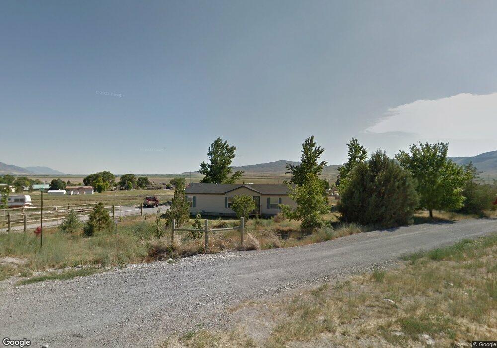
20385 N Old Highway Rd Plymouth, UT 84330
Estimated Value: $342,000 - $454,000
3
Beds
2
Baths
1,363
Sq Ft
$294/Sq Ft
Est. Value
About This Home
This home is located at 20385 N Old Highway Rd, Plymouth, UT 84330 and is currently estimated at $401,237, approximately $294 per square foot. 20385 N Old Highway Rd is a home located in Box Elder County with nearby schools including Fielding School, Alice C. Harris Intermediate School, and Bear River Middle School.
Ownership History
Date
Name
Owned For
Owner Type
Purchase Details
Closed on
Oct 14, 2019
Sold by
Palmer D Lyle D and Palmer Karen M
Bought by
Palmer D Lyle and The Durvard Lyle Separate Property Trust
Current Estimated Value
Purchase Details
Closed on
Aug 29, 2016
Sold by
Unck Kevin A
Bought by
Brummett Douglas D and Brummett Teresa L
Home Financials for this Owner
Home Financials are based on the most recent Mortgage that was taken out on this home.
Original Mortgage
$156,750
Outstanding Balance
$125,286
Interest Rate
3.45%
Mortgage Type
New Conventional
Estimated Equity
$275,951
Purchase Details
Closed on
Mar 16, 2005
Sold by
Unck Kevin
Bought by
Unjck Kevin A
Create a Home Valuation Report for This Property
The Home Valuation Report is an in-depth analysis detailing your home's value as well as a comparison with similar homes in the area
Home Values in the Area
Average Home Value in this Area
Purchase History
| Date | Buyer | Sale Price | Title Company |
|---|---|---|---|
| Palmer D Lyle | -- | None Available | |
| Brummett Douglas D | -- | Backman Title Services Ltd | |
| Unjck Kevin A | -- | None Available |
Source: Public Records
Mortgage History
| Date | Status | Borrower | Loan Amount |
|---|---|---|---|
| Open | Brummett Douglas D | $156,750 |
Source: Public Records
Tax History Compared to Growth
Tax History
| Year | Tax Paid | Tax Assessment Tax Assessment Total Assessment is a certain percentage of the fair market value that is determined by local assessors to be the total taxable value of land and additions on the property. | Land | Improvement |
|---|---|---|---|---|
| 2025 | $1,485 | $306,197 | $115,000 | $191,197 |
| 2024 | $1,485 | $302,210 | $110,000 | $192,210 |
| 2023 | $1,394 | $289,383 | $86,000 | $203,383 |
| 2022 | $1,462 | $161,558 | $35,200 | $126,358 |
| 2021 | $1,047 | $197,888 | $22,000 | $175,888 |
| 2020 | $1,082 | $197,888 | $22,000 | $175,888 |
| 2019 | $962 | $4,000 | $2,000 | $2,000 |
| 2018 | $916 | $83,100 | $13,000 | $70,100 |
| 2017 | $951 | $149,455 | $13,000 | $127,455 |
| 2016 | $938 | $79,762 | $13,000 | $66,762 |
| 2015 | $842 | $73,693 | $13,000 | $60,693 |
| 2014 | $842 | $70,803 | $13,000 | $57,803 |
| 2013 | -- | $65,548 | $11,000 | $54,548 |
Source: Public Records
Map
Nearby Homes
- 5450 W 20400 N
- 4530 W 13500 N Unit 2
- 18188 N 6000 W
- 18235 N 4400 W
- 18250 N 4400 W
- 18068 N 6000 W
- 18120 N 4400 W
- 18100 N 4400 W
- 95 W 100 N
- 16580 N 5200 W
- 209 W 100 S
- Winfield Plan at Lookout Mountain
- Xavier Plan at Lookout Mountain
- Vanbrough Plan at Lookout Mountain
- Oakfield Plan at Lookout Mountain
- Northfield Plan at Lookout Mountain
- Somerley Plan at Lookout Mountain
- Stanton Plan at Lookout Mountain
- Aldin Plan at Lookout Mountain
- Cambria Plan at Lookout Mountain
- 5304 W 20400 N
- 20375 N Old Highway Rd
- 5285 W 20400 N
- 5280 W 20400 N
- 20355 N Old Highway Rd
- 20450 N Old Highway Rd
- 5366 W 20300 N
- 62 Po Box
- 5415 W 20400 N
- 5270 W 20400 N
- 5350 W 20300 N
- 5290 W 20300 St N
- 5290 W 20300 N
- 5246 W 20300 N
- 20350 N Highway 13
- 20350 N Highway 13
- 5390 W 20300 N
- 5380 W 20300 St N
- 20375 N 5180 W
- 5418 W 20300 N