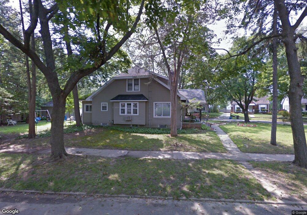
2039 Cartier St Flint, MI 48504
Mott Park NeighborhoodEstimated Value: $86,000 - $122,000
4
Beds
1
Bath
1,462
Sq Ft
$74/Sq Ft
Est. Value
About This Home
This home is located at 2039 Cartier St, Flint, MI 48504 and is currently estimated at $107,881, approximately $73 per square foot. 2039 Cartier St is a home located in Genesee County with nearby schools including Durant-Tuuri-Mott Elementary School, St John Vianney Catholic School, and St. Paul Lutheran School.
Ownership History
Date
Name
Owned For
Owner Type
Purchase Details
Closed on
Aug 17, 2004
Sold by
Dulude Todd L and Dulude Miranda
Bought by
Abramson Jamie and Patterson Phillip
Current Estimated Value
Purchase Details
Closed on
Aug 19, 1999
Sold by
Dulude A L
Bought by
Dulude Todd L
Home Financials for this Owner
Home Financials are based on the most recent Mortgage that was taken out on this home.
Original Mortgage
$74,400
Interest Rate
7.12%
Mortgage Type
Purchase Money Mortgage
Create a Home Valuation Report for This Property
The Home Valuation Report is an in-depth analysis detailing your home's value as well as a comparison with similar homes in the area
Home Values in the Area
Average Home Value in this Area
Purchase History
| Date | Buyer | Sale Price | Title Company |
|---|---|---|---|
| Abramson Jamie | $92,900 | -- | |
| Dulude Todd L | -- | -- |
Source: Public Records
Mortgage History
| Date | Status | Borrower | Loan Amount |
|---|---|---|---|
| Previous Owner | Dulude Todd L | $74,400 |
Source: Public Records
Tax History
| Year | Tax Paid | Tax Assessment Tax Assessment Total Assessment is a certain percentage of the fair market value that is determined by local assessors to be the total taxable value of land and additions on the property. | Land | Improvement |
|---|---|---|---|---|
| 2025 | $1,327 | $52,300 | $0 | $0 |
| 2024 | $1,190 | $47,200 | $0 | $0 |
| 2023 | $1,162 | $37,900 | $0 | $0 |
| 2022 | $0 | $30,500 | $0 | $0 |
| 2021 | $1,216 | $30,200 | $0 | $0 |
| 2020 | $1,085 | $29,100 | $0 | $0 |
| 2019 | $1,050 | $19,300 | $0 | $0 |
| 2018 | $1,075 | $17,500 | $0 | $0 |
| 2017 | $1,042 | $0 | $0 | $0 |
| 2016 | $1,042 | $0 | $0 | $0 |
| 2015 | -- | $0 | $0 | $0 |
| 2014 | -- | $0 | $0 | $0 |
| 2012 | -- | $22,000 | $0 | $0 |
Source: Public Records
Map
Nearby Homes
- 825 Frank St
- 2026 Monteith St
- 751 Dupont St
- 913 Perry St
- 2023 Cadillac St
- 1016 Dupont St
- 3320 Pencombe Place
- 612 Bradley Ave
- 2437 Zimmerman St
- 2513 Tiffin St
- 1025 Frost St
- 2663 W Court St
- 3617 Sherwood Dr
- 2540 Altoona St
- 2410 Sloan St
- 2547 Altoona St
- 2310 Gibson St
- 2464 Gibson St
- 932 Bradley Ave
- 2410 Corunna Rd
- 817 Dickinson St
- 2046 Cartier St
- 813 Dickinson St
- 821 Dickinson St
- 2042 Cartier St
- 2050 Cartier St
- 2023 Cartier St
- 2029 Cartier St
- 825 Dickinson St
- 809 Dickinson St
- 2038 Cartier St
- 2054 Cartier St
- 802 Dickinson St
- 829 Dickinson St
- 805 Dickinson St
- 2034 Cartier St Unit Bldg-Unit
- 2034 Cartier St
- 2058 Cartier St
- 2019 Cartier St
- 833 Dickinson St
Your Personal Tour Guide
Ask me questions while you tour the home.