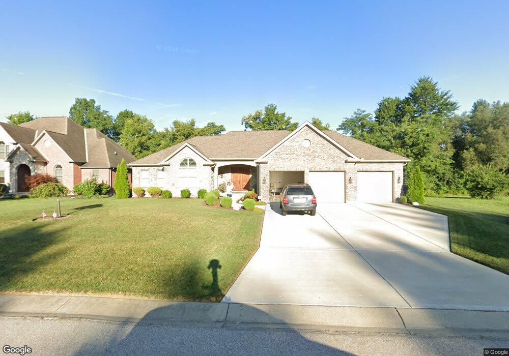
2039 Tall Pines Ln Anderson, OH 45244
Dry Run NeighborhoodEstimated Value: $693,000 - $742,152
3
Beds
3
Baths
2,564
Sq Ft
$277/Sq Ft
Est. Value
About This Home
This home is located at 2039 Tall Pines Ln, Anderson, OH 45244 and is currently estimated at $710,538, approximately $277 per square foot. 2039 Tall Pines Ln is a home located in Hamilton County with nearby schools including Summit Elementary School, Nagel Middle School, and Anderson High School.
Ownership History
Date
Name
Owned For
Owner Type
Purchase Details
Closed on
May 16, 2022
Sold by
Shinn Jr John O and Shinn Patty A
Bought by
Shinn Family Trust
Current Estimated Value
Purchase Details
Closed on
Jan 26, 2018
Sold by
Ross Michael J
Bought by
Shinn John O and Shinn Patty A
Home Financials for this Owner
Home Financials are based on the most recent Mortgage that was taken out on this home.
Original Mortgage
$422,000
Interest Rate
3.93%
Mortgage Type
New Conventional
Purchase Details
Closed on
Sep 21, 2006
Sold by
Clough Creek Farm Llc
Bought by
Ross Michael J
Home Financials for this Owner
Home Financials are based on the most recent Mortgage that was taken out on this home.
Original Mortgage
$93,750
Interest Rate
6.59%
Mortgage Type
Purchase Money Mortgage
Create a Home Valuation Report for This Property
The Home Valuation Report is an in-depth analysis detailing your home's value as well as a comparison with similar homes in the area
Home Values in the Area
Average Home Value in this Area
Purchase History
| Date | Buyer | Sale Price | Title Company |
|---|---|---|---|
| Shinn Family Trust | -- | None Listed On Document | |
| Shinn John O | $511,083 | Stewart Title | |
| Ross Michael J | -- | Buckeye Land Title Company |
Source: Public Records
Mortgage History
| Date | Status | Borrower | Loan Amount |
|---|---|---|---|
| Previous Owner | Shinn John O | $422,000 | |
| Previous Owner | Ross Michael J | $93,750 |
Source: Public Records
Tax History Compared to Growth
Tax History
| Year | Tax Paid | Tax Assessment Tax Assessment Total Assessment is a certain percentage of the fair market value that is determined by local assessors to be the total taxable value of land and additions on the property. | Land | Improvement |
|---|---|---|---|---|
| 2024 | $12,887 | $212,163 | $48,125 | $164,038 |
| 2023 | $12,258 | $212,163 | $48,125 | $164,038 |
| 2022 | $11,966 | $178,879 | $49,438 | $129,441 |
| 2021 | $11,899 | $178,879 | $49,438 | $129,441 |
| 2020 | $11,744 | $178,879 | $49,438 | $129,441 |
| 2019 | $12,991 | $43,750 | $43,750 | $0 |
| 2018 | $2,980 | $43,750 | $43,750 | $0 |
| 2017 | $2,848 | $43,750 | $43,750 | $0 |
| 2016 | $3,004 | $44,625 | $44,625 | $0 |
| 2015 | $2,891 | $44,625 | $44,625 | $0 |
| 2014 | $2,888 | $44,625 | $44,625 | $0 |
| 2013 | $2,686 | $43,750 | $43,750 | $0 |
Source: Public Records
Map
Nearby Homes
- 2051 Tall Pines Ln
- 1797 Muskegon Dr
- 463 Auxier Dr
- 8410 Kilkenny Dr
- 2161 Knightsbridge Dr
- 1728 Rockhurst Ln
- 8486 Bethany Ln
- 1624 Pinebluff Ln
- 471 Sanctuary Way
- 473 Sanctuary Way
- 4383 Wiborg Dr
- 2197 8 Mile Rd
- 475 Sanctuary Way
- 477 Sanctuary Way
- 477 Sanctuary Way Unit 23
- 4172 Brandonmore Dr
- 482 Sanctuary Way
- 486 Sanctuary Way
- 488 Sanctuary Way
- 490 Sanctuary Way
- 2031 Tall Pines Ln
- 3 Tall Pines Ln
- 2030 Tall Pines Ln
- 2030 Harcourt Estates Dr
- 2030 Harcourt Dr
- 2030 Harcourt Dr Unit 24
- 2042 Tall Pines Ln
- Lot Tall Pines Ln
- 2042 Harcourt Estates Dr
- 2050 Tall Pines Ln
- 2042 Harcourt Dr
- 2022 Tall Pines Ln
- 2054 Harcourt Dr
- 2055 Tall Pines Ln
- 2058 Tall Pines Ln
- 2066 Harcourt Estates Dr
- 2066 Harcourt Dr
- 2027 Harcourt Dr
- 8676 Clough Pike
- 2027 Harcourt Estates Dr