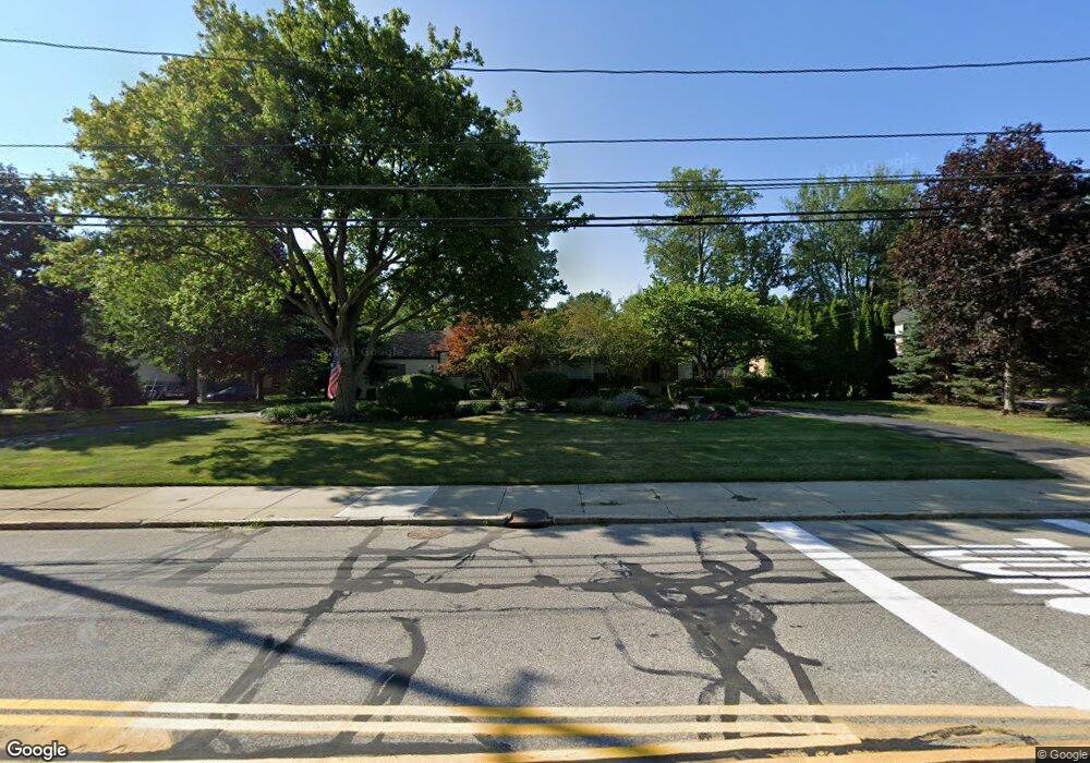
20391 Lake Rd Rocky River, OH 44116
Estimated Value: $413,000 - $524,000
3
Beds
2
Baths
1,794
Sq Ft
$270/Sq Ft
Est. Value
About This Home
This home is located at 20391 Lake Rd, Rocky River, OH 44116 and is currently estimated at $483,697, approximately $269 per square foot. 20391 Lake Rd is a home located in Cuyahoga County with nearby schools including Kensington Intermediate Elementary School, Goldwood Primary Elementary School, and Rocky River Middle School.
Ownership History
Date
Name
Owned For
Owner Type
Purchase Details
Closed on
Mar 4, 2010
Sold by
Adlum Kathleen
Bought by
City Of Rocky River
Current Estimated Value
Purchase Details
Closed on
Nov 24, 2009
Sold by
Buckley Brooke Matterm and Lowery Darrin
Bought by
Adlum Kathleen
Purchase Details
Closed on
Apr 29, 2002
Sold by
Kelly John and Kelly John C
Bought by
Buckley Brooke Mattern and Buckley Brooke M
Home Financials for this Owner
Home Financials are based on the most recent Mortgage that was taken out on this home.
Original Mortgage
$148,000
Interest Rate
7.18%
Purchase Details
Closed on
Jan 1, 1975
Bought by
Kelly John C and Kelly Genevieve I
Create a Home Valuation Report for This Property
The Home Valuation Report is an in-depth analysis detailing your home's value as well as a comparison with similar homes in the area
Home Values in the Area
Average Home Value in this Area
Purchase History
| Date | Buyer | Sale Price | Title Company |
|---|---|---|---|
| City Of Rocky River | $1,525 | None Available | |
| Adlum Kathleen | $193,550 | Barristers Of Ohio Llc | |
| Buckley Brooke Mattern | $185,000 | -- | |
| Kelly John C | -- | -- |
Source: Public Records
Mortgage History
| Date | Status | Borrower | Loan Amount |
|---|---|---|---|
| Previous Owner | Buckley Brooke Mattern | $148,000 | |
| Closed | Buckley Brooke Mattern | $18,500 |
Source: Public Records
Tax History Compared to Growth
Tax History
| Year | Tax Paid | Tax Assessment Tax Assessment Total Assessment is a certain percentage of the fair market value that is determined by local assessors to be the total taxable value of land and additions on the property. | Land | Improvement |
|---|---|---|---|---|
| 2024 | $7,985 | $144,445 | $70,175 | $74,270 |
| 2023 | $6,648 | $99,720 | $40,640 | $59,080 |
| 2022 | $6,602 | $99,720 | $40,640 | $59,080 |
| 2021 | $6,046 | $99,720 | $40,640 | $59,080 |
| 2020 | $5,672 | $81,760 | $33,320 | $48,440 |
| 2019 | $5,574 | $233,600 | $95,200 | $138,400 |
| 2018 | $5,557 | $81,760 | $33,320 | $48,440 |
| 2017 | $6,119 | $81,760 | $33,320 | $48,440 |
| 2016 | $5,958 | $81,760 | $33,320 | $48,440 |
| 2015 | $5,337 | $81,760 | $33,320 | $48,440 |
| 2014 | $5,337 | $69,900 | $28,490 | $41,410 |
Source: Public Records
Map
Nearby Homes
- 20695 Beaconsfield Blvd
- 459 Wagar Rd
- 505 Beachcliff Row Dr
- 19740 Lake Rd Unit 19740
- 20333 Detroit Rd Unit 311B
- 20333 Detroit Rd Unit 213B
- 19665 Roslyn Dr
- 1744 Lakeview Ave
- 829 Elmwood Rd
- 19334 Frazier Dr
- 19204 Frazier Dr
- 19486 Frazier Dr
- 19575 Shoreland Ave
- 0 Riverdale Dr Unit 5078145
- 0 Riverdale Dr
- 19712 Laurel Ave
- 416 Riverdale Dr
- 387 S Island Dr
- 21891 Avalon Dr
- 2039 Wooster Rd Unit D51
- 540 Morewood Pkwy
- 20421 Lake Rd
- 20400 Lake Rd
- 20451 Lake Rd
- 535 Morewood Pkwy
- 20661 Avalon Dr
- 20645 Avalon Dr
- 560 Morewood Pkwy
- 20420 Lake Rd
- 20643 Avalon Dr
- 20471 Lake Rd
- 20454 Lake Rd
- 571 Morewood Pkwy
- 20701 Avalon Dr
- 519 Morewood Pkwy
- 527 Morewood Pkwy
- 20512 Beaconsfield Blvd
- 20482 Lake Rd
- 20311 Lake Rd
- 581 Morewood Pkwy